The cartographic work of Christiaan van Adrichem
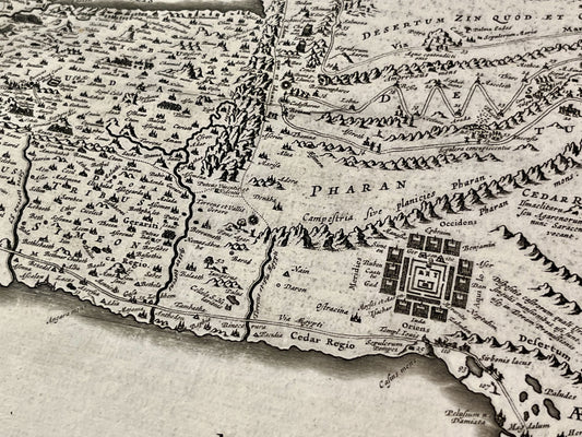
Christiaan van Adrichem (1533-1585) distinguished himself through a unique approach to cartography, centered on biblical exegesis. Although he lived in exile in Cologne due to religious conflicts in the Netherlands, he dedicated his life to the study of sacred texts, producing geographical documents of great spiritual and historical richness. His work aimed above all to offer a visual representation faithful to the narratives of the Old and New Testaments.
The “Theatrum Terrae Sanctae” and the Holy Land
His major work, theTheatrum Terrae SanctaePublished posthumously, it is one of the most influential atlases on the Holy Land. Van Adrichem details the divisions of the twelve tribes of Israel and traces the routes of biblical figures. These maps are not merely geographical tools, but veritable illustrated narratives that have served as a reference for theologians and collectors for centuries.
The historical topography of Jerusalem
Besides his regional maps, Van Adrichem is renowned for his plan of Jerusalem and its surroundings. This reconstruction, based on the writings of Flavius Josephus and the Scriptures, accurately depicts the sites of the Passion and the ancient architecture of the city. His illustrations, often adorned with meticulous iconographic details, make his maps highly prized collector's items for their aesthetic appeal and documentary value.