-
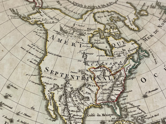
Antique map of America by E. Mentelle and PG. Chanlaire - 1798
Regular price 110,00 €Regular priceUnit price per -
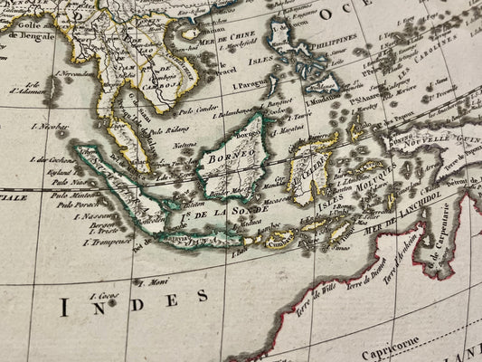
Antique map of Asia by E. Mentelle and PG. Chanlaire - 1798
Regular price 110,00 €Regular priceUnit price per -
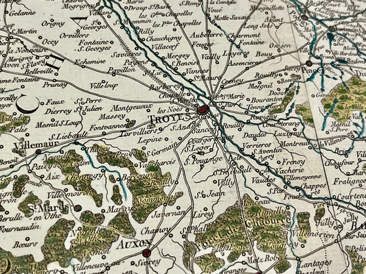
Antique map of southern Champagne by PG. Chanlaire and E. Mentelle - ca. 1790
Regular price 120,00 €Regular priceUnit price per -
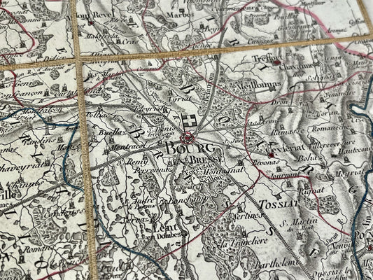
Antique map of Ain by PG Chanlaire - ca. 1820
Regular price 150,00 €Regular priceUnit price per -
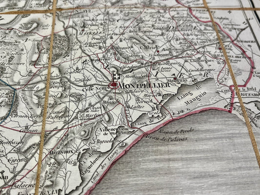
Antique map of Hérault by PG Chanlaire - ca. 1820
Regular price 150,00 €Regular priceUnit price per -
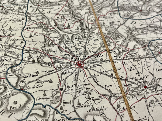
Antique map of Ille-et-Vilaine by PG Chanlaire - ca. 1820
Regular price 150,00 €Regular priceUnit price per -
Antique map of Indre-et-Loire by PG Chanlaire - ca. 1820
Regular price 150,00 €Regular priceUnit price per -
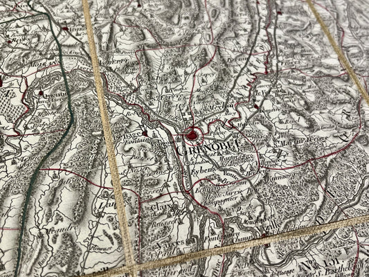
Antique map of Isère by PG Chanlaire - ca. 1820
Regular price 150,00 €Regular priceUnit price per -
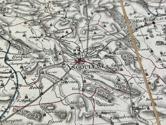
Antique map of Charente by PG Chanlaire - ca. 1820
Regular price 150,00 €Regular priceUnit price per -
Antique map of Creuse by PG Chanlaire - ca. 1820
Regular price 150,00 €Regular priceUnit price per -
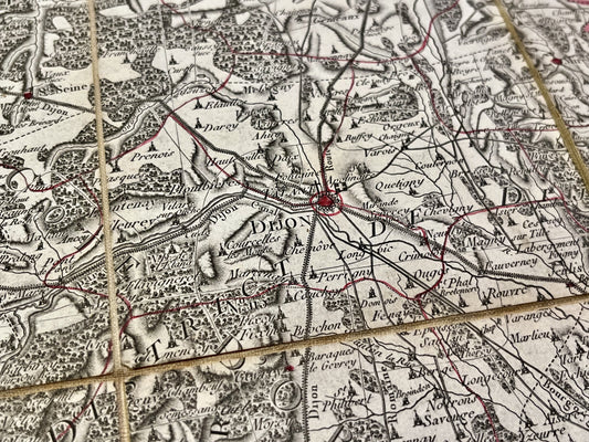
Antique map of Côte d'Or by PG Chanlaire - ca. 1820
Regular price 150,00 €Regular priceUnit price per -
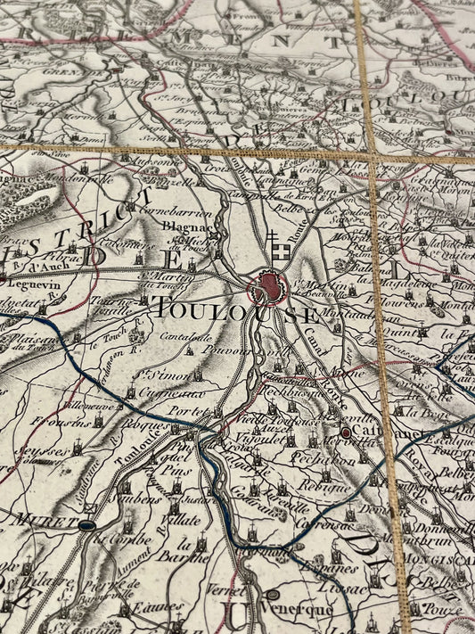
Antique map of Haute-Garonne by PG Chanlaire - ca. 1820
Regular price 150,00 €Regular priceUnit price per -
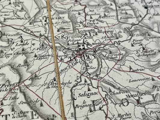
Antique map of Haute-Loire by PG Chanlaire - ca. 1820
Regular price 150,00 €Regular priceUnit price per -
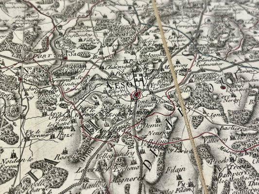
Antique map of Haute-Saône by PG Chanlaire - ca. 1820
Regular price 150,00 €Regular priceUnit price per -
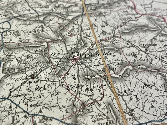
Antique map of Haute-Vienne by PG Chanlaire - ca. 1820
Regular price 150,00 €Regular priceUnit price per -
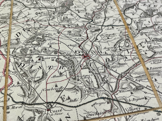
Antique map of Mayenne by PG Chanlaire - ca. 1820
Regular price 150,00 €Regular priceUnit price per -
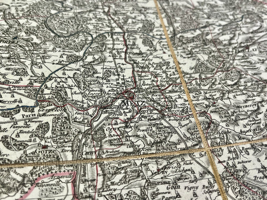
Antique map of Moselle by PG Chanlaire - ca. 1820
Regular price 150,00 €Regular priceUnit price per -
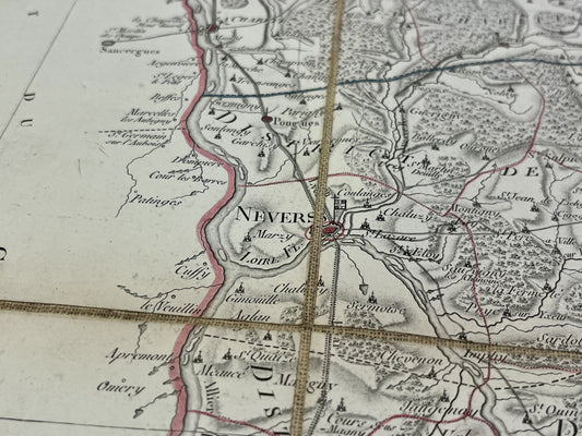
Antique map of Nièvre by PG Chanlaire - ca. 1820
Regular price 150,00 €Regular priceUnit price per -
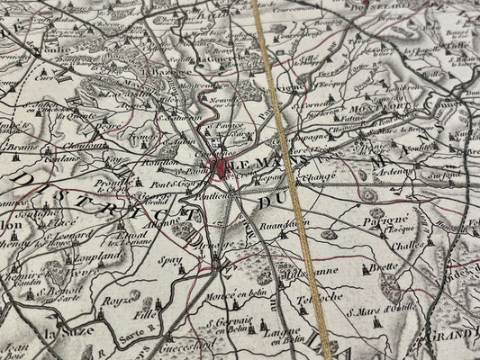
Antique map of Sarthe by PG Chanlaire - ca. 1820
Regular price 150,00 €Regular priceUnit price per -
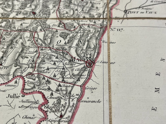
Antique map of Saône-et-Loire by PG Chanlaire - ca. 1820
Regular price 150,00 €Regular priceUnit price per -
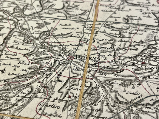
Antique map of the Somme by PG Chanlaire - ca. 1820
Regular price 150,00 €Regular priceUnit price per -
Antique map of Deux-Sèvres by PG Chanlaire - ca. 1820
Regular price 150,00 €Regular priceUnit price per -
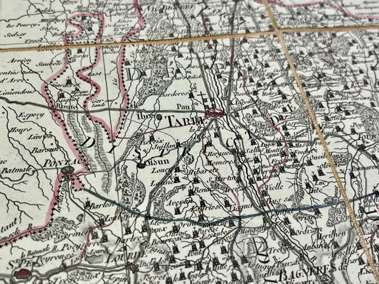
Antique map of the Hautes-Pyrénées by PG Chanlaire - ca. 1820
Regular price 150,00 €Regular priceUnit price per -
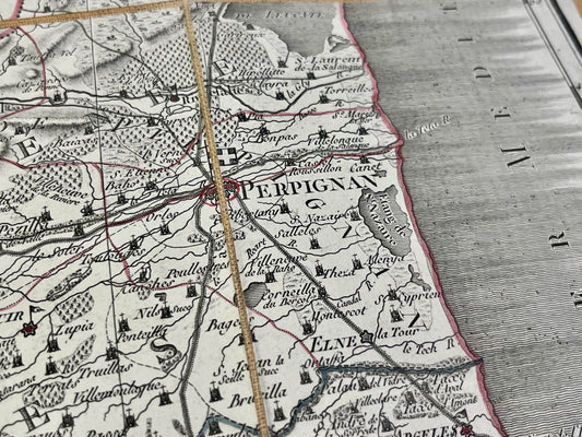
Antique map of the Pyrénées-Orientales by PG Chanlaire - ca. 1820
Regular price 150,00 €Regular priceUnit price per