-
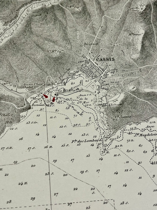
Antique nautical chart of the bay of Cassis
Regular price 120,00 €Regular priceUnit price per -
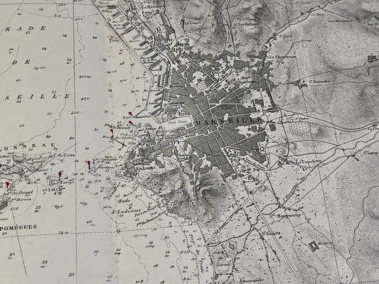
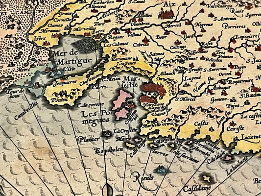
Antique nautical chart of the area around Marseille
Regular price 120,00 €Regular priceUnit price per -
Antique nautical chart of the southern approaches to Marseille
Regular price 120,00 €Regular priceUnit price per -
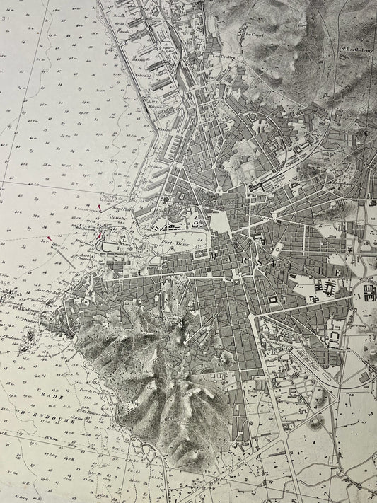
Antique nautical chart of the Gulf of Marseille
Regular price 130,00 €Regular priceUnit price per -
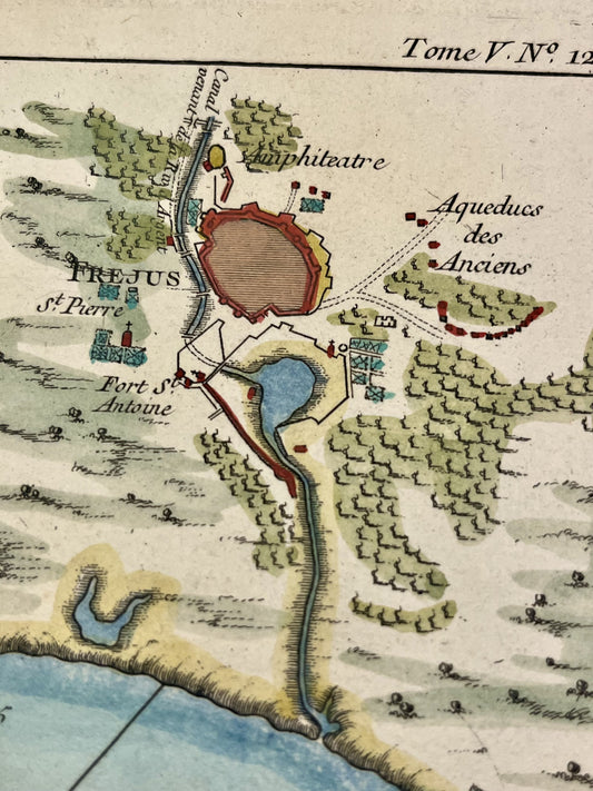
Antique map of the Gulf of Fréjus by JN Bellin - ca. 1760
Regular price 180,00 €Regular priceUnit price per -
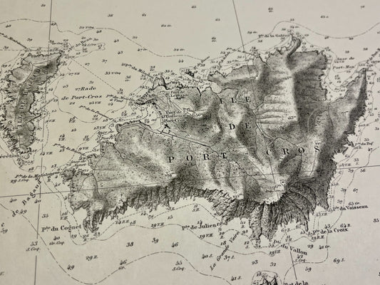
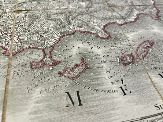
Antique nautical chart of the islands of Port-Cros and Levant
Regular price 180,00 €Regular priceUnit price per -
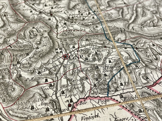
Antique map of the Hautes-Alpes department by PG Chanlaire - ca. 1820
Regular price 190,00 €Regular priceUnit price per -
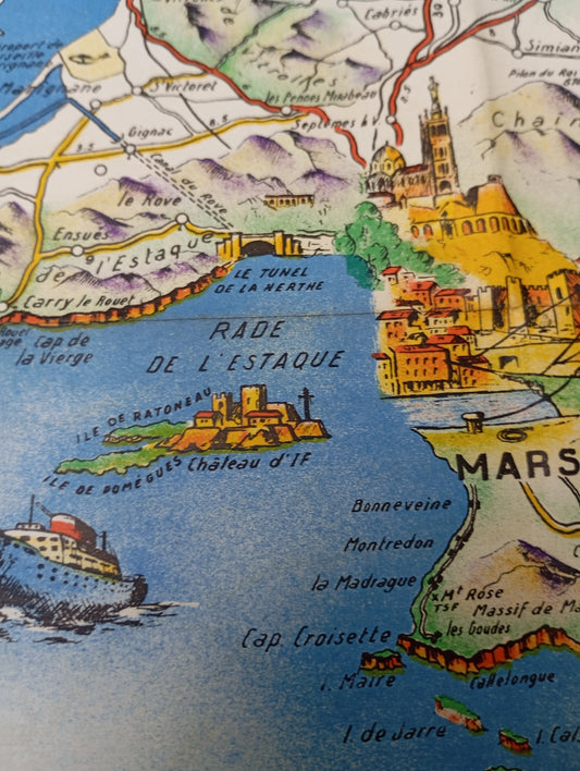
Old illustrated geographical map of Provence and Corsica by O. Poisson - ca. 1950
Regular price 199,00 €Regular priceUnit price per -
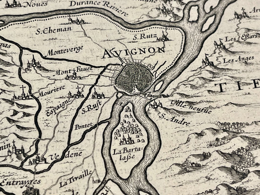
Antique map of the Principality of Orange and the Comtat Venaissin by H. Hondius - 1627
Regular price 250,00 €Regular priceUnit price per -
Antique map of the Var by PG Chanlaire - ca. 1820
Regular price 260,00 €Regular priceUnit price per -
Antique map of Provence by PJ. Bompar - ca 1610
Regular price 420,00 €Regular priceUnit price per -
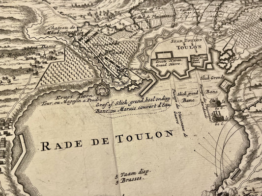
Antique map of the harbor of Toulon during the siege of 1707 by N. Visscher - ca. 1710
Regular price 460,00 €Regular priceUnit price per