


Illustrated tourist poster of the Benelux countries - ca. 1950
Illustrated tourist poster of the Benelux countries - ca. 1950
Couldn't load pickup availability
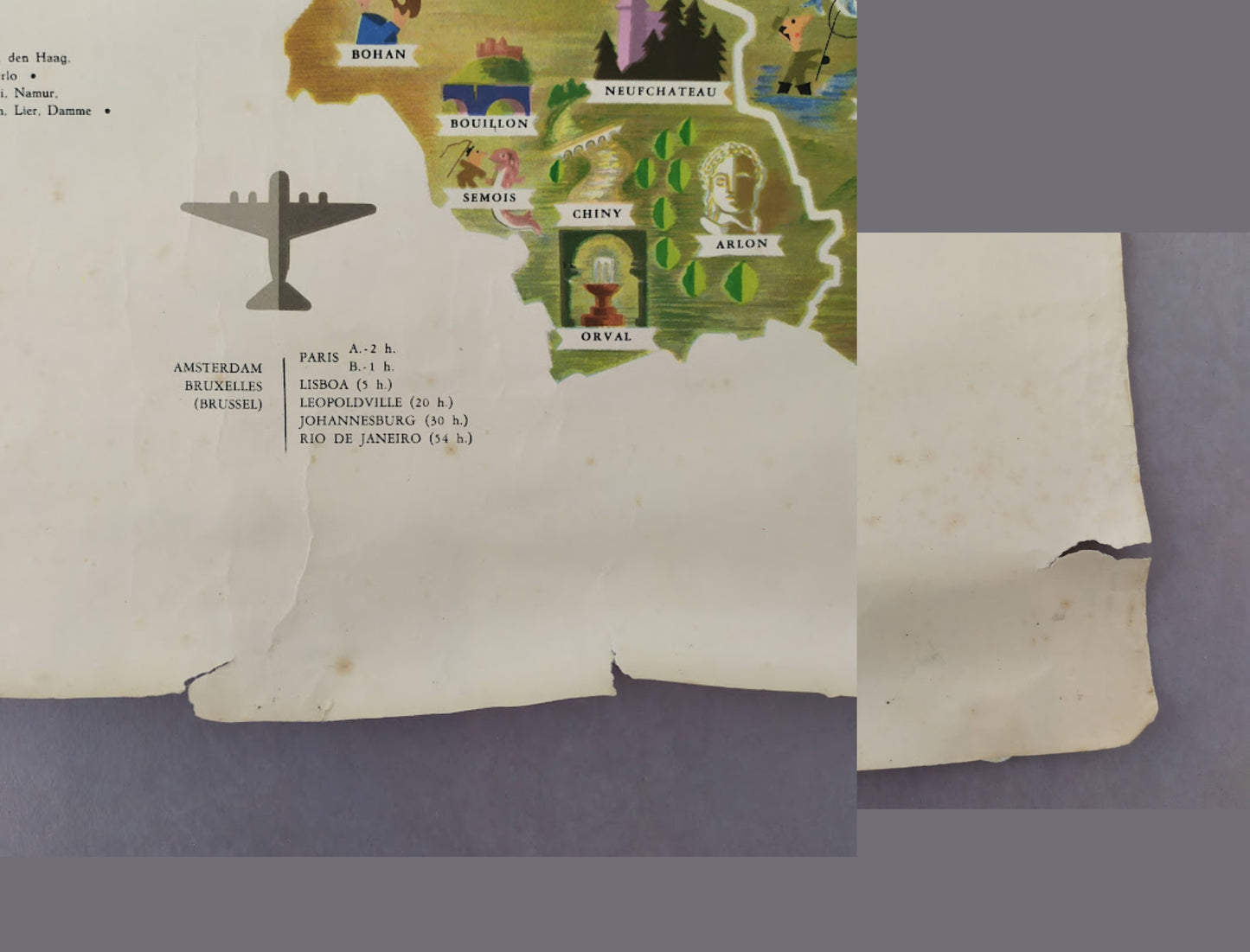
This vintage geographical and pictorial poster depicts the Benelux countries (Belgium, the Netherlands, and Luxembourg) in a graphic style typical of the 1950s. Richly illustrated, it highlights the architectural heritage, traditional costumes, and local activities of each region through small, colorful vignettes. Numerous details are visible, such as windmills, figures in regional dress (particularly in Volendam and Marken), castles, and iconic monuments. The poster also includes flight times from Amsterdam and Brussels to international destinations like Paris, Lisbon, Leopoldville, and Rio de Janeiro, emphasizing its touristic appeal. The inscription "LIMA STUDIO" is visible on the left edge. The map measures 100 cm by 60 cm.
Condition :
Good condition, see photos. Please note, my maps are old and not always in perfect condition! Shipped in a tube.
List of the main locations represented:
Amsterdam, Brussels, Luxembourg, Rotterdam, Antwerp, Ghent, Bruges, Liège, Namur, Utrecht, Eindhoven, Groningen, Maastricht, Volendam, Marken, Alkmaar, Enkhuizen, Texel, Zwolle, Delft, Bastogne, Arlon, Dinant, Ostend.


-

Secure payment
-

Careful shipping
-

No reproduction
-

Satisfied or refunded


-

“Hello, thank you for sending this, the cards are superb!”
Jean-Philippe
-
"They are very beautiful, just need to frame them! Thank you"
Baptiste
-
"Fast shipping and very good tracking."
Alice
-
"My husband loved the maps I gave him for Christmas!"
Solène
