


Antique illustrated map of the Province of Luxembourg by the CGER - ca. 1950
Antique illustrated map of the Province of Luxembourg by the CGER - ca. 1950
Couldn't load pickup availability
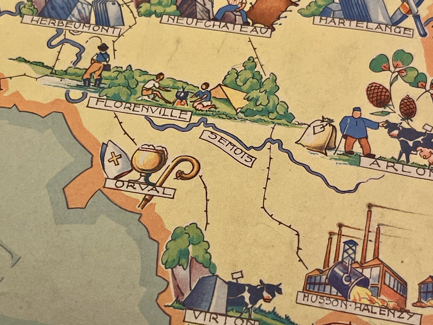
This antique map of Belgium, depicting the Province of Luxembourg, dates from the mid-20th century and measures 46x36cm. Each city is represented by illustrations reflecting its economy and specialties. It was published by the Caisse Générale d'Épargne et de Retraite.
Condition:
Minimal stains, edge tears, writing. Please note, my maps are old and are not always in perfect condition!
List of cities represented:
Rochehaut, Bouillon, Herbeumont, Neufchâteau, Orval, Libramont-Chevigny, Saint-Hubert, Marche-en-Famenne, La Roche-en-Ardenne, Houffalize, Bastogne, Arlon, Virton


-

Secure payment
-

Careful shipping
-

No reproduction
-

Satisfied or refunded


-

“Hello, thank you for sending this, the cards are superb!”
Jean-Philippe
-
"They are very beautiful, just need to frame them! Thank you"
Baptiste
-
"Fast shipping and very good tracking."
Alice
-
"My husband loved the maps I gave him for Christmas!"
Solène
