


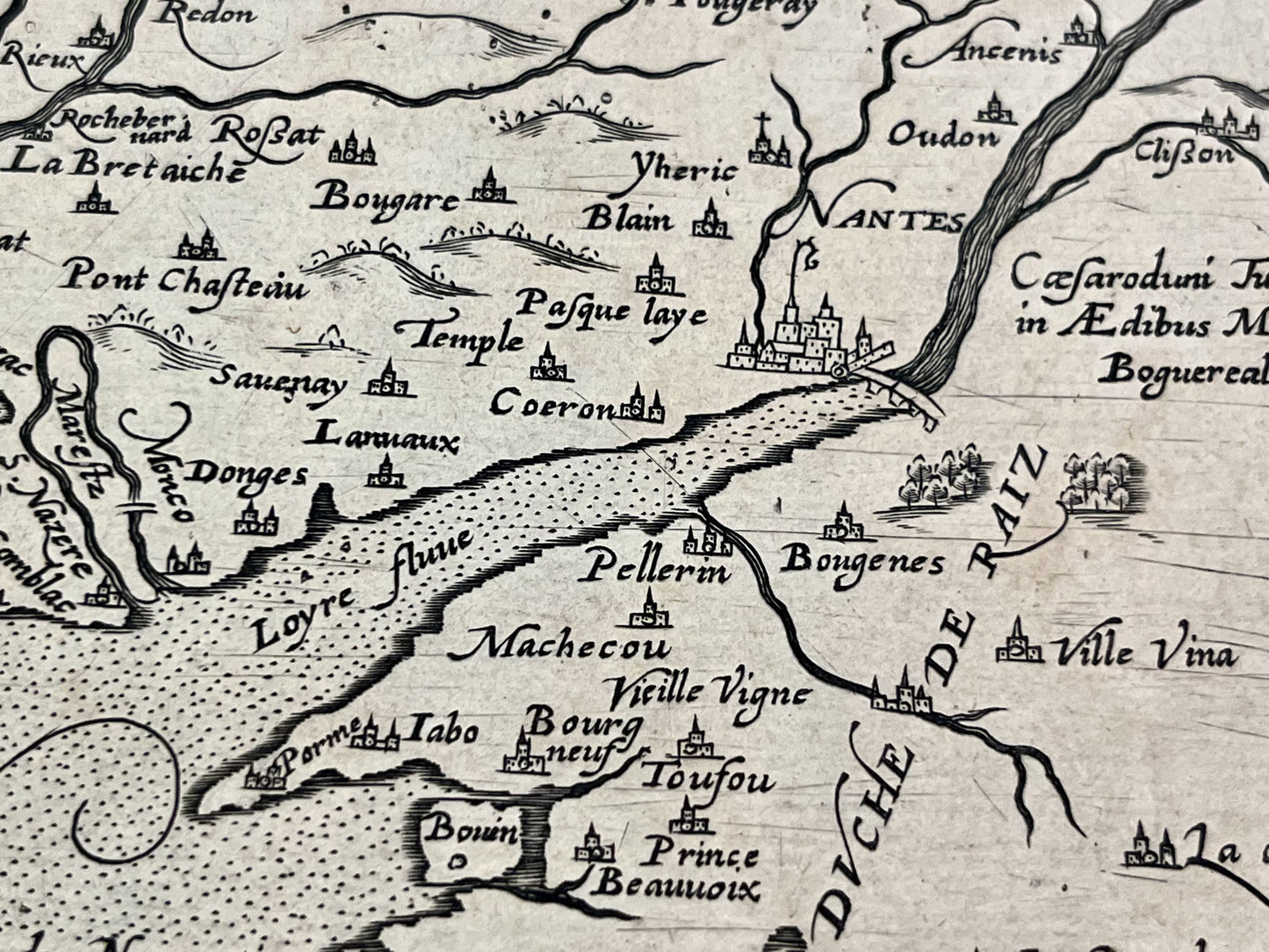
Antique map of Armorica by J. Leclerc and M. Bouguereau - ca. 1620
Antique map of Armorica by J. Leclerc and M. Bouguereau - ca. 1620
Regular price
250,00 €
Regular price
Sale price
250,00 €
Unit price
per
Taxes included.
Couldn't load pickup availability
This antique map of Brittany dates from the early 17th century and measures 51.5x40cm. It was published by M. Bouguereau and J. Leclerc.
Condition:
Central crease and large stain on the lower left side. Please note, my maps are old and not always in perfect condition!
Main cities represented:
Nantes, Vannes, Rennes, Saint-Brieuc, Saint-Malo, Dinard, Mont-Saint-Michel, Brest, Quimper, Quiberon,...


-

Secure payment
-

Careful shipping
-

No reproduction
-

Satisfied or refunded


-

“Hello, thank you for sending this, the cards are superb!”
Jean-Philippe
-
"They are very beautiful, just need to frame them! Thank you"
Baptiste
-
"Fast shipping and very good tracking."
Alice
-
"My husband loved the maps I gave him for Christmas!"
Solène
