


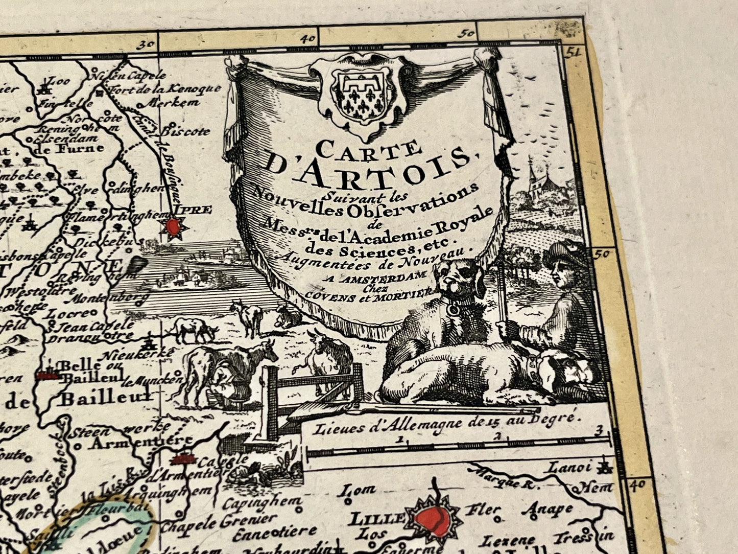
Small antique map of Artois by P. van der Aa - ca. 1710
Small antique map of Artois by P. van der Aa - ca. 1710
Couldn't load pickup availability
This antique map of Artois was created by the Dutch cartographer Pieter van der Aa and published by Covens & Mortier in the early 18th century. The map measures 36x25.5cm.
Condition:
Good condition, minor holes on the left side. Please note, my maps are old and not always in perfect condition!
Main cities represented:
Bapaume, Arras, Lens, Douai, Lille, Cambrai, Abbeville, Doullens, Saint-Pol-sur-Ternoise, Rue, Étaples, Béthune, Aire-sur-la-Lys, Saint-Omer, Boulogne-sur-Mer, Calais, Cassel,...


-

Secure payment
-

Careful shipping
-

No reproduction
-

Satisfied or refunded


-

“Hello, thank you for sending this, the cards are superb!”
Jean-Philippe
-
"They are very beautiful, just need to frame them! Thank you"
Baptiste
-
"Fast shipping and very good tracking."
Alice
-
"My husband loved the maps I gave him for Christmas!"
Solène
