


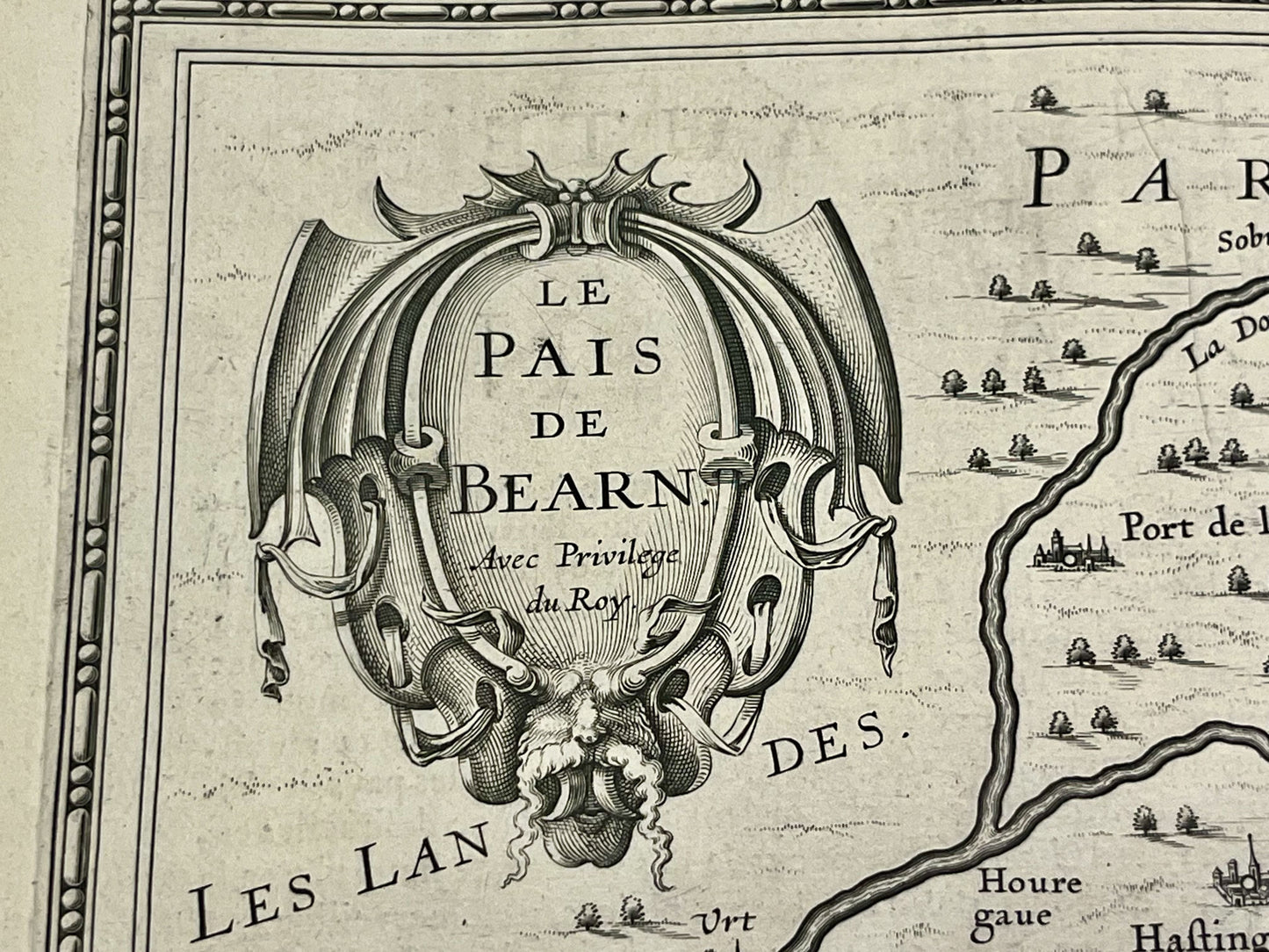
Antique map of Béarn by J. Janssonius - ca. 1630
Antique map of Béarn by J. Janssonius - ca. 1630
Couldn't load pickup availability
This antique map of Béarn dates from the mid-17th century and measures 56x48cm. It provides a detailed depiction of each town and village in the Béarn region. It was published by the Dutch cartographer J. Janssonius.
Condition:
Central crease and warped paper. Please note, my maps are old and not always in perfect condition!
Main cities represented:
Bayonne, Bidache, Guiche, Peyrehorade, Sorde-l'Abbaye, Saint-Palais, Orthez, Salies-de-Béarn, Artix, Morlanne, Sauveterre-de-Béarn, Navarrenx, Mauléon-Licharre, Lescar, Pau, Nay, Oloron-Sainte-Marie, Arudy, Bielle,...


-

Secure payment
-

Careful shipping
-

No reproduction
-

Satisfied or refunded


-

“Hello, thank you for sending this, the cards are superb!”
Jean-Philippe
-
"They are very beautiful, just need to frame them! Thank you"
Baptiste
-
"Fast shipping and very good tracking."
Alice
-
"My husband loved the maps I gave him for Christmas!"
Solène
