


Antique map of the Beauce region by H. Hondius - ca. 1650
Antique map of the Beauce region by H. Hondius - ca. 1650
Couldn't load pickup availability
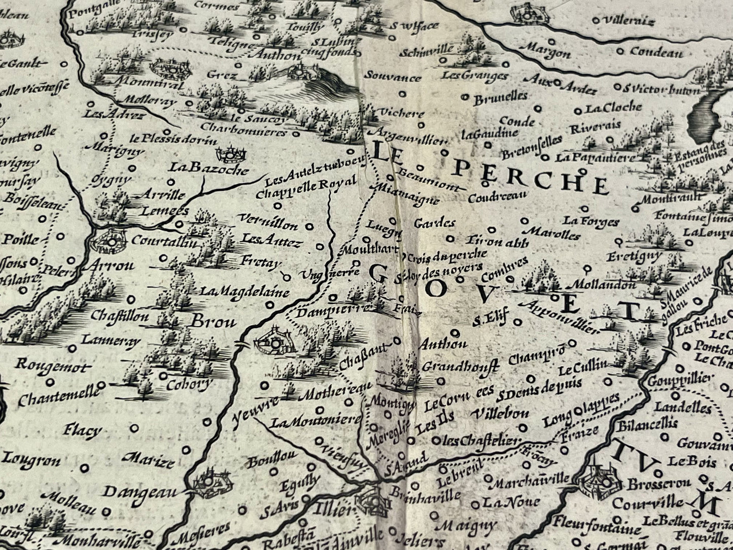
This antique map of the Beauce, a historical region straddling the Eure-et-Loir, Loir-et-Cher and Loiret departments, was published by the Dutch cartographer and publisher H. Hondius in the mid-17th century. Its dimensions are 57.5x48cm.
Condition:
Central crease, tears on the edges and warped paper. Please note, my maps are old and not always in perfect condition!
Main cities represented:
Paris, Dourdan, Etampes, Orléans, Beaugency, Chartres, Dreux, Houdan, Nogent-le-Roi, Épernon,...


-

Secure payment
-

Careful shipping
-

No reproduction
-

Satisfied or refunded


-

“Hello, thank you for sending this, the cards are superb!”
Jean-Philippe
-
"They are very beautiful, just need to frame them! Thank you"
Baptiste
-
"Fast shipping and very good tracking."
Alice
-
"My husband loved the maps I gave him for Christmas!"
Solène
