


Antique map of Belgium by J. Janvier - ca. 1770
Antique map of Belgium by J. Janvier - ca. 1770
Regular price
120,00 €
Regular price
Sale price
120,00 €
Unit price
per
Taxes included.
Couldn't load pickup availability
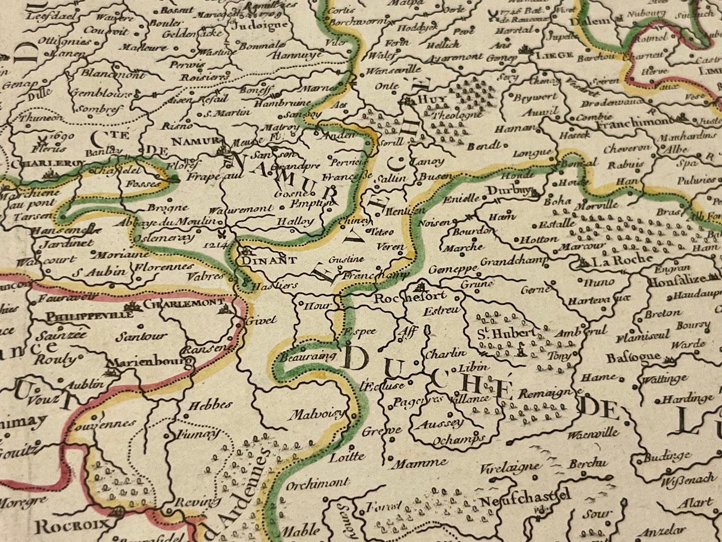
This antique map of Belgium (southern part of the Netherlands), represents its major historical regions such as Liège, Flanders or Brabant. It was drawn up by J. Janvier and published by J. Lattré at the end of the 18th century. The size of this map is 56x39cm.
Condition:
Good condition, stain on the left side, central fold. Please note, my maps are old and are not always in perfect condition!


-

Secure payment
-

Careful shipping
-

No reproduction
-

Satisfied or refunded


-

“Hello, thank you for sending this, the cards are superb!”
Jean-Philippe
-
"They are very beautiful, just need to frame them! Thank you"
Baptiste
-
"Fast shipping and very good tracking."
Alice
-
"My husband loved the maps I gave him for Christmas!"
Solène
