


Antique map of Bourbonnais by J. Blaeu - ca. 1650
Antique map of Bourbonnais by J. Blaeu - ca. 1650
Couldn't load pickup availability
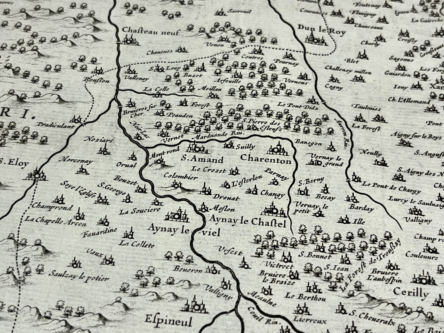
This antique map of Bourbonnais, a former region mainly located in the current department of Allier, dates from the middle of the 17th century and its dimensions are 56.5x44cm. It was produced by the Dutch cartographer J. Blaeu.
Condition:
Center crease and minimal staining. Please note, my maps are old and are not always in perfect condition!
List of main cities represented:
Moulins, Bourbon-Lancy, Lapalisse, Vichy, Varennes-sur-Allier, Saint-Pourçain-sur-Sioule, Chantelle, Montmarault, Villefranche-d'Allier, Cosne-d'Allier, Montluçon, Hérisson, Bourbon-l'Archambault, Saint-Amand-Montrond, Charenton-du-Cher, Ainay-le-Château, Ainay-le-Vieil, Decize, Nevers,...


-

Secure payment
-

Careful shipping
-

No reproduction
-

Satisfied or refunded


-

“Hello, thank you for sending this, the cards are superb!”
Jean-Philippe
-
"They are very beautiful, just need to frame them! Thank you"
Baptiste
-
"Fast shipping and very good tracking."
Alice
-
"My husband loved the maps I gave him for Christmas!"
Solène
