


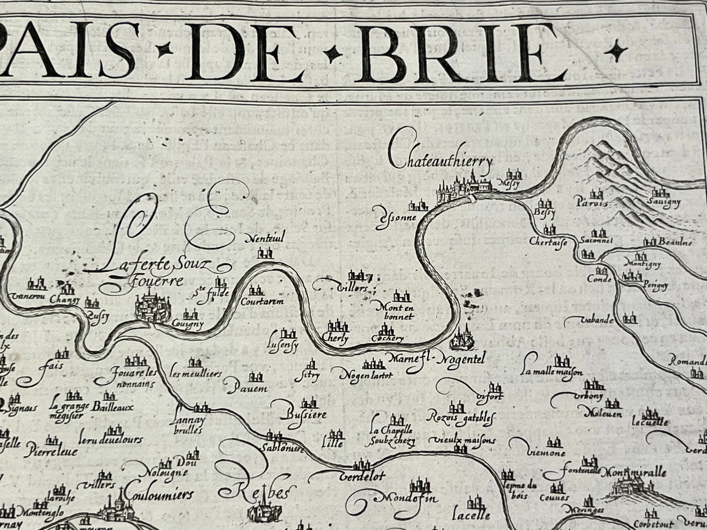
Antique map of the Brie region by D. de Templeux - ca. 1650
Antique map of the Brie region by D. de Templeux - ca. 1650
Regular price
150,00 €
Regular price
Sale price
150,00 €
Unit price
per
Taxes included.
Couldn't load pickup availability
This antique map of the Île-de-France region, depicting the Brie region, dates from the mid-17th century and measures 56.5x44cm. It was published by Damien de Templeux.
Condition:
Center crease and minimal staining. Please note, my maps are old and are not always in perfect condition!
List of main cities represented:
Paris, Corbeil-Essonnes, Melun, Meaux, Crécy-la-Chapelle, Provins, La Ferté-Gauché,...


-

Secure payment
-

Careful shipping
-

No reproduction
-

Satisfied or refunded


-

“Hello, thank you for sending this, the cards are superb!”
Jean-Philippe
-
"They are very beautiful, just need to frame them! Thank you"
Baptiste
-
"Fast shipping and very good tracking."
Alice
-
"My husband loved the maps I gave him for Christmas!"
Solène
