


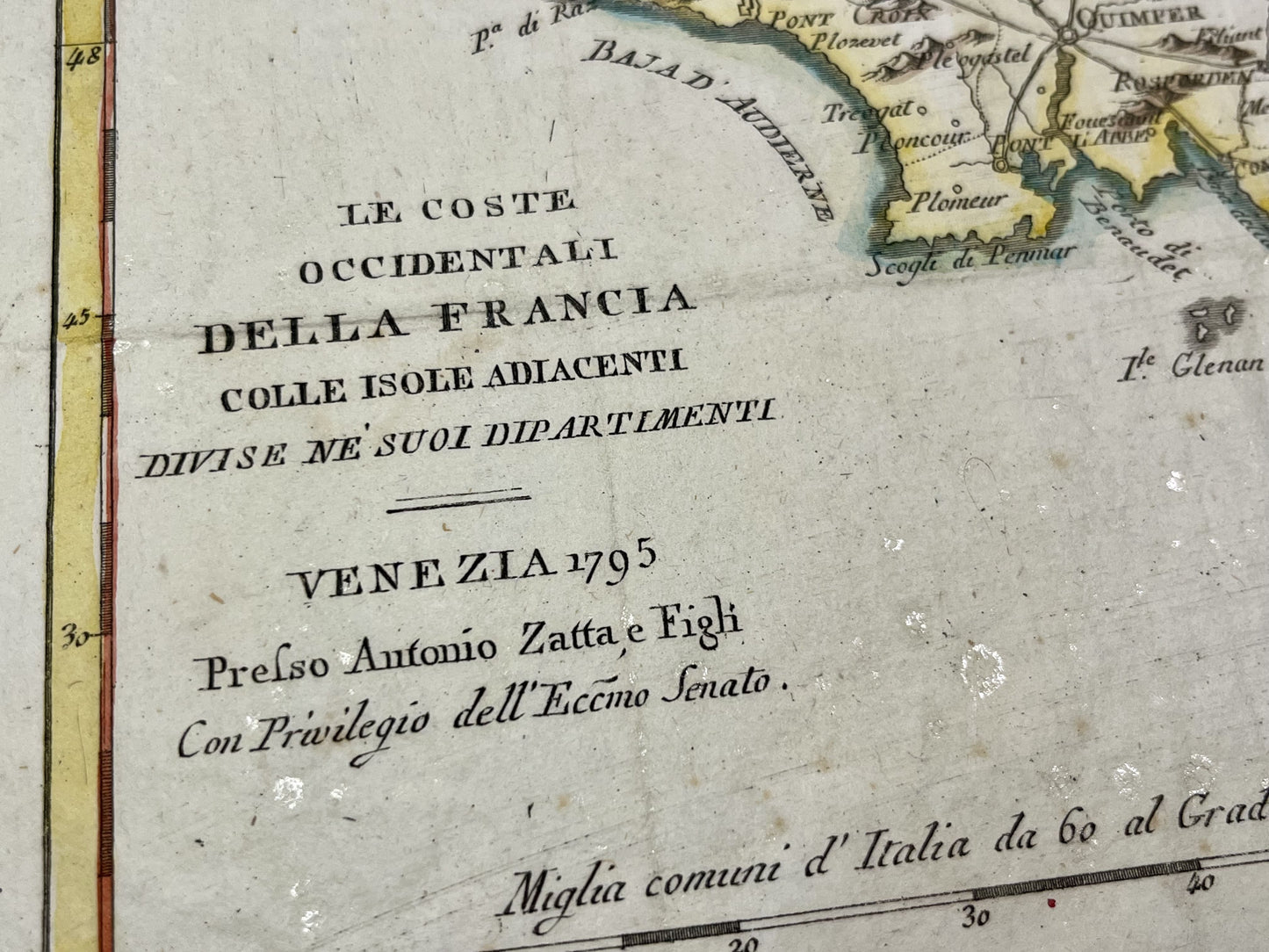
Antique map of Brittany by A. Zatta - 1795
Antique map of Brittany by A. Zatta - 1795
Regular price
180,00 €
Regular price
Sale price
180,00 €
Unit price
per
Taxes included.
Couldn't load pickup availability
This antique map of Brittany was drawn up by Antonio Zatta in Venice and published in 1795. The dimensions of this map are 42x35cm.
Condition:
Good condition, minimal stains, creases. Please note, my maps are old and are not always in perfect condition!
List of main cities represented:
Brest, Quimper, Douarnenez, Vannes, Belle-Ile, Groix, Saint-Brieuc, Carhaix, Saint-Malo, Rennes, Pontivy, Gourin,...


-

Secure payment
-

Careful shipping
-

No reproduction
-

Satisfied or refunded


-

“Hello, thank you for sending this, the cards are superb!”
Jean-Philippe
-
"They are very beautiful, just need to frame them! Thank you"
Baptiste
-
"Fast shipping and very good tracking."
Alice
-
"My husband loved the maps I gave him for Christmas!"
Solène
