


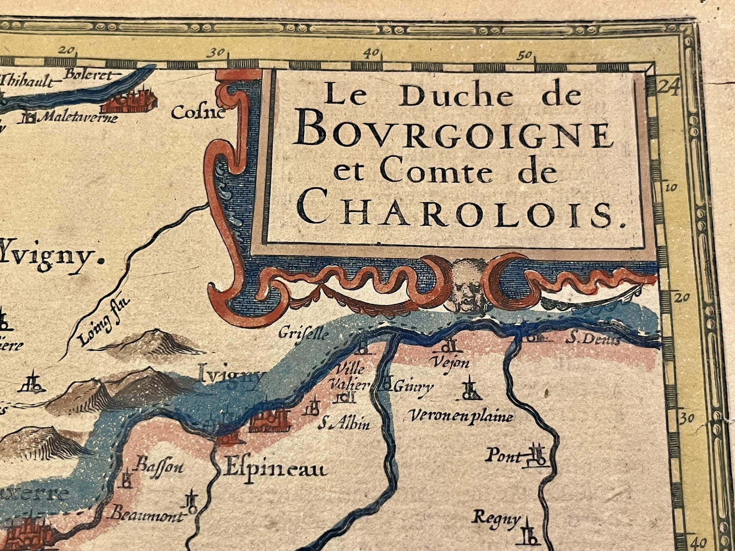
Antique map of the Duchy of Burgundy and the County of Charolais by J. Hondius - ca. 1630
Antique map of the Duchy of Burgundy and the County of Charolais by J. Hondius - ca. 1630
Couldn't load pickup availability
This antique map of Burgundy covering the departments of Côte d'Or, Yonne and Nièvre was drawn up and published by the Dutch cartographer J. Hondius at the beginning of the 17th century. Its dimensions are 52x40cm.
Condition:
Tears at the edge of the map. Please note, my maps are old and are not always in perfect condition!
List of main cities represented:
Gray, Selongey, Châtillon-sur-Seine, Laignes, Noyers-sur-Serein, Ravières, Semur-en-Auxois, Avallon, Vitteaux, Dijon, Tonnerre, Saulieu, Arnay-le-Duc, Beaune, Autun, Bourbon-Lancy, Chalon-sur-Saône, Tournus, Mâcon,...


-

Secure payment
-

Careful shipping
-

No reproduction
-

Satisfied or refunded


-

“Hello, thank you for sending this, the cards are superb!”
Jean-Philippe
-
"They are very beautiful, just need to frame them! Thank you"
Baptiste
-
"Fast shipping and very good tracking."
Alice
-
"My husband loved the maps I gave him for Christmas!"
Solène
