


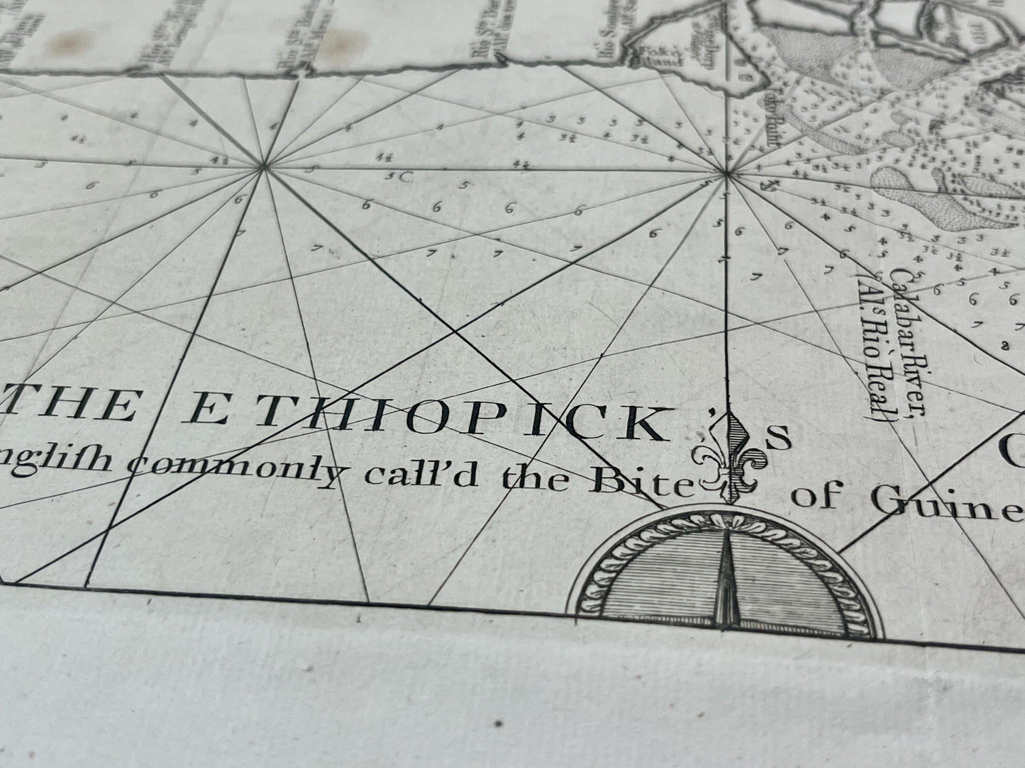
Antique map of the mouth of the Calabar River in Nigeria - ca. 1700
Antique map of the mouth of the Calabar River in Nigeria - ca. 1700
Regular price
160,00 €
Regular price
Sale price
160,00 €
Unit price
per
Taxes included.
Couldn't load pickup availability
This antique map of Africa, depicting the mouth of the Calabar River in Niger, dates from the early 18th century and measures 45x33.5cm. It was created through the joint surveys of several captains in 1699.
Condition:
Minimal tasks. Please note, my maps are old and are not always in perfect condition!


-

Secure payment
-

Careful shipping
-

No reproduction
-

Satisfied or refunded


-

“Hello, thank you for sending this, the cards are superb!”
Jean-Philippe
-
"They are very beautiful, just need to frame them! Thank you"
Baptiste
-
"Fast shipping and very good tracking."
Alice
-
"My husband loved the maps I gave him for Christmas!"
Solène
