

Antique map of Cambodia by A. Vuillemin
Antique map of Cambodia by A. Vuillemin
Couldn't load pickup availability
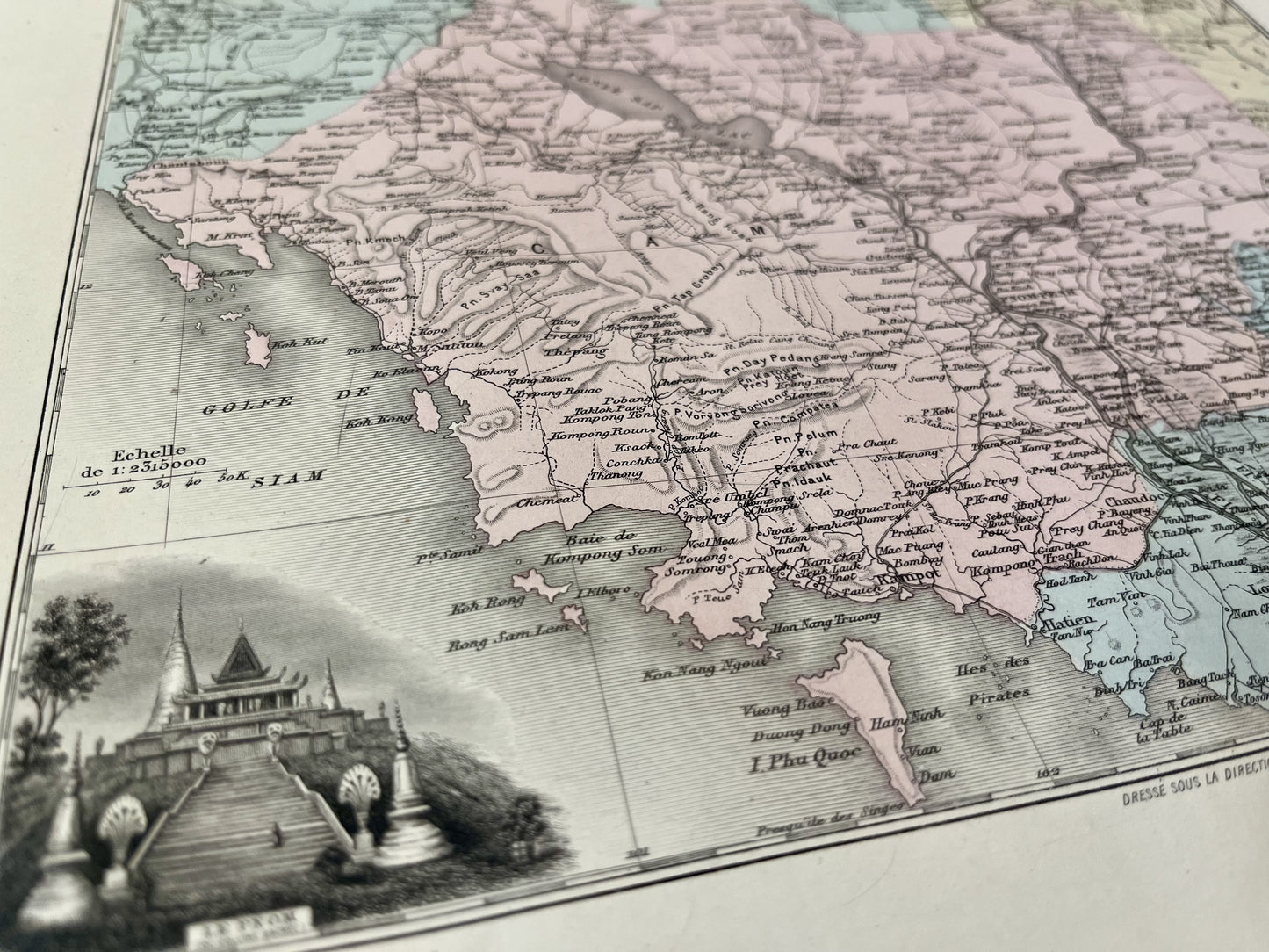
This antique map of Asia is colored and represents Cambodia. It comes from the New Illustrated National Atlas, a work published during the end of the 19th century and the beginning of the 20th, and was produced by the Geographers A. Vuillemin, L. Thuillier, Ch. Lacoste and G. Lorsignol. Its dimensions are 39x29cm. This map shows the cities and villages of Cambodia at the time.
Condition:
Very good condition, minimal stains.

-

Secure payment
-

Careful shipping
-

No reproduction
-

Satisfied or refunded


-

“Hello, thank you for sending this, the cards are superb!”
Jean-Philippe
-
"They are very beautiful, just need to frame them! Thank you"
Baptiste
-
"Fast shipping and very good tracking."
Alice
-
"My husband loved the maps I gave him for Christmas!"
Solène
