


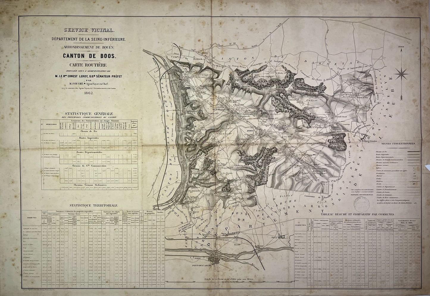
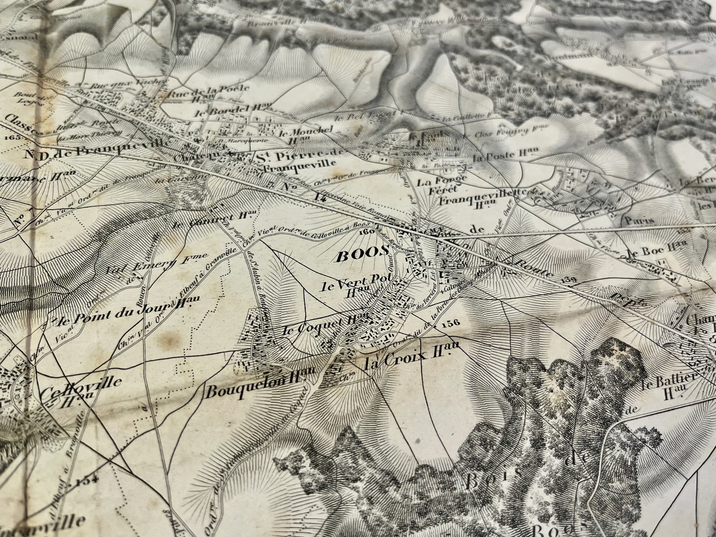
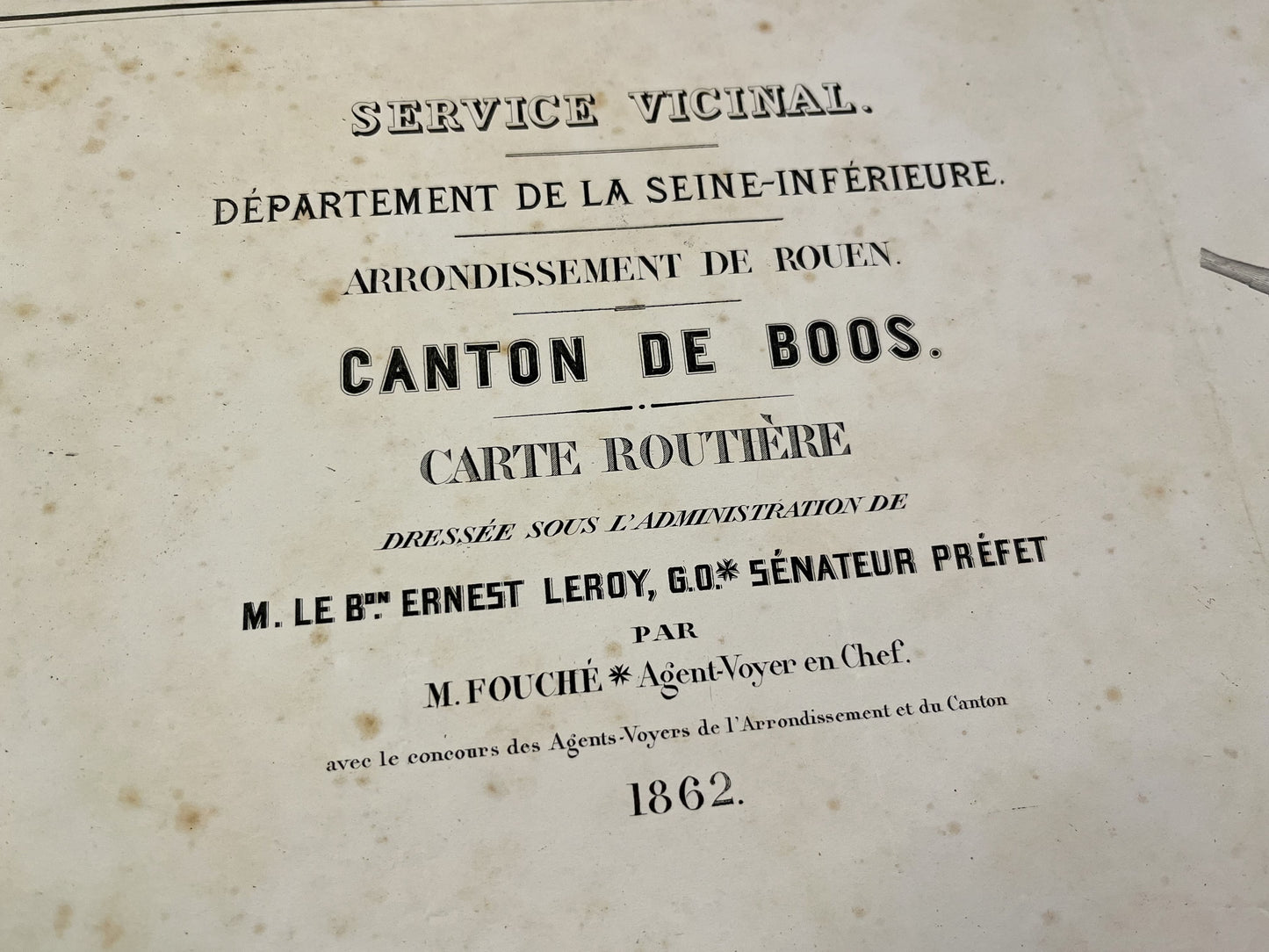
Antique map of the Canton of Boos by the Service Vicinal - 1862
Antique map of the Canton of Boos by the Service Vicinal - 1862
Couldn't load pickup availability
This antique road map of the Canton of Boos, Seine-Maritime, was drawn up under the Administration of Baron Ernest Leroy, Senator Prefect of Seine-Inférieure. It is dated 1862 (date of production, no print) and its size is 105x74.5cm.
Condition:
Folds, minimal hole at the junction of the folds, tear on the right and stains. Please note, my maps are old and are not always in perfect condition!
List of main villages represented:
Bonsecours, Le Mesnil-Esnard, Franqueville-Saint-Pierre, Amfreville-la-Mi-Voie, Boos, Belbeuf, Saint-Aubin-Celloville, Quévreville-la-Poterie, Ymare, Gouy, Les Authieux-sur-le-Port- Saint-Ouen, La Neuville-Chant-d'Oisel, Mesnil-Raoul, Fresne-le-Plan, Montmain,...
-

Secure payment
-

Careful shipping
-

No reproduction
-

Satisfied or refunded


-

“Hello, thank you for sending this, the cards are superb!”
Jean-Philippe
-
"They are very beautiful, just need to frame them! Thank you"
Baptiste
-
"Fast shipping and very good tracking."
Alice
-
"My husband loved the maps I gave him for Christmas!"
Solène
