


Antique map of Castile by R. Mendes Silva - ca. 1710
Antique map of Castile by R. Mendes Silva - ca. 1710
Regular price
300,00 €
Regular price
Sale price
300,00 €
Unit price
per
Taxes included.
Couldn't load pickup availability
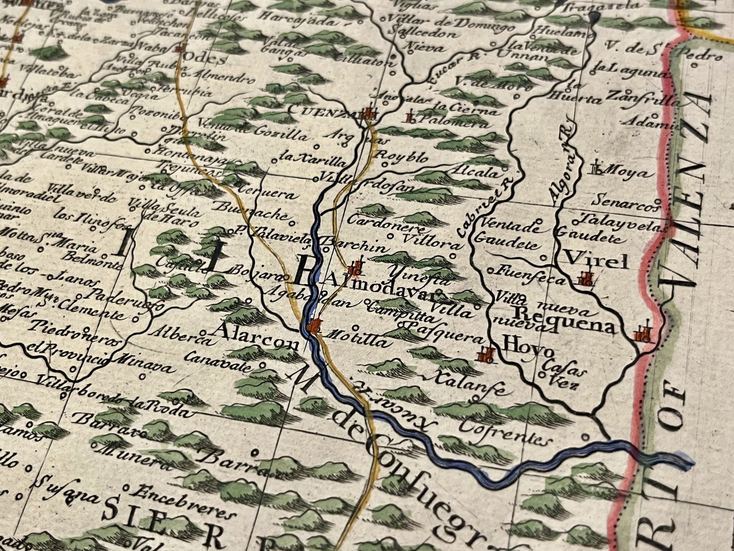
This antique map of Spain depicts Castile. It was drawn by Rodrigo Mendes Silva in the early 18th century. It measures 60x50cm.
Condition:
Good condition, repair on the upper part. Please note, my maps are old and are not always in perfect condition!
List of main cities represented:
Madrid, Badajoz, Caceres, Toledo, Ciudad Real, Cuenca, Salamanca, Valladolid, Avila, Segovia, Siguenza,...


-

Secure payment
-

Careful shipping
-

No reproduction
-

Satisfied or refunded


-

“Hello, thank you for sending this, the cards are superb!”
Jean-Philippe
-
"They are very beautiful, just need to frame them! Thank you"
Baptiste
-
"Fast shipping and very good tracking."
Alice
-
"My husband loved the maps I gave him for Christmas!"
Solène
