


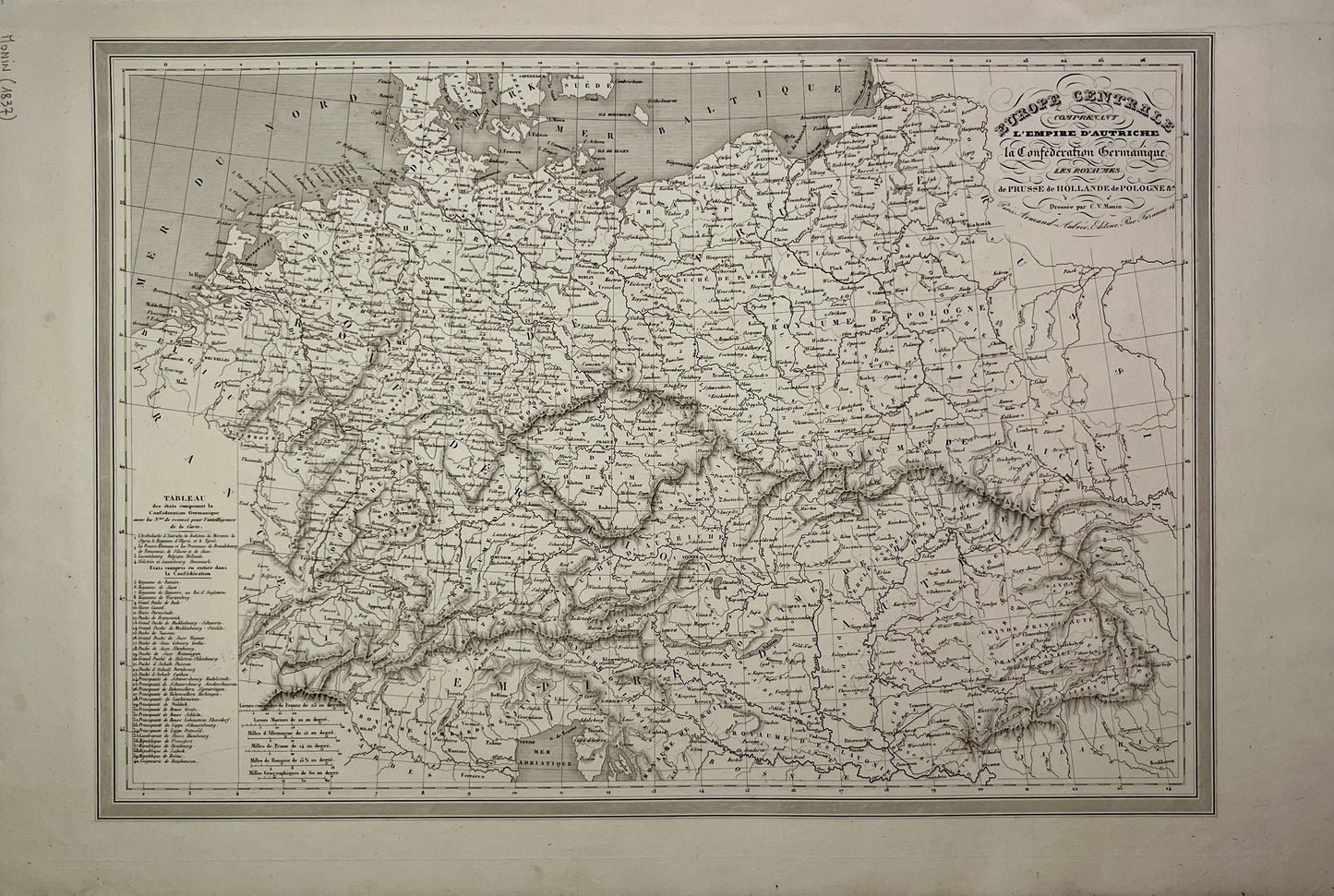
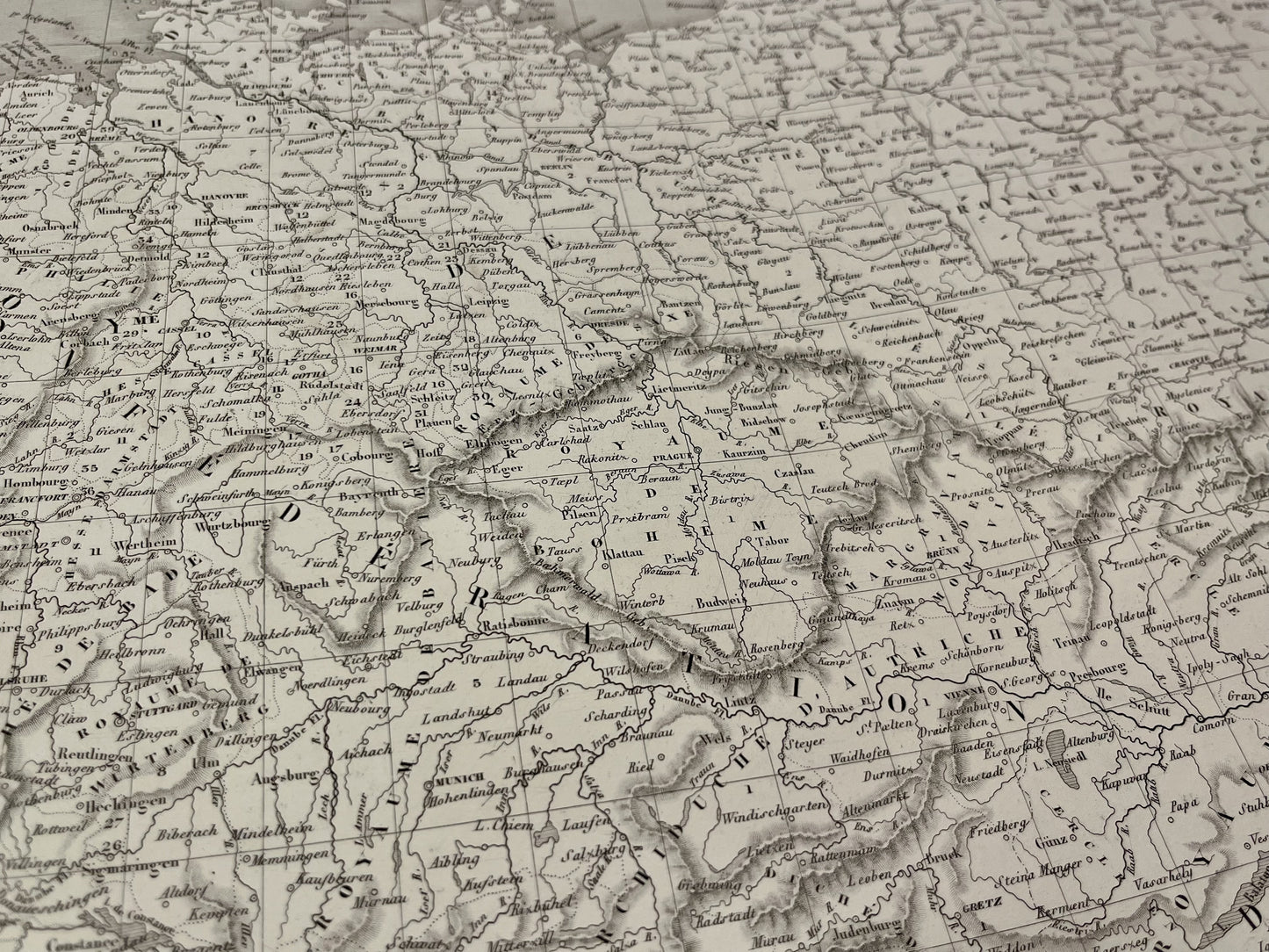
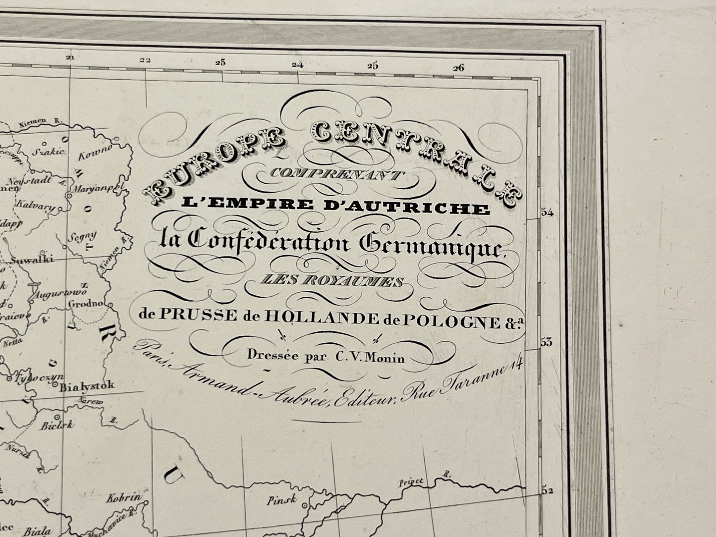
Antique map of Central Europe by CV Monin - ca. 1860
Antique map of Central Europe by CV Monin - ca. 1860
Regular price
50,00 €
Regular price
Sale price
50,00 €
Unit price
per
Taxes included.
Couldn't load pickup availability
This antique map of Central Europe showing the Austrian Empire, the German Confederation and the Kingdoms of Prussia, Holland and Poland was drawn up by CV Monin in the mid-19th century and its dimensions are 55x36.5cm.
Condition:
Good condition, minimal tears outside the map. Please note, my maps are old and are not always in perfect condition!
-

Secure payment
-

Careful shipping
-

No reproduction
-

Satisfied or refunded


-

“Hello, thank you for sending this, the cards are superb!”
Jean-Philippe
-
"They are very beautiful, just need to frame them! Thank you"
Baptiste
-
"Fast shipping and very good tracking."
Alice
-
"My husband loved the maps I gave him for Christmas!"
Solène
