


Antique map of Champagne by G. and J. Blaeu - ca. 1660
Antique map of Champagne by G. and J. Blaeu - ca. 1660
Couldn't load pickup availability
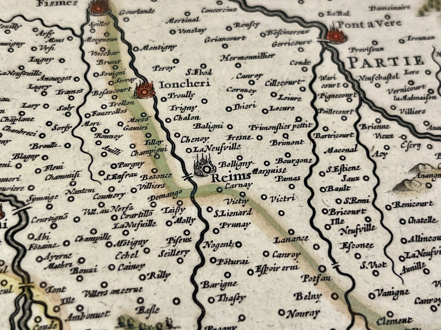
This antique map of Champagne representing the Diocese of Reims and the Pays de Rethel was made and published by the Dutch cartographers Guilem and Joan Blaeu at the end of the 17th century. Its period are magnificent. Its dimension is 58x48cm.
Condition:
Minimal stains and tears off map. Please note, my maps are old and are not always in perfect condition!
List of cities represented:
Châlons-en-Champagne, Sézanne, Épernay, Reims, Vertus, Avize, Aÿ-Champagne, Fismes, Château-Thierry, La Ferté-Milon, Laon, Château-Porcien, Rethel, Signy-l'Abbaye, Charleville-Mézières, Attigny, Sedan, Suippes, Sommepy, Stenay, Dun-sur-Meuse,...


-

Secure payment
-

Careful shipping
-

No reproduction
-

Satisfied or refunded


-

“Hello, thank you for sending this, the cards are superb!”
Jean-Philippe
-
"They are very beautiful, just need to frame them! Thank you"
Baptiste
-
"Fast shipping and very good tracking."
Alice
-
"My husband loved the maps I gave him for Christmas!"
Solène
