


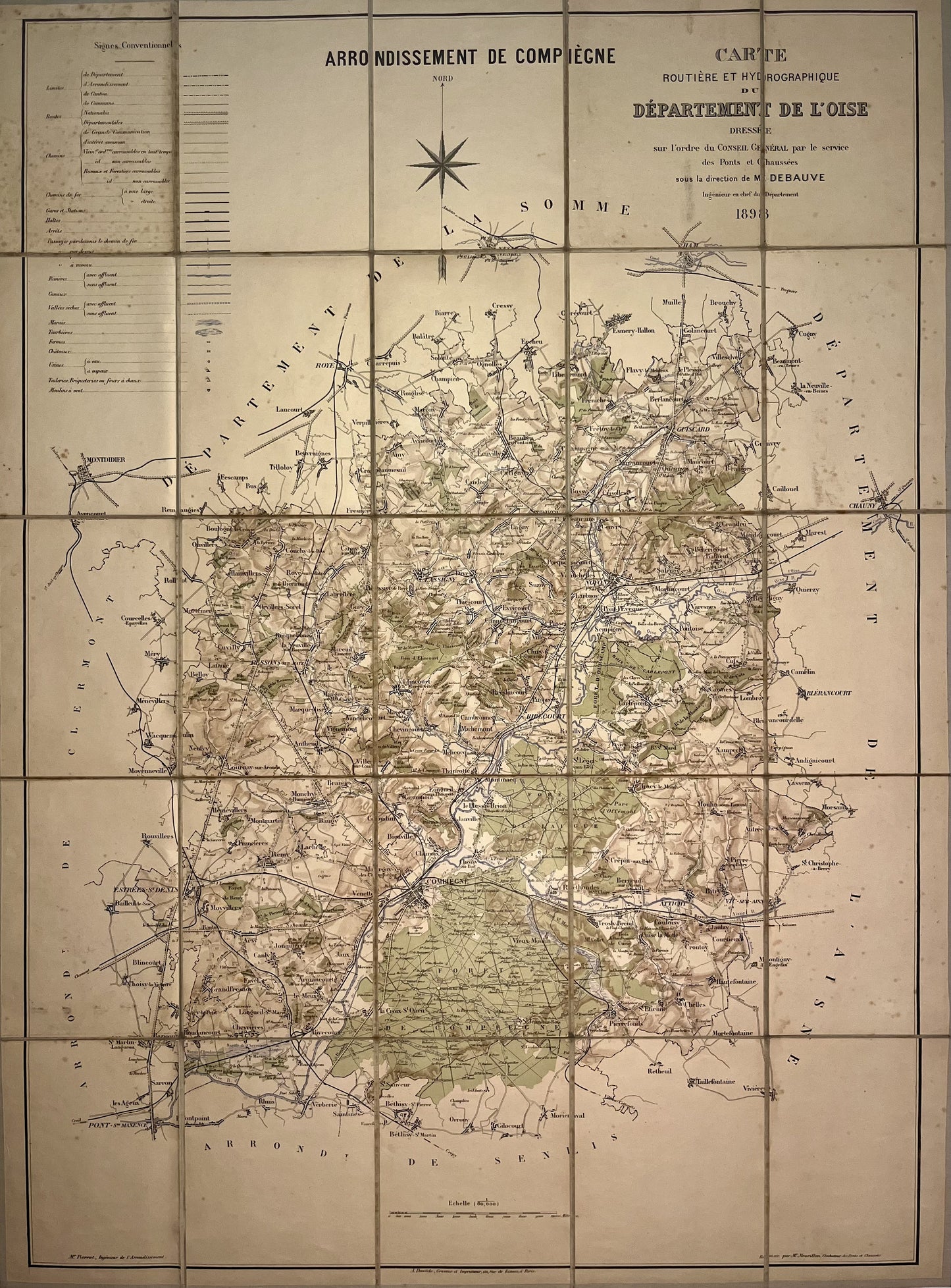
Antique map of the district of Compiègne by M. Debauve - 1898
Antique map of the district of Compiègne by M. Debauve - 1898
Couldn't load pickup availability
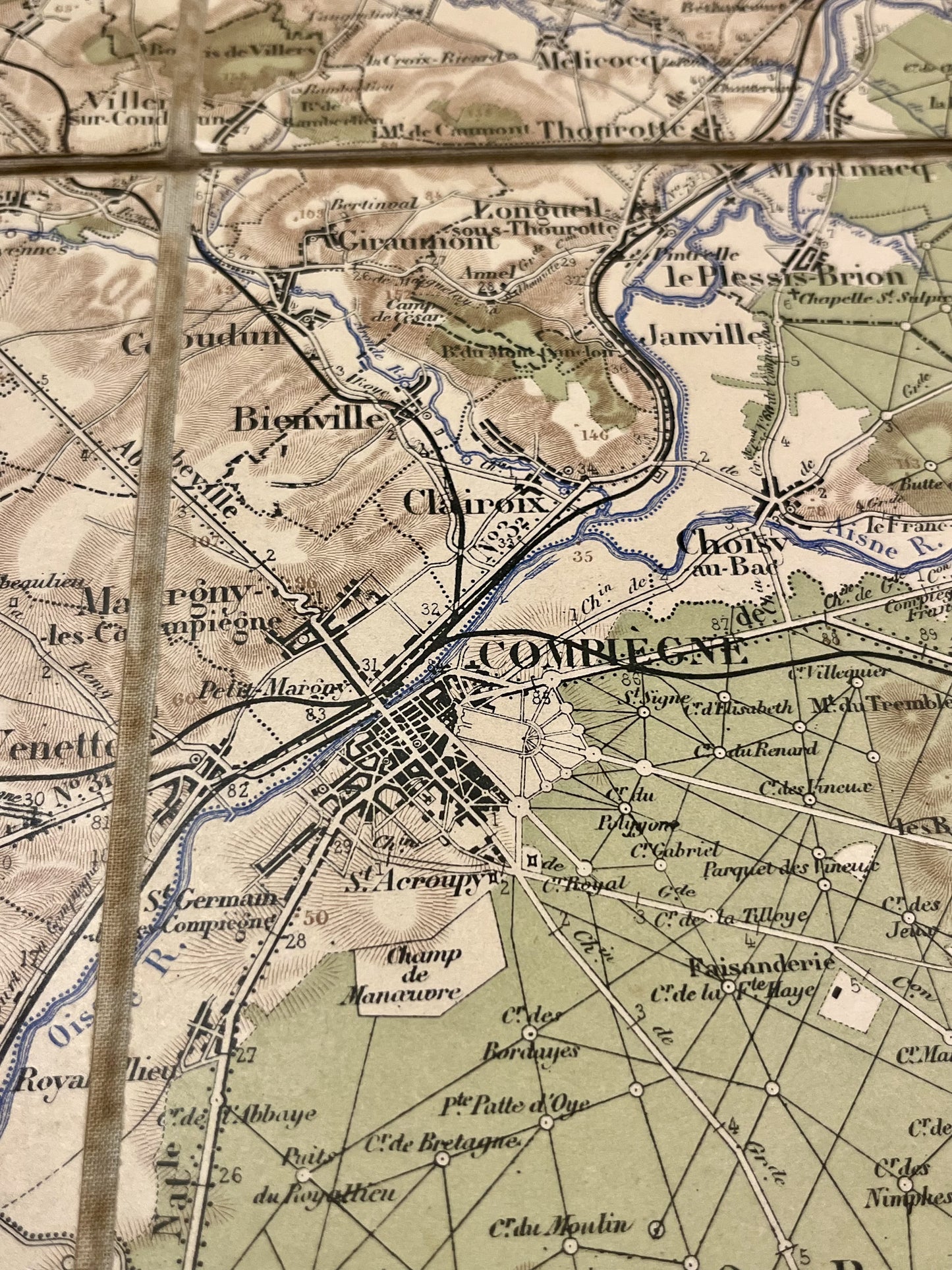
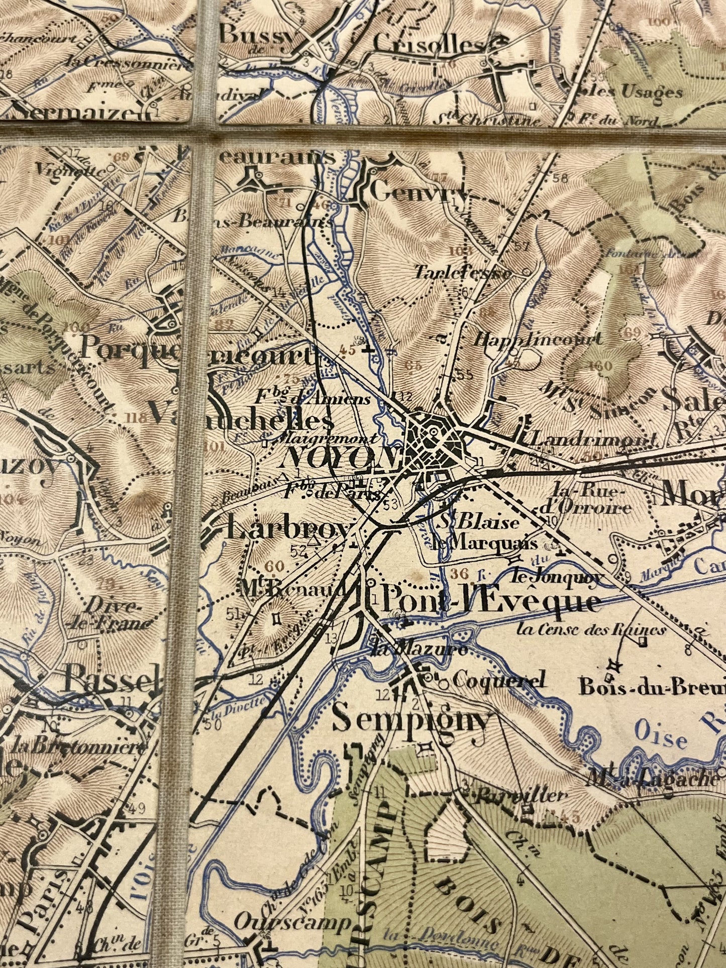
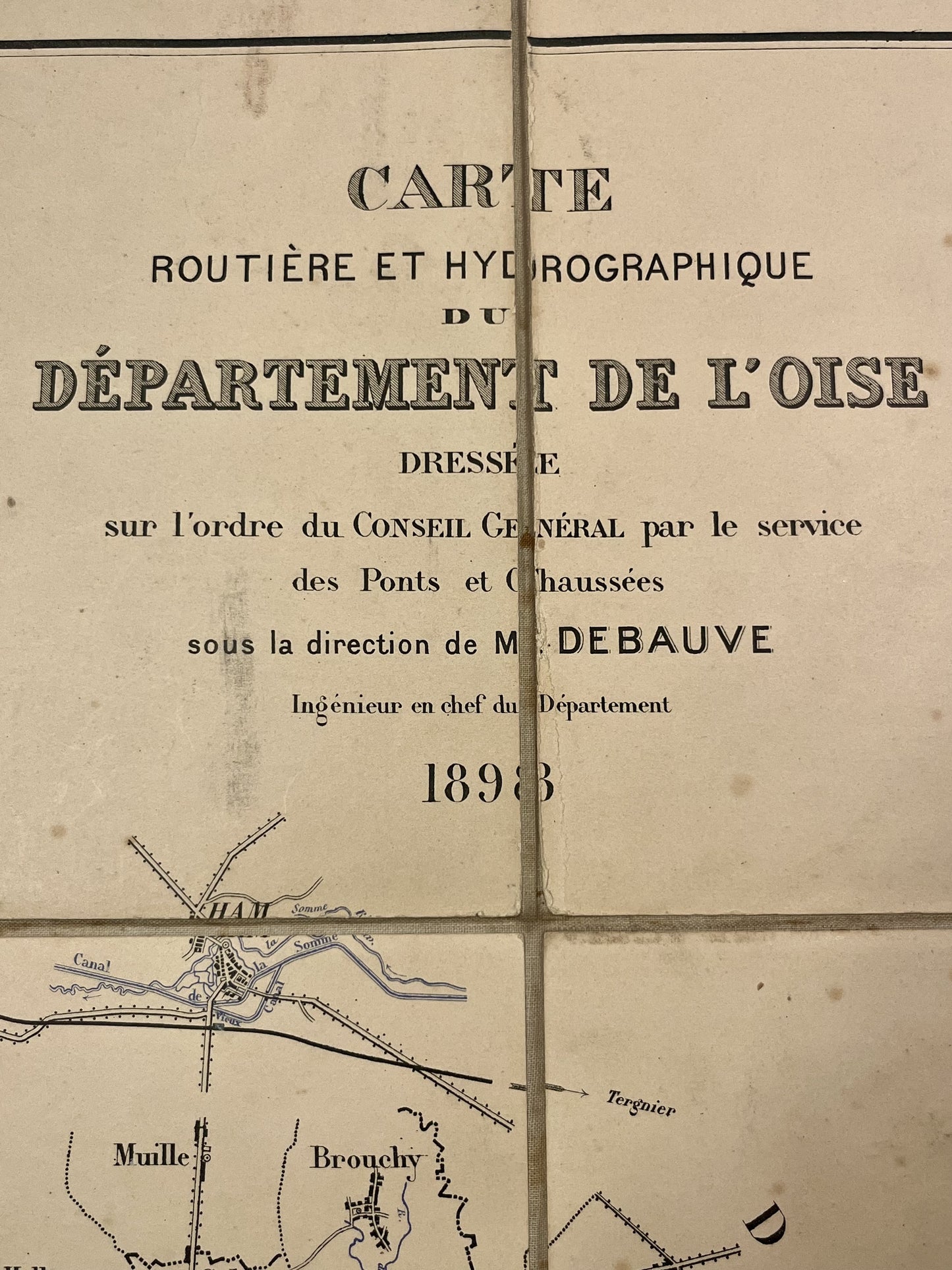
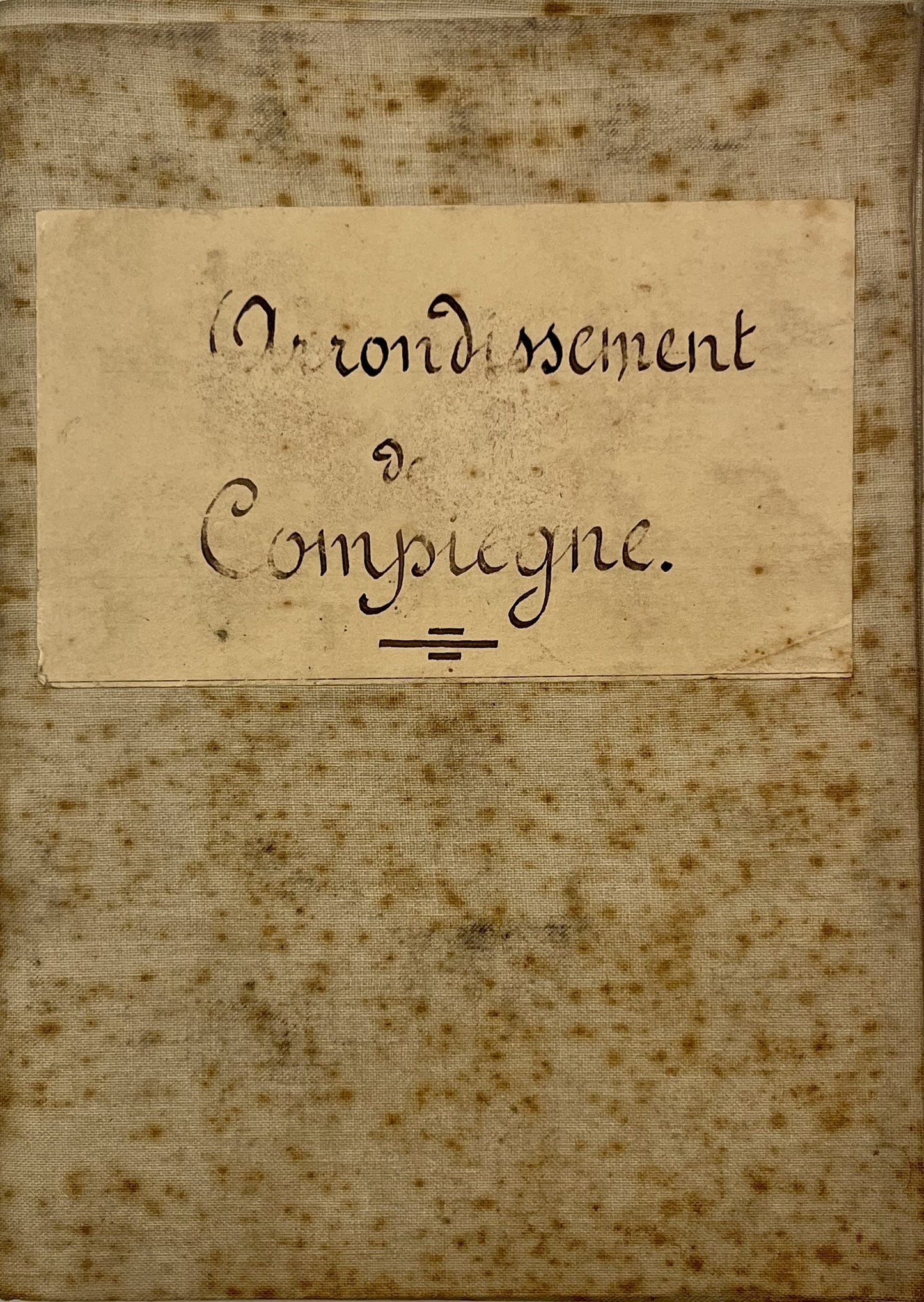
This antique map of Compiègne - Oise - and its surroundings was produced in 1898 on the orders of the Conseil Général by the Ponts et Chaussées department under the direction of Mr. Debauve. It is canvas-backed and its dimensions are 97x72.5cm.
Condition:
Minimal stains. Please note, my maps are old and are not always in perfect condition!
List of main cities represented:
Rivecourt, Béthisy-Saint-Pierre, Estrées-Saint-Denis, Pierrefonds, Attichy, Berneuil-sur-Aisne, Clairoix, Bienville, Hémévillers, Remy, Baugy, Antheuil, Gournay-sur-Aronde, Neufvy, Belloy, Marquéglise, Ressons-sur-Matz, Cuvilly, Mortemer, Laberlière, Hainvillers, le Plessis-Brion, Rethondes, Chelles, Hautefontaine, Chevincourt, Elincourt-Sainte-Marguerite, Ribecourt, Machemont, Cambronne, Dreslincourt, Evricourt, Lassigny, Suzoy, Tracy-le-Val, Carlepont, Caisnes, Cuts, Sempigny, Noyon, Béhéricourt, Appilly, Dives, Candor, Avricourt, Ecuvilly, Guiscard, Fréniches, Frétoy-le-Château, Maucourt, Quesmy, Grandrû,...
-

Secure payment
-

Careful shipping
-

No reproduction
-

Satisfied or refunded


-

“Hello, thank you for sending this, the cards are superb!”
Jean-Philippe
-
"They are very beautiful, just need to frame them! Thank you"
Baptiste
-
"Fast shipping and very good tracking."
Alice
-
"My husband loved the maps I gave him for Christmas!"
Solène
