


Antique map of Dauphiné by JB Homann - ca. 1720
Antique map of Dauphiné by JB Homann - ca. 1720
Couldn't load pickup availability
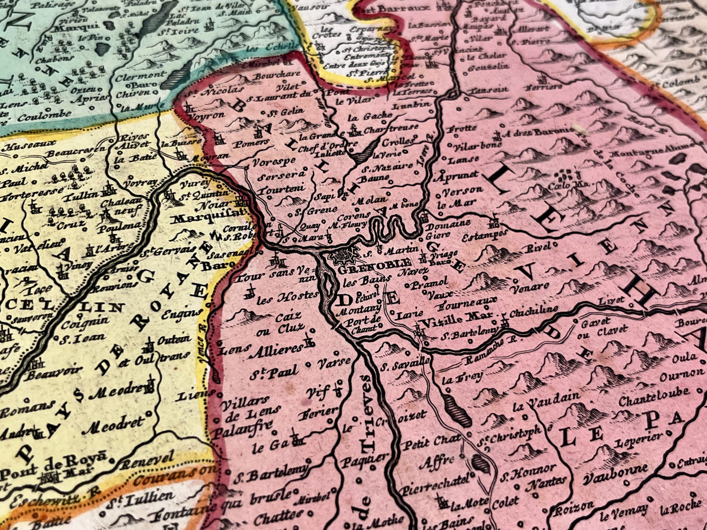
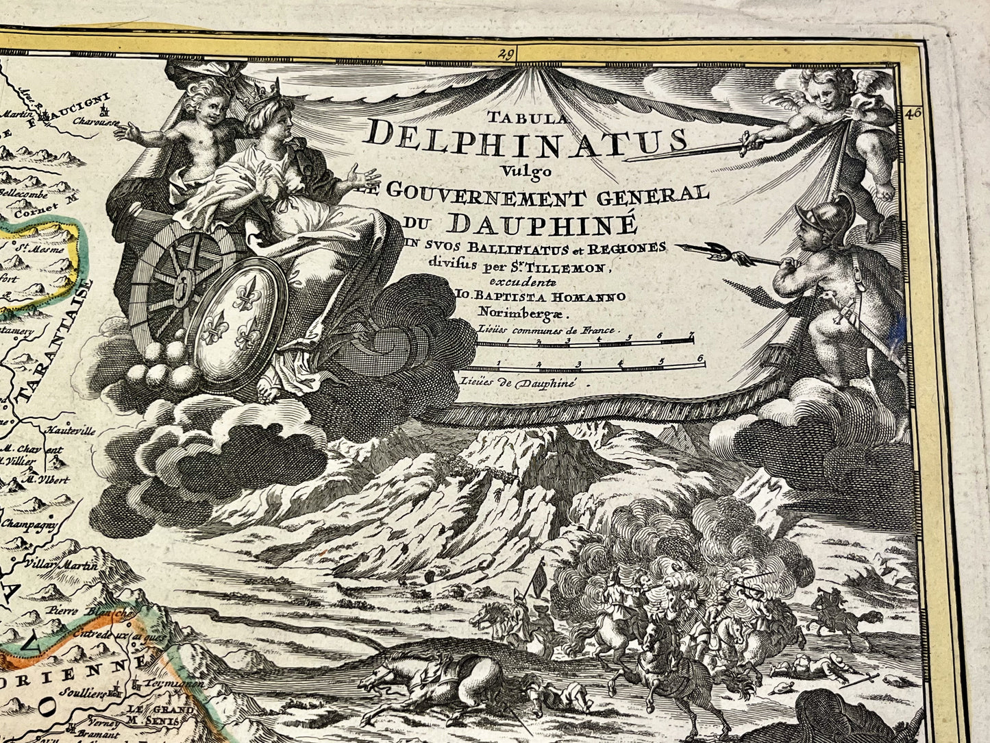
This antique map of Dauphiné dates from the early 18th century and measures 60.5x51.5cm. It was created by the German cartographer Johann Baptist Homann and is adorned with a beautiful Latin cartouche.
Condition:
Crease in the center and tears on the edges. Please note, my maps are old and are not always in perfect condition!
List of main cities represented:
Montélimar, Crest, Die, Gap, Embrun, Briançon, Queyras, Turin, Barcelonette, Grenoble, Saint-Jean-de-Maurienne, Annecy, Valence, Saint-Marcellin, Vienne, Lyon,...

-

Secure payment
-

Careful shipping
-

No reproduction
-

Satisfied or refunded


-

“Hello, thank you for sending this, the cards are superb!”
Jean-Philippe
-
"They are very beautiful, just need to frame them! Thank you"
Baptiste
-
"Fast shipping and very good tracking."
Alice
-
"My husband loved the maps I gave him for Christmas!"
Solène
