


Antique map of the Diocese of Le Mans by N. Sanson - ca. 1660
Antique map of the Diocese of Le Mans by N. Sanson - ca. 1660
Couldn't load pickup availability
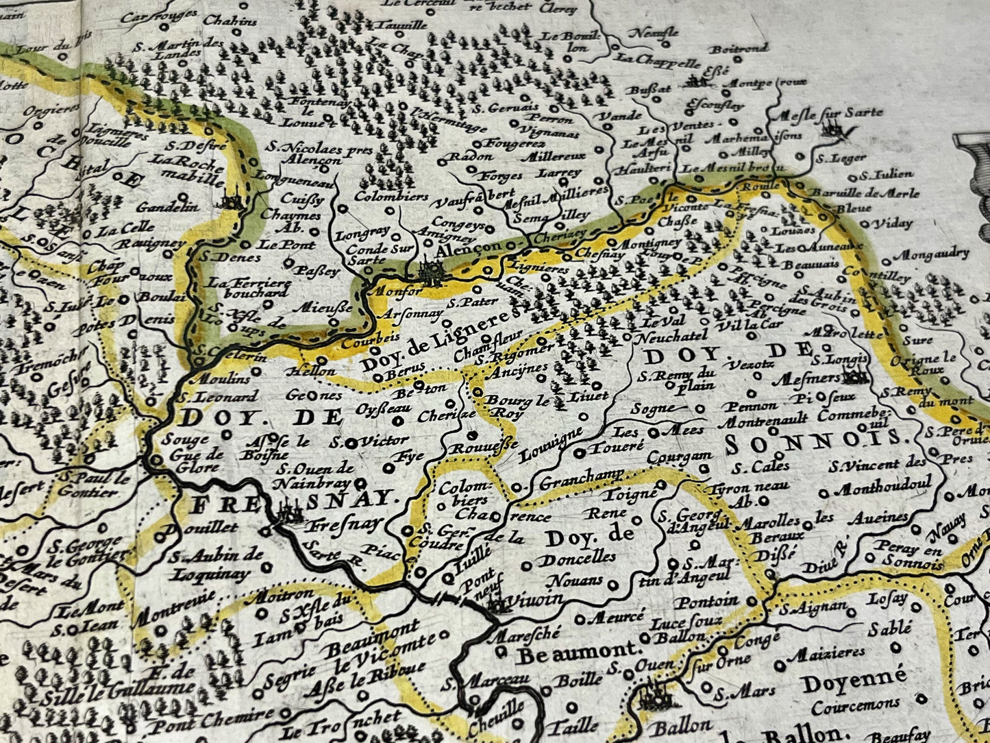
This antique map of Sarthe, depicting the Diocese of Le Mans, dates from the mid-17th century and measures 56x44cm. It was created by the French cartographer Nicolas Sanson d'Abbeville.
Condition:
Central fold and repair on the illustration located in the lower right corner (see photo 4). Please note, my maps are old and are not always in perfect condition!
List of main cities represented:
Le Mans, La Flèche, Luché-Pringé, Sablé-sur-Sarthe, Parcé-sur-Sarthe, Noyen-sur-Sarthe, Laval, Brûlon, Mayenne, Villaines-la-Juhel, Sillé-le-Guillaume, Alençon, Mamers, Bonnétable, la Ferté-Bernard, le Grand-Lucé, Bessé-sur-Braye,...


-

Secure payment
-

Careful shipping
-

No reproduction
-

Satisfied or refunded


-

“Hello, thank you for sending this, the cards are superb!”
Jean-Philippe
-
"They are very beautiful, just need to frame them! Thank you"
Baptiste
-
"Fast shipping and very good tracking."
Alice
-
"My husband loved the maps I gave him for Christmas!"
Solène
