


Antique map of the Duchy of Brabant by F. de Wit - ca. 1670
Antique map of the Duchy of Brabant by F. de Wit - ca. 1670
Couldn't load pickup availability
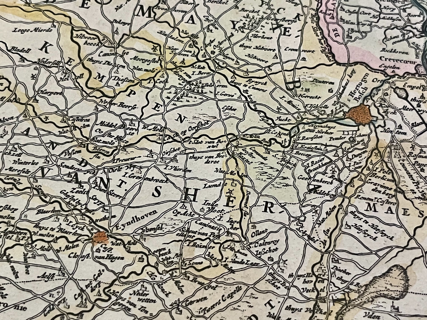
This antique map of Belgium and the Netherlands depicts the Duchy of Brabant. It was published by the Dutch cartographer Frederik de Witt at the end of the 17th century and measures 60x50.5cm. Beautiful period colors.
Condition:
Central fold, unneeded adhesive tape on the back. Please note, my maps are old and not always in perfect condition!
Main cities represented:
Breda, Dordrecht, 's-Hertogenbosch, Eindhoven, Helmond, Antwerp, Berg-op-Zoom, Dendermonde, Brussels, Mechelen, Leuven, Lier, Aarschot, Diest, Hasselt, Tienen, Sint-Truiden, Maastricht, Liège, Namur,...


-

Secure payment
-

Careful shipping
-

No reproduction
-

Satisfied or refunded


-

“Hello, thank you for sending this, the cards are superb!”
Jean-Philippe
-
"They are very beautiful, just need to frame them! Thank you"
Baptiste
-
"Fast shipping and very good tracking."
Alice
-
"My husband loved the maps I gave him for Christmas!"
Solène
