


Antique map of East Flanders by F. de Wit - ca. 1640
Antique map of East Flanders by F. de Wit - ca. 1640
Couldn't load pickup availability
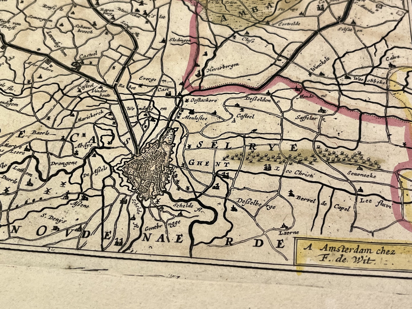
This antique map spanning Belgium and the Netherlands represents East Flanders. It was published by the Dutch cartographer F. de Wit in the middle of the 17th century. Its colors are magnificent. Its dimension is 62x53cm.
Condition:
4cm tear at the bottom of the central fold, good general condition. Please note, my maps are old and are not always in perfect condition!
List of cities represented:
Bruges, Damme, Sluis, Aardenburg, Ostend, Oudenburg, Deinze, Ghent, Roeselare,...


-

Secure payment
-

Careful shipping
-

No reproduction
-

Satisfied or refunded


-

“Hello, thank you for sending this, the cards are superb!”
Jean-Philippe
-
"They are very beautiful, just need to frame them! Thank you"
Baptiste
-
"Fast shipping and very good tracking."
Alice
-
"My husband loved the maps I gave him for Christmas!"
Solène
