


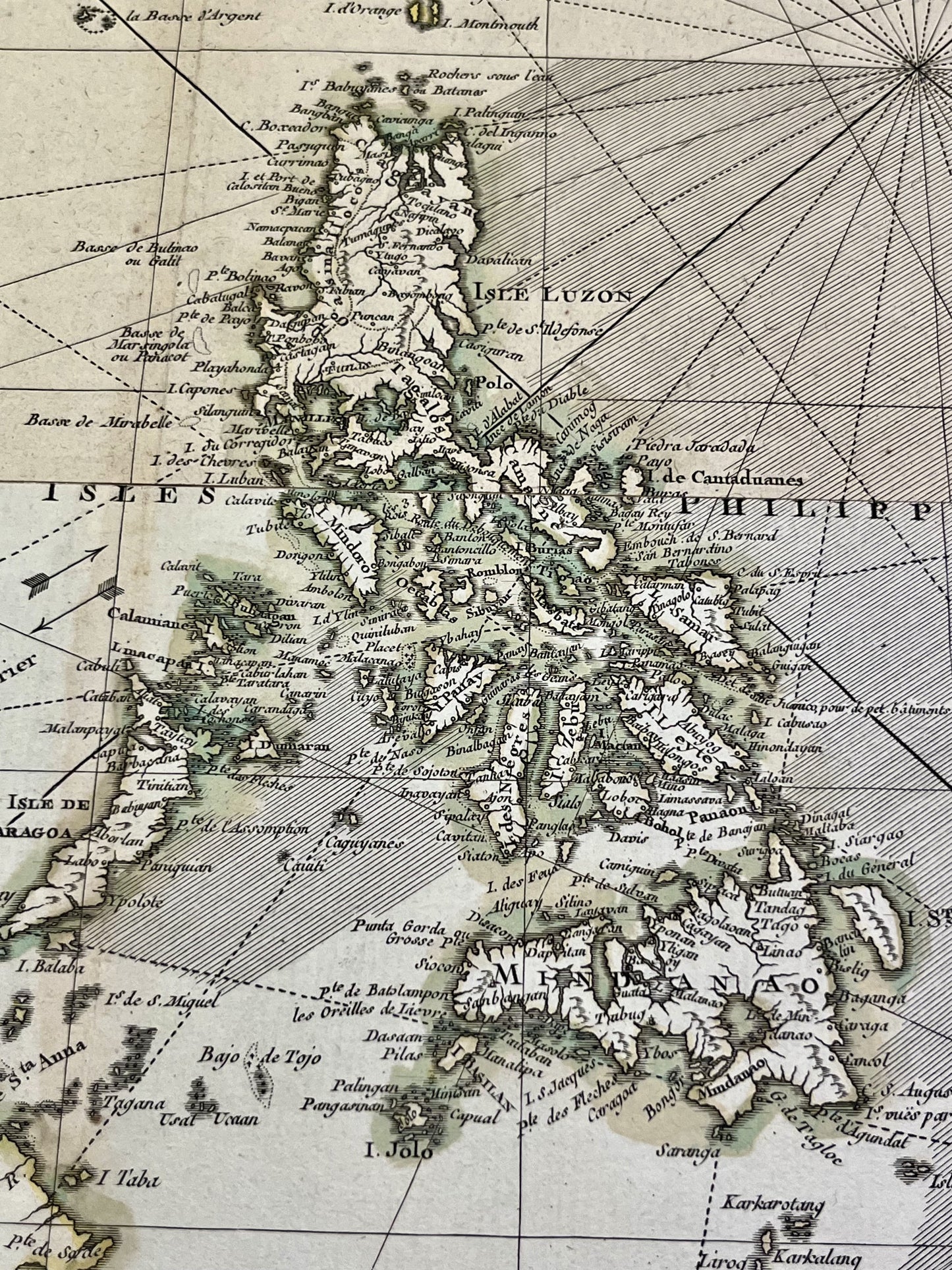
Antique map of the East Indies by R. Bonne - 1771
Antique map of the East Indies by R. Bonne - 1771
Regular price
200,00 €
Regular price
Sale price
200,00 €
Unit price
per
Taxes included.
Couldn't load pickup availability
This antique map of Asia representing the Far East was drawn by Rigobert Bonne and published by J. Lattré in 1771. It is composed of two sheets joined together and its total dimensions are 66.5x51cm.
Condition:
Stains, tears on the edges. Please note, my maps are old and not always in perfect condition!
Countries represented:
Philippines, Taiwan, Indonesia, Malaysia, Vietnam, Cambodia, Brunei


-

Secure payment
-

Careful shipping
-

No reproduction
-

Satisfied or refunded


-

“Hello, thank you for sending this, the cards are superb!”
Jean-Philippe
-
"They are very beautiful, just need to frame them! Thank you"
Baptiste
-
"Fast shipping and very good tracking."
Alice
-
"My husband loved the maps I gave him for Christmas!"
Solène
