


Antique map of the Forest and the Montmorency Valley
Antique map of the Forest and the Montmorency Valley
Couldn't load pickup availability
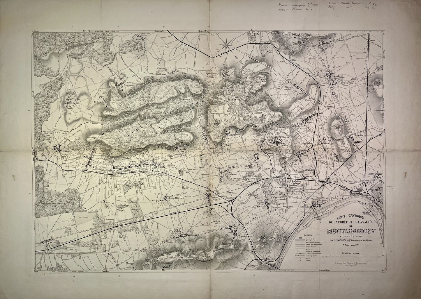
This old cantonal map of the Forest and the Montmorency Valley, Val-d'Oise, was drawn up by A. Ponsini, Surveyor-Engineer and Architect. It dates from the end of the 19th century and its size is 105x74.5cm.
Condition:
Folds, minimal hole at the junction of the folds. Good condition. Please note, my maps are old and are not always in perfect condition!
List of main villages represented:
Saint-Denis, Epinay, Villetaneuse, Pierrefitte, Montmagny, Sarcelles, Villiers-le-Bel, Groslay, Deuil, Enghien-les-Bains, Saint-Gratien, Sannois, Argenteuil, Ermont, Soisy, Montmorency, Margency, Saint-Brice-sous-Forêt, Piscop, Domont, Ecouen, Andilly, Franconville-la-Garenne, Plessis-Bouchard, Pierrelaye, Saint-Prix, Montlignon, Taverny, Bessancourt, Frépillon, Baillet, Bouffémont, Chauvry, Bethemont, Villiers-Adam,...


-

Secure payment
-

Careful shipping
-

No reproduction
-

Satisfied or refunded


-

“Hello, thank you for sending this, the cards are superb!”
Jean-Philippe
-
"They are very beautiful, just need to frame them! Thank you"
Baptiste
-
"Fast shipping and very good tracking."
Alice
-
"My husband loved the maps I gave him for Christmas!"
Solène
