


Antique map of France by GA. Rizzi-Zannoni - ca. 1760
Antique map of France by GA. Rizzi-Zannoni - ca. 1760
Couldn't load pickup availability
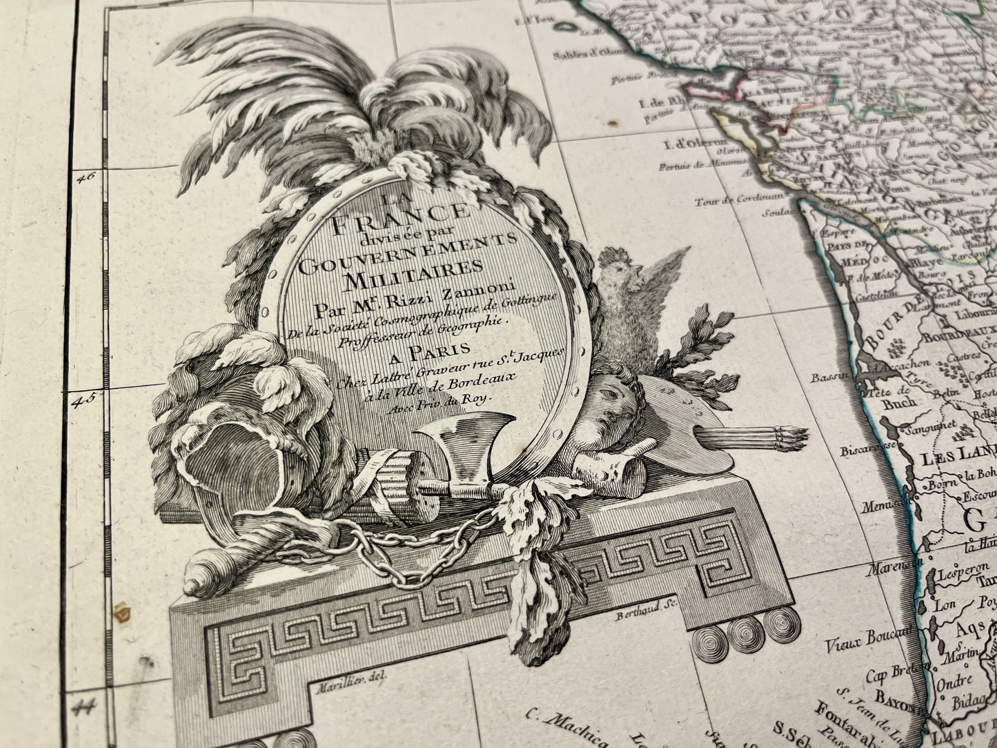
This antique map of France shows, in two parts, its different military governments. It was drawn up by GA. Rizzi-Zannoni and published by J. Lattré at the end of the 18th century. The dimensions of each of the two maps are 56x39cm.
Condition:
Good condition, minimal stains, central fold and tear at the bottom of this fold for the map of the South of France. Please note, my maps are old and are not always in perfect condition!


-

Secure payment
-

Careful shipping
-

No reproduction
-

Satisfied or refunded


-

“Hello, thank you for sending this, the cards are superb!”
Jean-Philippe
-
"They are very beautiful, just need to frame them! Thank you"
Baptiste
-
"Fast shipping and very good tracking."
Alice
-
"My husband loved the maps I gave him for Christmas!"
Solène
