


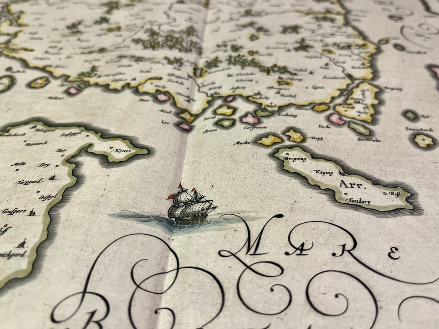
Antique map of the island of Funen, Denmark, by J. Blaeu - ca. 1640
Antique map of the island of Funen, Denmark, by J. Blaeu - ca. 1640
Regular price
270,00 €
Regular price
Sale price
270,00 €
Unit price
per
Taxes included.
Couldn't load pickup availability
This antique map of Scandinavia showing the island of Funen in Denmark was made and published by the Dutch cartographer J. Blaeu in the mid-17th century. Its colors are magnificent. Its size is 61x47cm.
Condition:
Center fold, minimal stains. Please note, my maps are old and are not always in perfect condition!


-

Secure payment
-

Careful shipping
-

No reproduction
-

Satisfied or refunded


-

“Hello, thank you for sending this, the cards are superb!”
Jean-Philippe
-
"They are very beautiful, just need to frame them! Thank you"
Baptiste
-
"Fast shipping and very good tracking."
Alice
-
"My husband loved the maps I gave him for Christmas!"
Solène
