


Antique map of the Garonne and Dordogne rivers by J. Tarde - 1628
Antique map of the Garonne and Dordogne rivers by J. Tarde - 1628
Couldn't load pickup availability
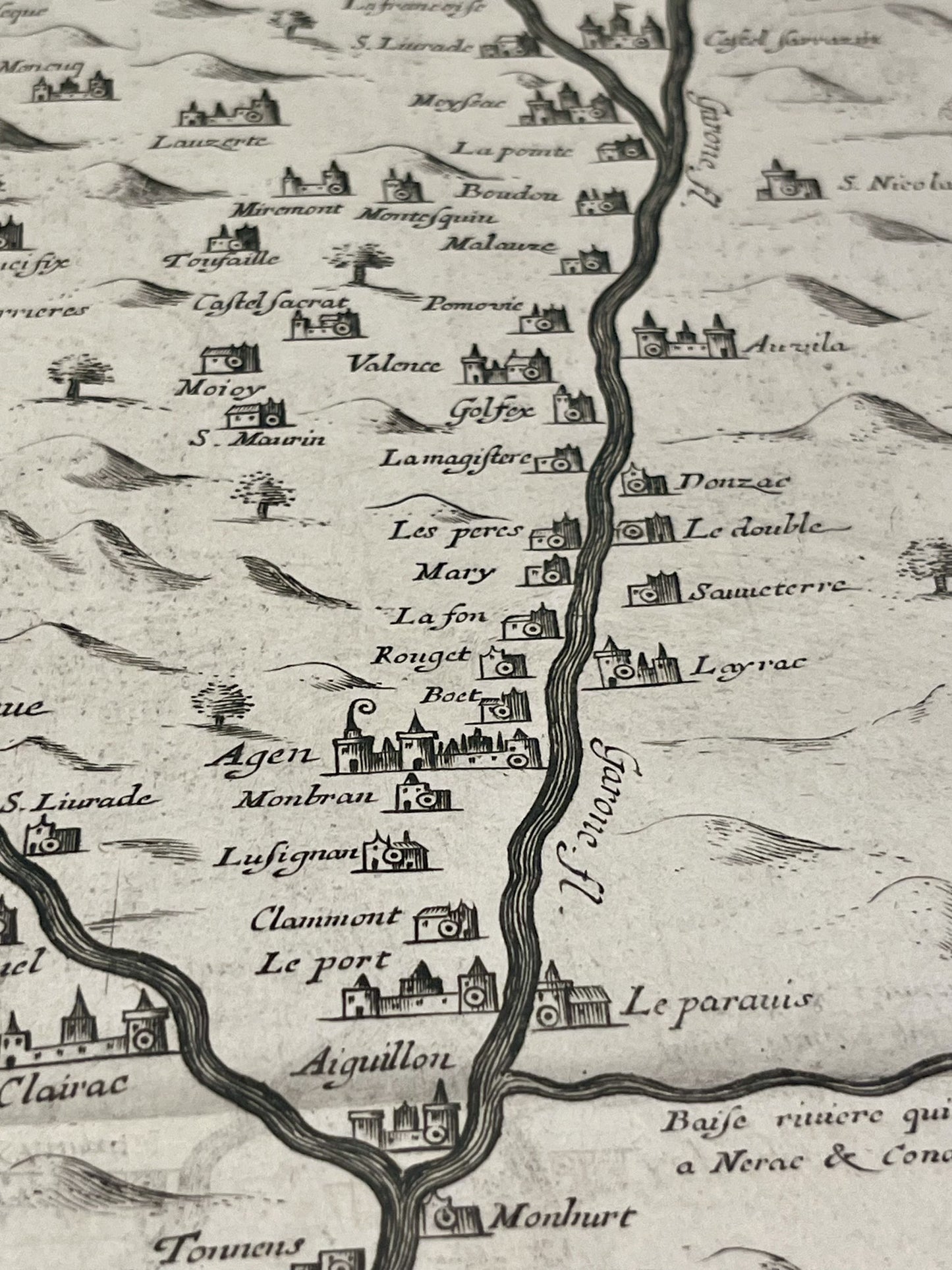
This antique map, or potamography, representing the course of the Garonne and its tributaries such as the Dordogne or the Lot was produced by Jean Tarde and published by Jean Leclerc in 1628. Its dimensions are 56.5x44cm.
Condition:
Center fold, stains. Please note, my maps are old and are not always in perfect condition!
List of main cities represented:
Bordeaux, Rions, La Réole, Langon, Marmande, Agen, Castelsarrasin, Montauban, Toulouse, Eymet, Cahors, Monpazier, Périgueux, Bergerac, Sarlat-la-Canéda, Gourdon,...


-

Secure payment
-

Careful shipping
-

No reproduction
-

Satisfied or refunded


-

“Hello, thank you for sending this, the cards are superb!”
Jean-Philippe
-
"They are very beautiful, just need to frame them! Thank you"
Baptiste
-
"Fast shipping and very good tracking."
Alice
-
"My husband loved the maps I gave him for Christmas!"
Solène
