


Antique map of Gâtinais and Sénonais by J. Leclerc - ca. 1630
Antique map of Gâtinais and Sénonais by J. Leclerc - ca. 1630
Couldn't load pickup availability
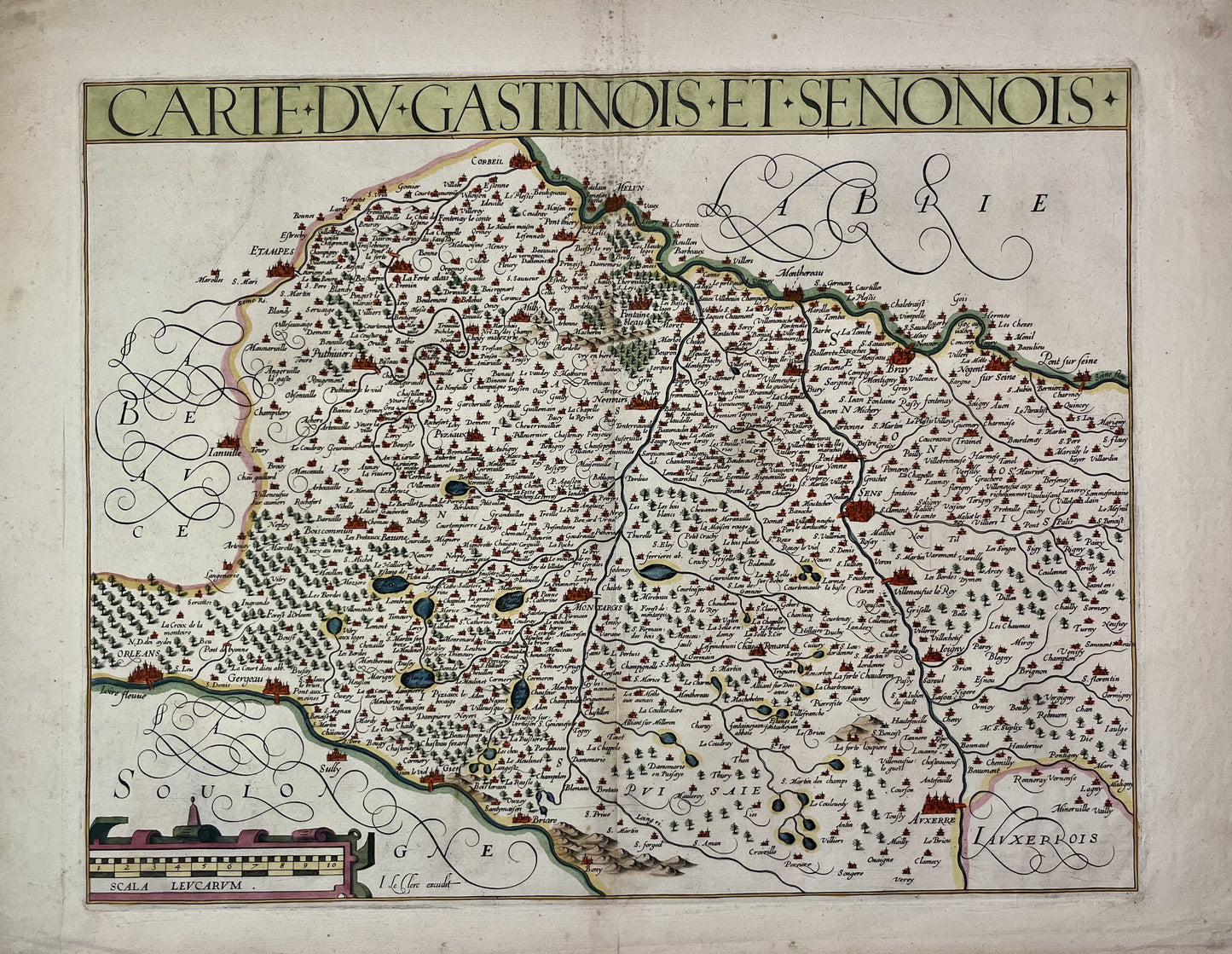
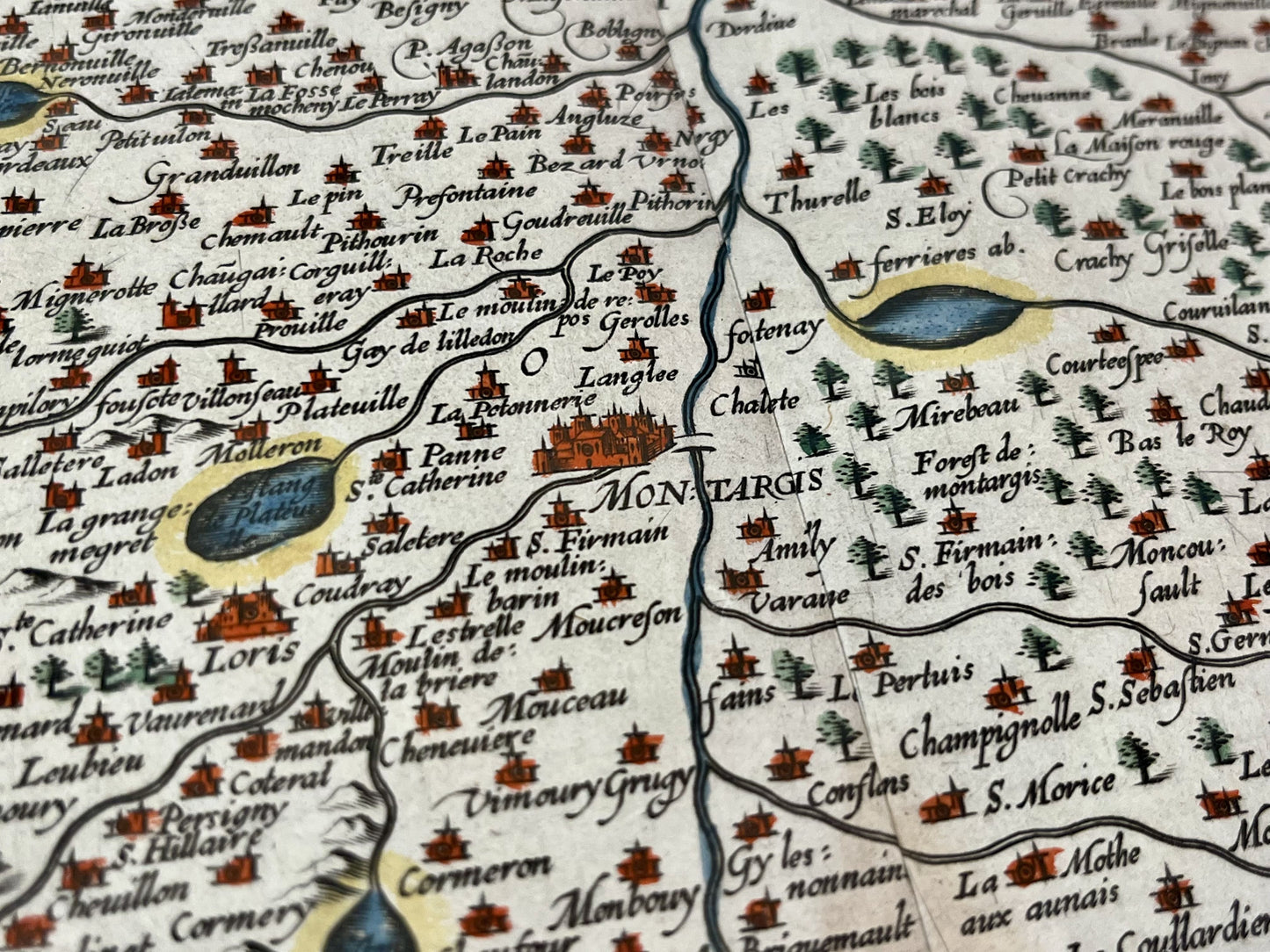
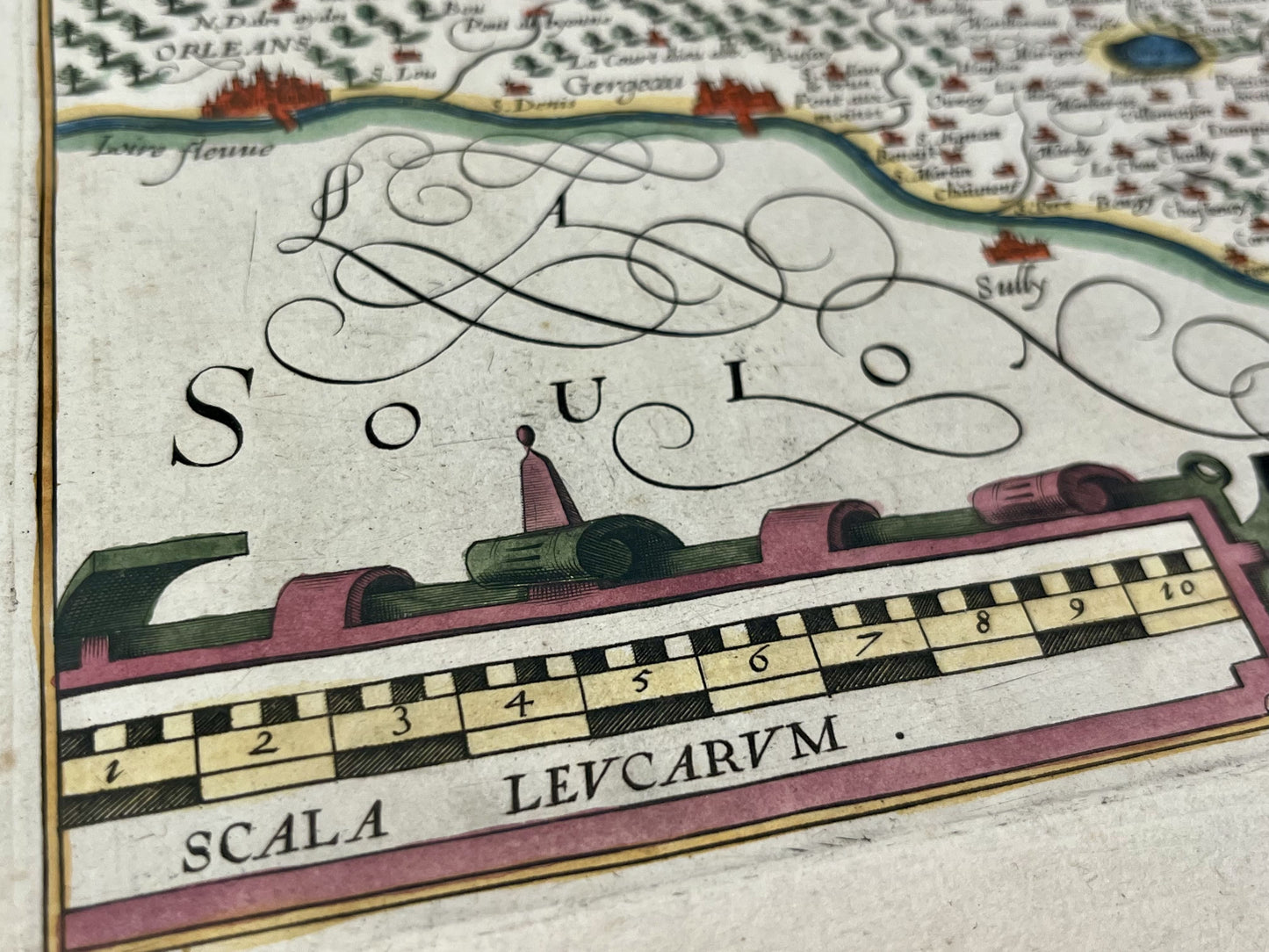
This antique map spanning Burgundy, the Centre and the Île-de-France region, representing the Gâtinais and the Sénonais, dates from the mid-17th century and measures 52x40.5cm. It was published by the French cartographer Jean Leclerc.
Condition:
Center crease and minimal staining. Please note, my maps are old and are not always in perfect condition!
List of main cities represented:
Orleans, Auxerre, Sens, Nogent-sur-Seine, Fontainebleau, Montargis, Joigny, Saint-Florentin, Etampes, Pithiviers, Corbeil, Melun, Gien,...

-

Secure payment
-

Careful shipping
-

No reproduction
-

Satisfied or refunded


-

“Hello, thank you for sending this, the cards are superb!”
Jean-Philippe
-
"They are very beautiful, just need to frame them! Thank you"
Baptiste
-
"Fast shipping and very good tracking."
Alice
-
"My husband loved the maps I gave him for Christmas!"
Solène
