


Antique map of the Generality of Orléans by H. Jaillot - 1719
Antique map of the Generality of Orléans by H. Jaillot - 1719
Couldn't load pickup availability
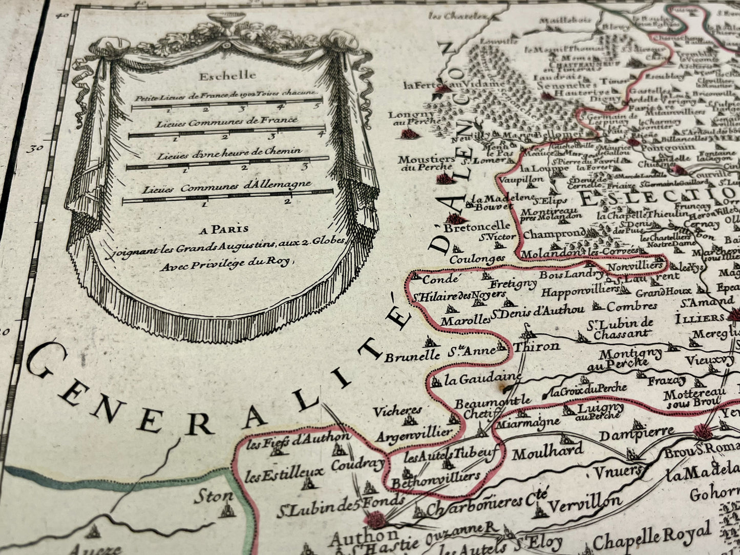
This antique map covering Loiret as well as part of Eure-et-Loir and Loir-et-Cher represents the Generality of Orléans divided into its elections. It was drawn up and published by H. Jaillot in 1719. The size of this map is 77x54cm.
Condition:
Good condition, minimal stains and some tears at the edge of the card. Please note, my maps are old and are not always in perfect condition!
List of main cities represented:
Clamecy, Cosne-sur-Loire, Briare, Gien, Montargis, Saint-Fargeau, Châtillon-Coligny, Pithiviers, Sully-sur-Loire, Orléans, Dourdan, Chartres, Châteaudun, Bonneval, Beaugency, Vendôme, Blois, Romorentin,...


-

Secure payment
-

Careful shipping
-

No reproduction
-

Satisfied or refunded


-

“Hello, thank you for sending this, the cards are superb!”
Jean-Philippe
-
"They are very beautiful, just need to frame them! Thank you"
Baptiste
-
"Fast shipping and very good tracking."
Alice
-
"My husband loved the maps I gave him for Christmas!"
Solène
