


Antique map of German Lorraine and the Duchy of Deux Ponts by H. Sengre - ca. 1690
Antique map of German Lorraine and the Duchy of Deux Ponts by H. Sengre - ca. 1690
Couldn't load pickup availability
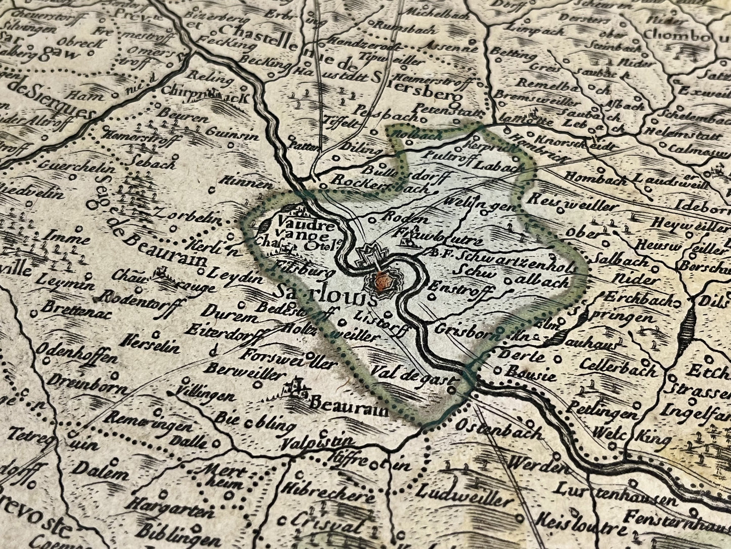
This antique map straddling Germany and the Bas-Rhin, depicts the "États entre la Nied, la Sarre et le Rhin où sont la Lorraine Allemande, le Duché des Deux Ponts, les Comtés de Bitche, de Spanheim et de Linange". It was drawn by the cartographer Henri Sengre at the end of the 17th century. Its dimensions are 95x52.5cm.
Condition:
Good condition, two creases, minimal stains. Please note, my maps are old and not always in perfect condition!
List of the main cities represented:
Landau, Wissembourg, Bitche, Sarreguemines, Saint-Avold, Faulquemont, Saarbrücken, Homburg, Deux-Ponts, Kaiserslautern, Worms, Mannheim, Heidelberg,...


-

Secure payment
-

Careful shipping
-

No reproduction
-

Satisfied or refunded


-

“Hello, thank you for sending this, the cards are superb!”
Jean-Philippe
-
"They are very beautiful, just need to frame them! Thank you"
Baptiste
-
"Fast shipping and very good tracking."
Alice
-
"My husband loved the maps I gave him for Christmas!"
Solène
