


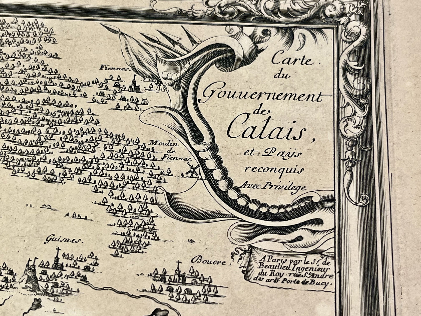
Antique map of the Government of Calais by S. de Beaulieu - ca. 1660
Antique map of the Government of Calais by S. de Beaulieu - ca. 1660
Couldn't load pickup availability
This antique map of Nord-Pas-de-Calais, depicting the Government of Calais, was created by the French cartographer Sébastien de Beaulieu in the mid-17th century. The map measures 67x48.5cm.
Condition :
Central fold, minor stains, tears outside the map (see photos). Please note, my maps are old and not always in perfect condition!
Main cities represented:
Calais, Marck, Audruicq, Grand-Fort-Philippe, Gravelines, Saint-Folquin, Saint-Omer-Capelle,...


-

Secure payment
-

Careful shipping
-

No reproduction
-

Satisfied or refunded


-

“Hello, thank you for sending this, the cards are superb!”
Jean-Philippe
-
"They are very beautiful, just need to frame them! Thank you"
Baptiste
-
"Fast shipping and very good tracking."
Alice
-
"My husband loved the maps I gave him for Christmas!"
Solène
