


Antique map of the Government of Orleans by GA. Rizzi-Zannoni - 1762
Antique map of the Government of Orleans by GA. Rizzi-Zannoni - 1762
Couldn't load pickup availability
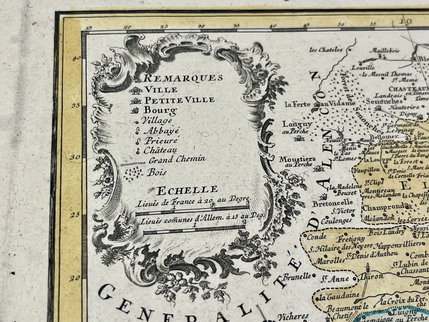
This antique map covering Loiret as well as part of Eure-et-Loir and Loir-et-Cher represents the General and Military Government of Orléans divided into its 12 elections. It was drawn up by GA. Rizzi-Zannoni and published by the Homann heirs in 1762. The size of this map is 64x52cm.
Condition:
Good condition, minimal stains and central crease. Please note, my maps are old and are not always in perfect condition!
List of main cities represented:
Clamecy, Cosne-sur-Loire, Briare, Gien, Montargis, Saint-Fargeau, Châtillon-Coligny, Pithiviers, Sully-sur-Loire, Orléans, Dourdan, Chartres, Châteaudun, Bonneval, Beaugency, Vendôme, Blois, Romorentin,...


-

Secure payment
-

Careful shipping
-

No reproduction
-

Satisfied or refunded


-

“Hello, thank you for sending this, the cards are superb!”
Jean-Philippe
-
"They are very beautiful, just need to frame them! Thank you"
Baptiste
-
"Fast shipping and very good tracking."
Alice
-
"My husband loved the maps I gave him for Christmas!"
Solène
