


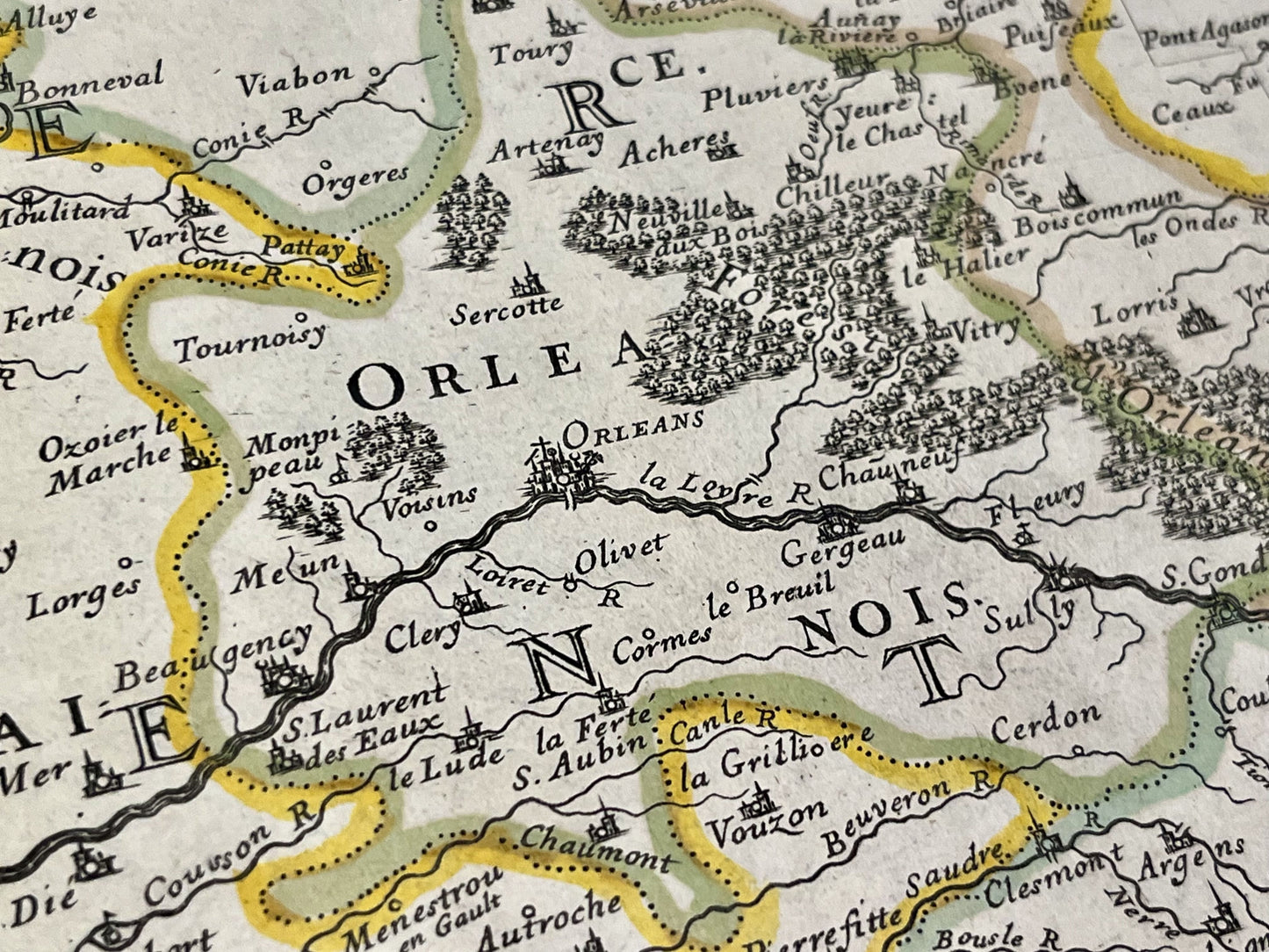
Antique map of the General Government of Orléans by N. Sanson - 1651
Antique map of the General Government of Orléans by N. Sanson - 1651
Couldn't load pickup availability
This antique map of the Pays de la Loire region, depicting the General Government of Orléans, dates from 1651 and was created by the French cartographer Nicolas Sanson d'Abbeville. Its dimensions are 57x44cm.
Condition:
Center crease, minimal stains. Please note, my maps are old and are not always in perfect condition!
List of main cities represented:
Nantes, Luçon, Ile de Ré, Ile d'Oléron, Saintes, Angoulême, Niort, Poitiers, Angers, Tours, Argenton, Bourges, Loches, Amboise, Blois, Romorantin, Le Mans, Laval, Orléans, Gien, Châteaudun,...


-

Secure payment
-

Careful shipping
-

No reproduction
-

Satisfied or refunded


-

“Hello, thank you for sending this, the cards are superb!”
Jean-Philippe
-
"They are very beautiful, just need to frame them! Thank you"
Baptiste
-
"Fast shipping and very good tracking."
Alice
-
"My husband loved the maps I gave him for Christmas!"
Solène
