


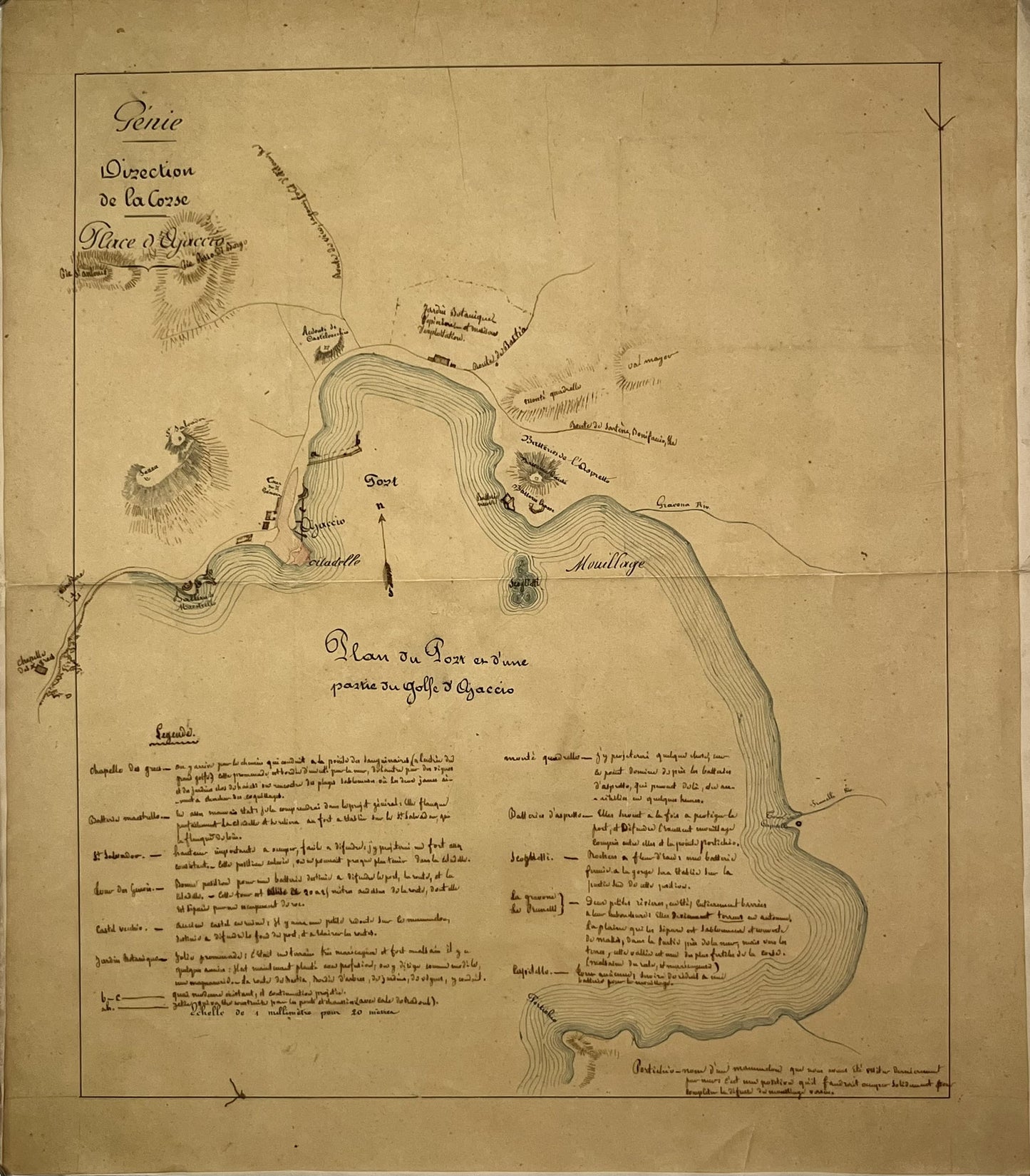
Antique handwritten map of the Gulf of Ajaccio by the Army Engineers - ca. 1850
Antique handwritten map of the Gulf of Ajaccio by the Army Engineers - ca. 1850
Couldn't load pickup availability
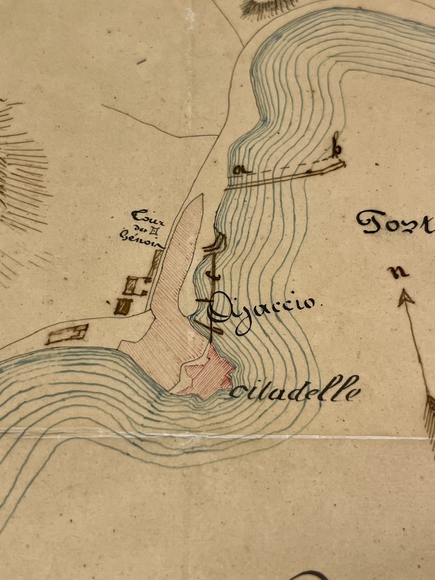
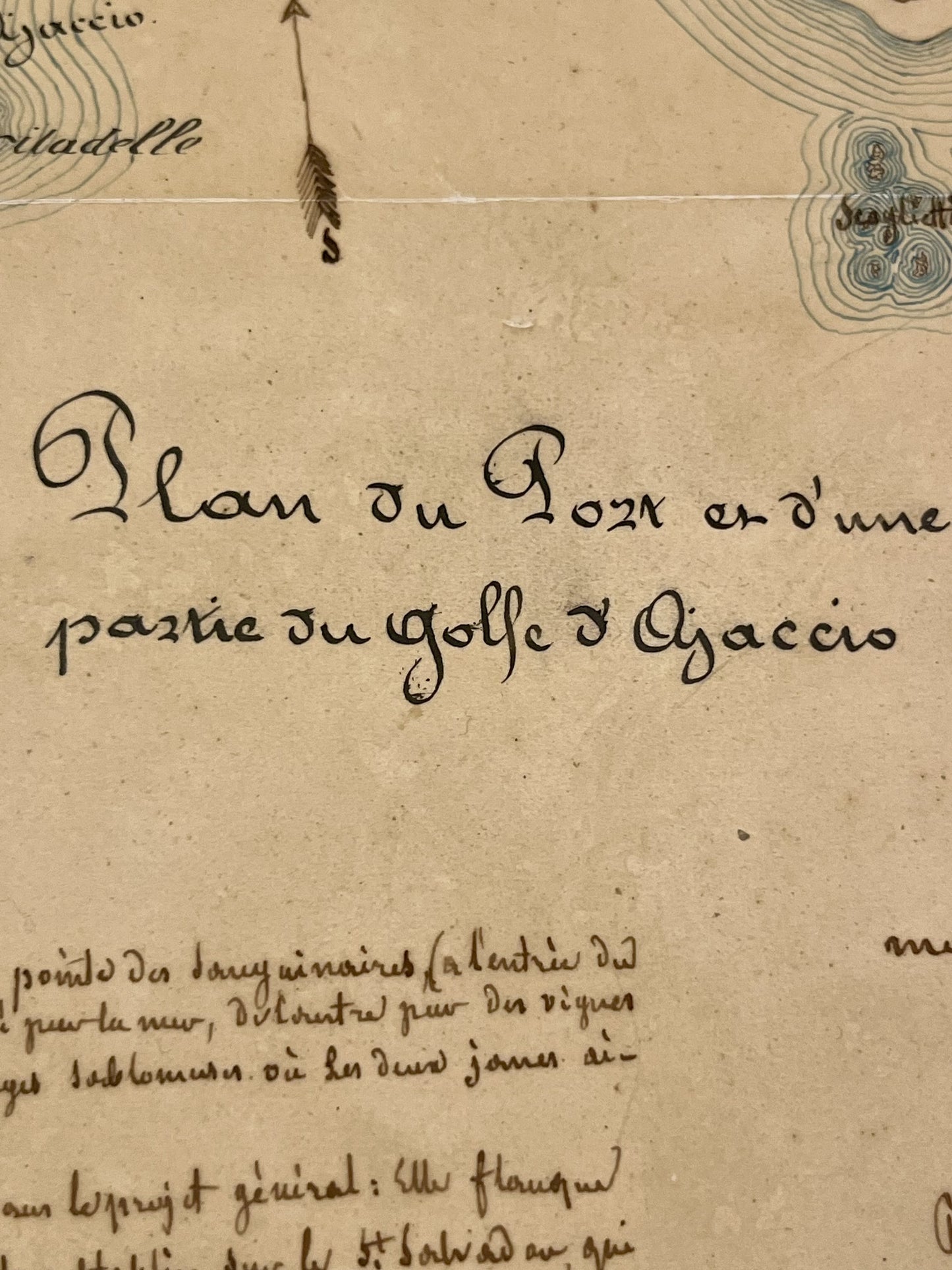
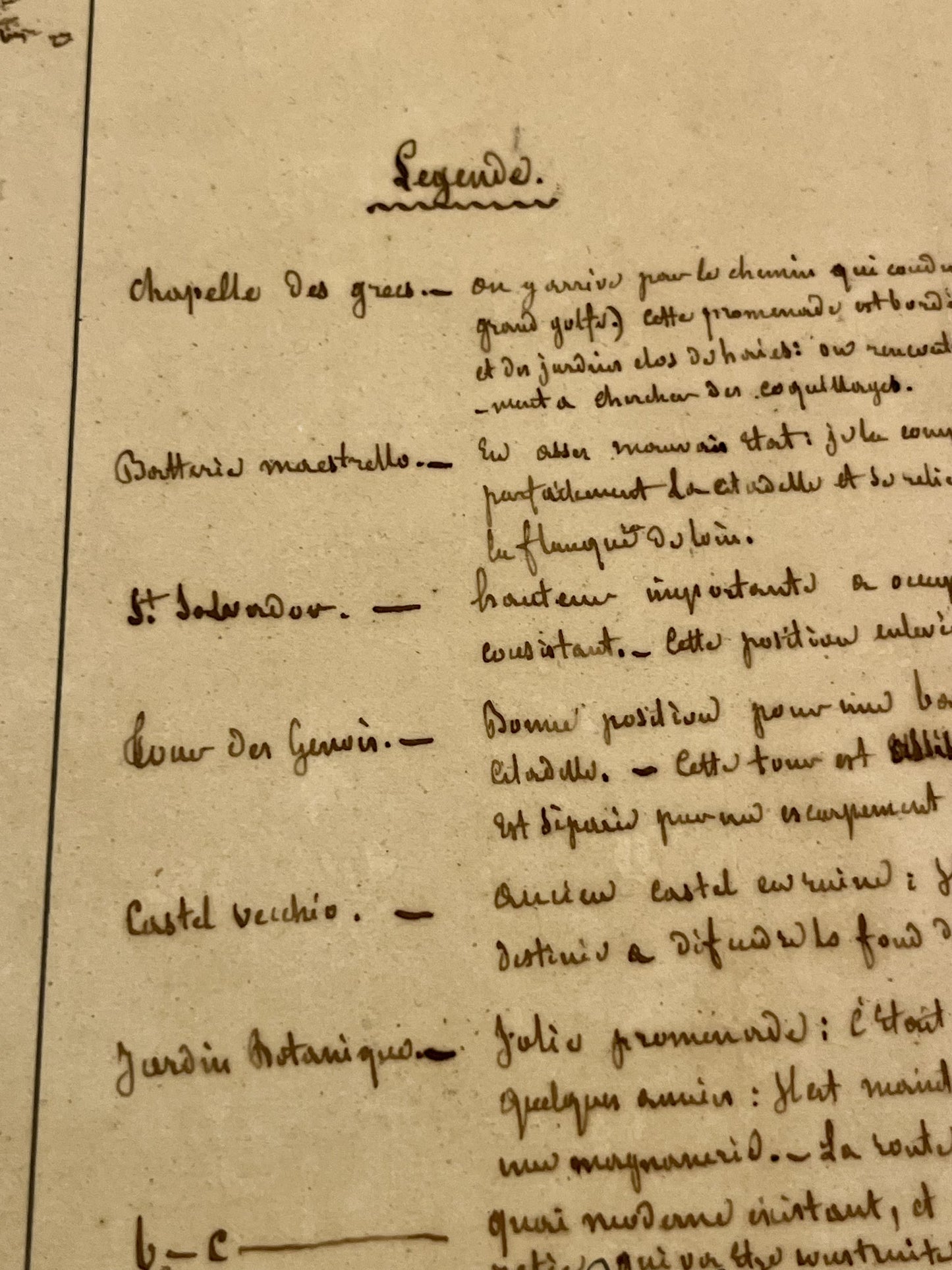
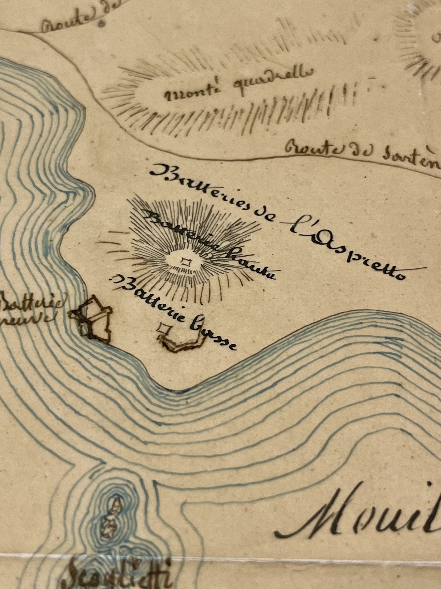
This antique handwritten map of Corsica dates from the mid-19th century and measures 54,5x47cm. It was created by the Army Engineers and shows the Port and part of the Gulf of Ajaccio. It includes the Greek Chapel, the Maestrello Battery, the Botanical Garden, the Castel Vecchio, etc.
Condition:
Map laminated on strong paper, folding in two. Good condition, some stains. Please note, my maps are old and are not always in perfect condition!

-

“Hello, thank you for sending this, the cards are superb!”
Jean-Philippe
-
"They are very beautiful, just need to frame them! Thank you"
Baptiste
-
"Fast shipping and very good tracking."
Alice
-
"My husband loved the maps I gave him for Christmas!"
Solène

-

Secure payment
-

Careful shipping
-

No reproduction
-

Satisfied or refunded


