


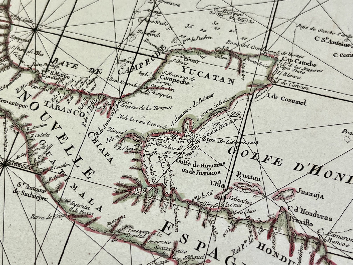
Antique map of the Gulf of Mexico and the Antilles by GA. Rizzi-Zannoni - ca. 1760
Antique map of the Gulf of Mexico and the Antilles by GA. Rizzi-Zannoni - ca. 1760
Couldn't load pickup availability
This antique map of Central America and the Antilles shows the Gulf of Mexico and all the Caribbean Islands. The coast of America from Florida to Venezuela can also be seen. It was drawn up by GA. Rizzi-Zannoni and published by J. Lattré at the end of the 18th century. The size of this map is 56x39cm.
Condition:
Very good condition, minimal stains, central crease. Please note, my maps are old and are not always in perfect condition!
List of countries represented:
United States, Mexico, Guatemala, Honduras, Nicaragua, Costa Rica, Panama, Colombia, Venezuela, Bahamas, Cuba, Jamaica, Haiti, Dominican Republic, Puerto Rico, Dominica, Montserrat, Guadeloupe, Martinique,...


-

Secure payment
-

Careful shipping
-

No reproduction
-

Satisfied or refunded


-

“Hello, thank you for sending this, the cards are superb!”
Jean-Philippe
-
"They are very beautiful, just need to frame them! Thank you"
Baptiste
-
"Fast shipping and very good tracking."
Alice
-
"My husband loved the maps I gave him for Christmas!"
Solène
