


Antique map of Guyenne by J. Janssonius - ca. 1650
Antique map of Guyenne by J. Janssonius - ca. 1650
Couldn't load pickup availability
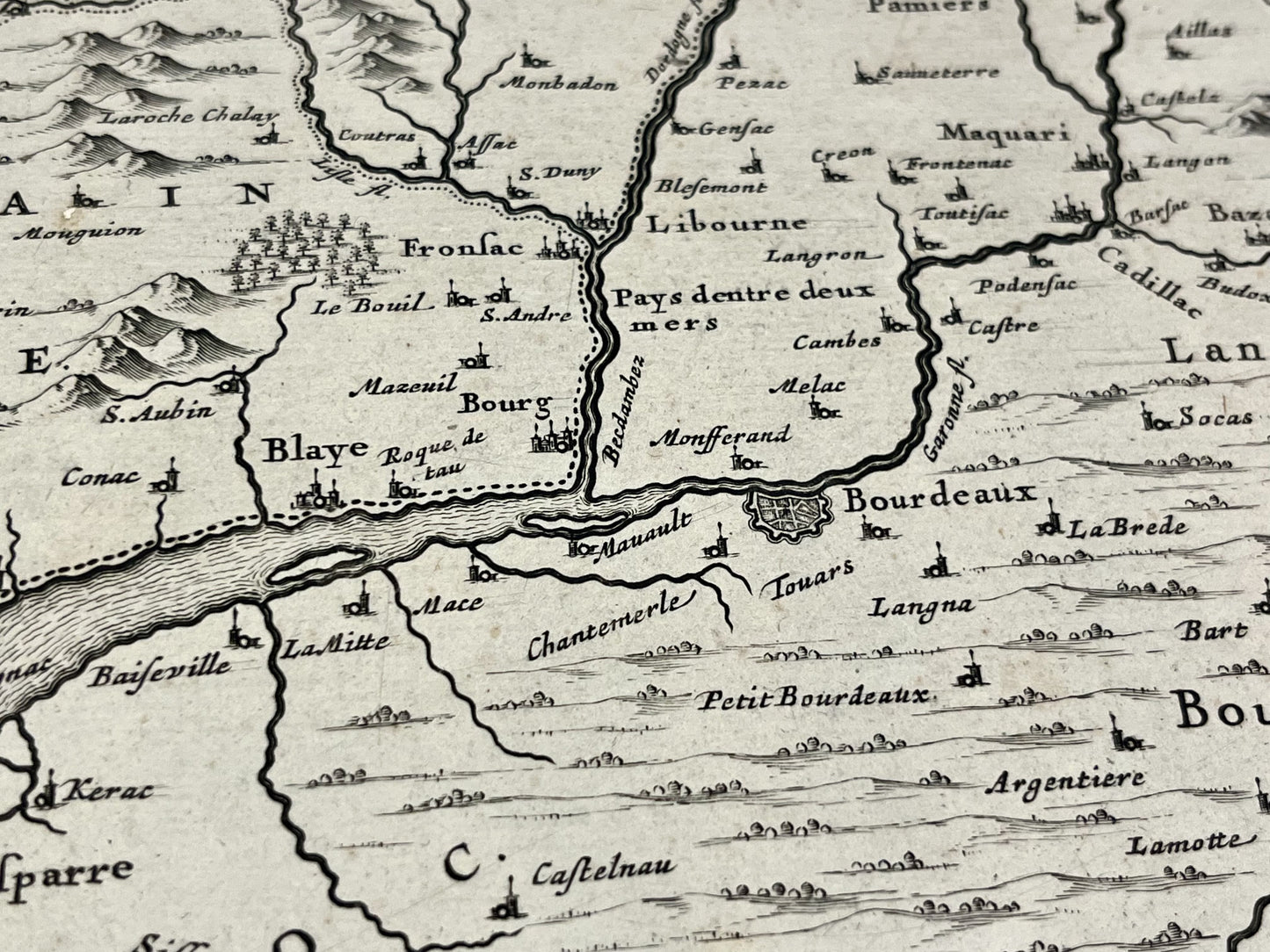
This antique map of Guyenne, a former region covering mainly present-day Aquitaine, dates from the mid-17th century and measures 56.5x44cm. It was produced by the Dutch cartographer J. Janssonius.
Condition:
Central fold and missing part on the upper left part. Please note, my maps are old and are not always in perfect condition!
List of main cities represented:
Bordeaux, Lesparre, Arcachon, Bayonne, Saint-Jean-de-Luz, Libourne, Pamiers, Pons, Bergerac, Montauban, Agen, Toulouse, Pau, Dax, Orthez, Mont-de-Marsan, Tarbes, Auch, Bazas,...


-

Secure payment
-

Careful shipping
-

No reproduction
-

Satisfied or refunded


-

“Hello, thank you for sending this, the cards are superb!”
Jean-Philippe
-
"They are very beautiful, just need to frame them! Thank you"
Baptiste
-
"Fast shipping and very good tracking."
Alice
-
"My husband loved the maps I gave him for Christmas!"
Solène
