


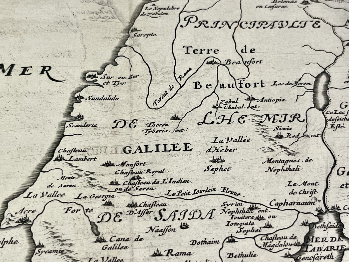
Antique map of the Holy Land by P. Mariette - ca. 1650
Antique map of the Holy Land by P. Mariette - ca. 1650
Regular price
190,00 €
Regular price
Sale price
190,00 €
Unit price
per
Taxes included.
Couldn't load pickup availability
This antique map of the Middle East depicting the Holy Land (Israel, Palestine) dates from the mid-17th century and measures 57x44cm. It was published by Pierre Mariette.
Condition:
Center fold, minimal stains and significant tears on the lower part (off map). Please note, my maps are old and are not always in perfect condition!


-

Secure payment
-

Careful shipping
-

No reproduction
-

Satisfied or refunded


-

“Hello, thank you for sending this, the cards are superb!”
Jean-Philippe
-
"They are very beautiful, just need to frame them! Thank you"
Baptiste
-
"Fast shipping and very good tracking."
Alice
-
"My husband loved the maps I gave him for Christmas!"
Solène
