


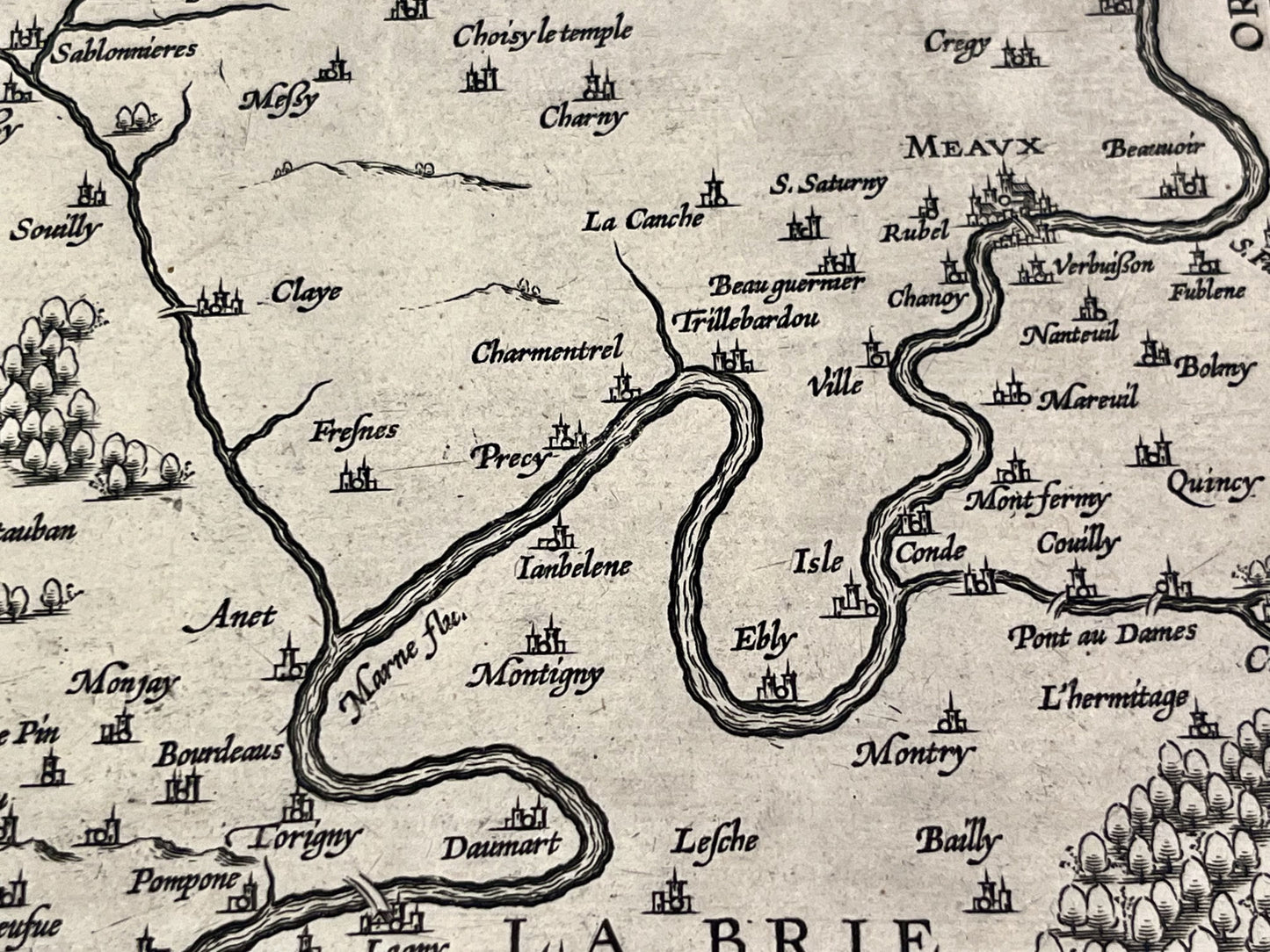
Antique map of Île-de-France by A. Ortelius - 1598
Antique map of Île-de-France by A. Ortelius - 1598
Regular price
190,00 €
Regular price
Sale price
190,00 €
Unit price
per
Taxes included.
Couldn't load pickup availability
This antique map of Île-de-France was drawn by the famous cartographer Abraham Ortelius in 1598. Its dimensions are 57.5x45cm.
Condition:
Minor stains and tears on the edges outside the map. Please note, my maps are old and not always in perfect condition!
Main cities represented:
Paris, Saint-Denis, Meaux, L'Isle-Adam, Senlis, Pontoise,...


-

Secure payment
-

Careful shipping
-

No reproduction
-

Satisfied or refunded


-

“Hello, thank you for sending this, the cards are superb!”
Jean-Philippe
-
"They are very beautiful, just need to frame them! Thank you"
Baptiste
-
"Fast shipping and very good tracking."
Alice
-
"My husband loved the maps I gave him for Christmas!"
Solène
