


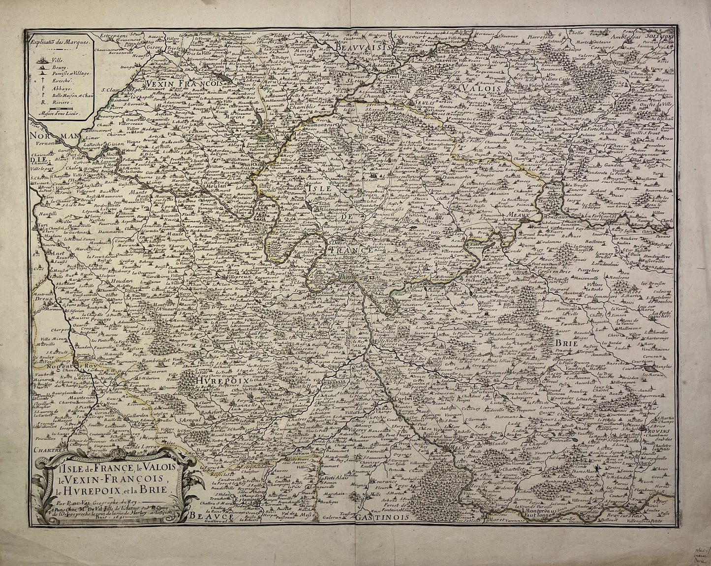
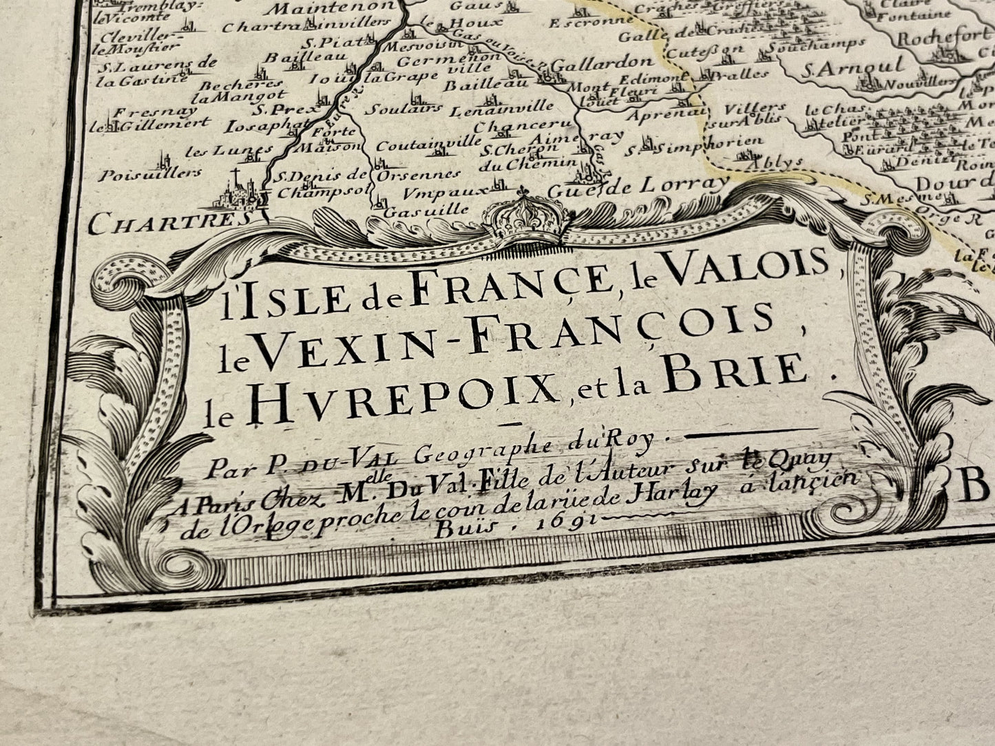
Antique map of Île-de-France, Valois, Vexin, Hurepoix and Brie by P. Duval - 1691
Antique map of Île-de-France, Valois, Vexin, Hurepoix and Brie by P. Duval - 1691
Couldn't load pickup availability
This antique map of Île-de-France, Valois, Vexin, Hurepoix and Brie was produced by the geographer Pierre Duval and published by his daughter in 1691. Its dimensions are 57.5x46cm.
Condition:
Central fold, very good general condition. Please note, my maps are old and are not always in perfect condition!
List of main cities represented:
Melun, Corbeil, Meaux, Dammartin, Creil, Etampes, Chartres, Palaiseau, Trappes, Paris, Nanterre, Versailles, Meudon, Pontoise, Beaumont-sur-Oise, Mantes, Dreux,...

-

Secure payment
-

Careful shipping
-

No reproduction
-

Satisfied or refunded


-

“Hello, thank you for sending this, the cards are superb!”
Jean-Philippe
-
"They are very beautiful, just need to frame them! Thank you"
Baptiste
-
"Fast shipping and very good tracking."
Alice
-
"My husband loved the maps I gave him for Christmas!"
Solène
