


Antique map of Île-de-France, Champagne and Lorraine by N. Sanson - 1648
Antique map of Île-de-France, Champagne and Lorraine by N. Sanson - 1648
Couldn't load pickup availability
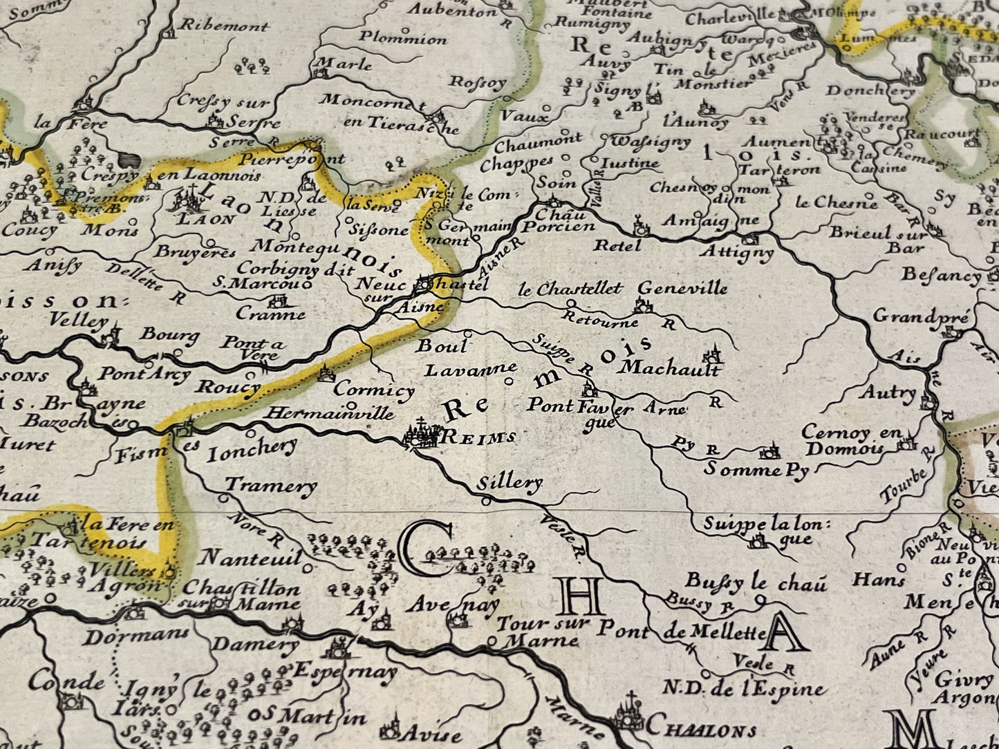
This antique map of Île-de-France, Champagne and Lorraine dates from 1648 and measures 57x44cm. It was created by the French cartographer Nicolas Sanson d'Abbeville.
Condition:
Center crease, minimal stains and tears on edges. Please note, my maps are old and are not always in perfect condition!
List of main cities represented:
Paris, Sens, Troyes, Reims, Soissons, Verdun, Metz, Toul, Nancy, Auxerre, Châtillon-sur-Seine, Bar-le-Duc, Charleville-Mézières,...


-

Secure payment
-

Careful shipping
-

No reproduction
-

Satisfied or refunded


-

“Hello, thank you for sending this, the cards are superb!”
Jean-Philippe
-
"They are very beautiful, just need to frame them! Thank you"
Baptiste
-
"Fast shipping and very good tracking."
Alice
-
"My husband loved the maps I gave him for Christmas!"
Solène
