


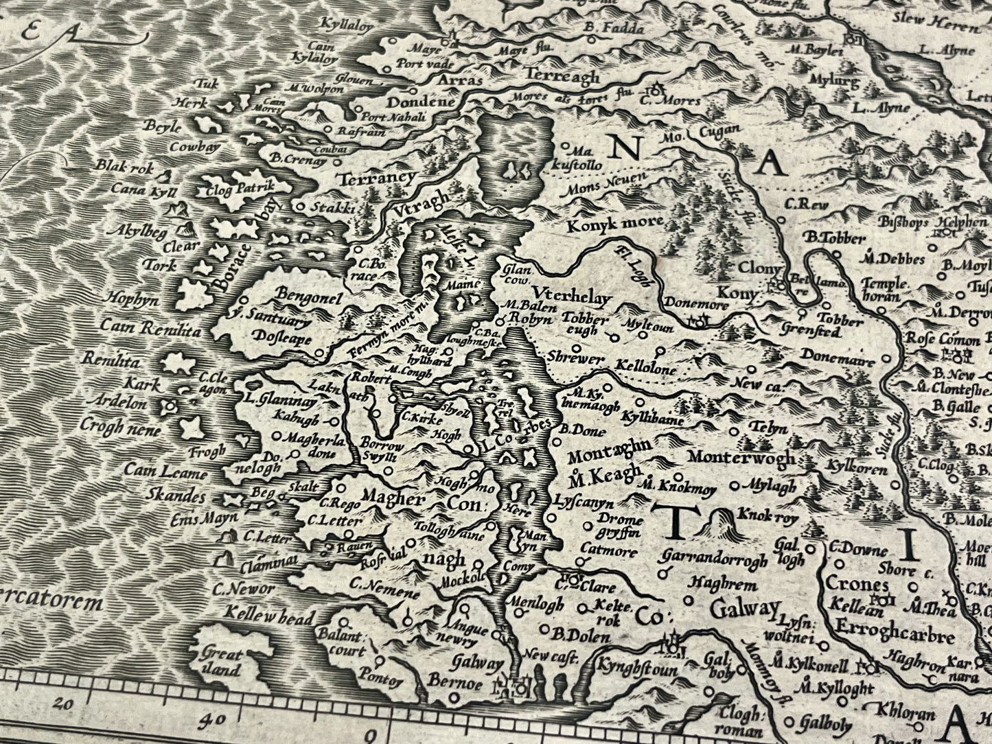
Antique map of Ireland by G. Mercator - ca. 1610
Antique map of Ireland by G. Mercator - ca. 1610
Regular price
440,00 €
Regular price
Sale price
440,00 €
Unit price
per
Taxes included.
Couldn't load pickup availability
This two-part antique map of Ireland was drawn by Gerard Mercator and published in the early 17th century. Each map measures 57x44cm.
Condition:
Good condition, minimal stains, central fold and tear at the bottom of this fold for the map of Northern Ireland. Please note, my maps are old and are not always in perfect condition!


-

Secure payment
-

Careful shipping
-

No reproduction
-

Satisfied or refunded


-

“Hello, thank you for sending this, the cards are superb!”
Jean-Philippe
-
"They are very beautiful, just need to frame them! Thank you"
Baptiste
-
"Fast shipping and very good tracking."
Alice
-
"My husband loved the maps I gave him for Christmas!"
Solène
