


Antique map of Israel by R. Bonne - ca. 1760
Antique map of Israel by R. Bonne - ca. 1760
Regular price
210,00 €
Regular price
Sale price
210,00 €
Unit price
per
Taxes included.
Couldn't load pickup availability
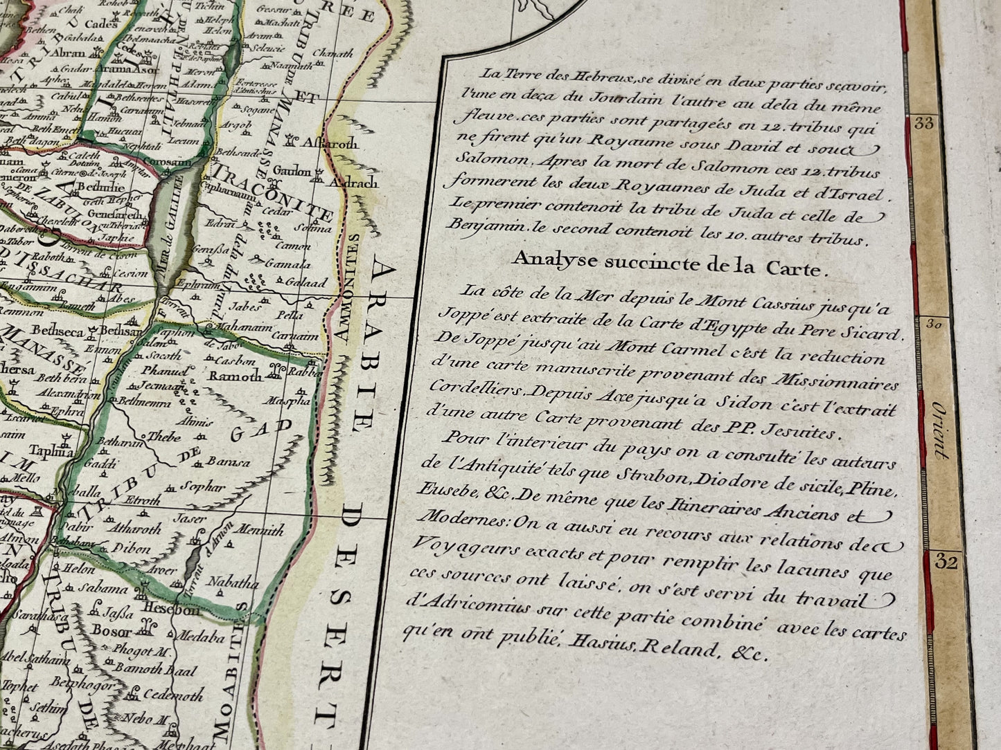
This antique map of the Middle East depicts Israel and its twelve tribes. It was drawn by R. Bonne and published by J. Lattré at the end of the 18th century. The map measures 51x38.5cm. It features beautiful period colors.
Condition:
Very good condition, minimal stains, central crease. Please note, my maps are old and not always in perfect condition!
Countries represented:
Israel, Palestine


-

Secure payment
-

Careful shipping
-

No reproduction
-

Satisfied or refunded


-

“Hello, thank you for sending this, the cards are superb!”
Jean-Philippe
-
"They are very beautiful, just need to frame them! Thank you"
Baptiste
-
"Fast shipping and very good tracking."
Alice
-
"My husband loved the maps I gave him for Christmas!"
Solène
