


Antique map of Limousin by J. Janssonius - ca. 1640
Antique map of Limousin by J. Janssonius - ca. 1640
Regular price
170,00 €
Regular price
Sale price
170,00 €
Unit price
per
Taxes included.
Couldn't load pickup availability
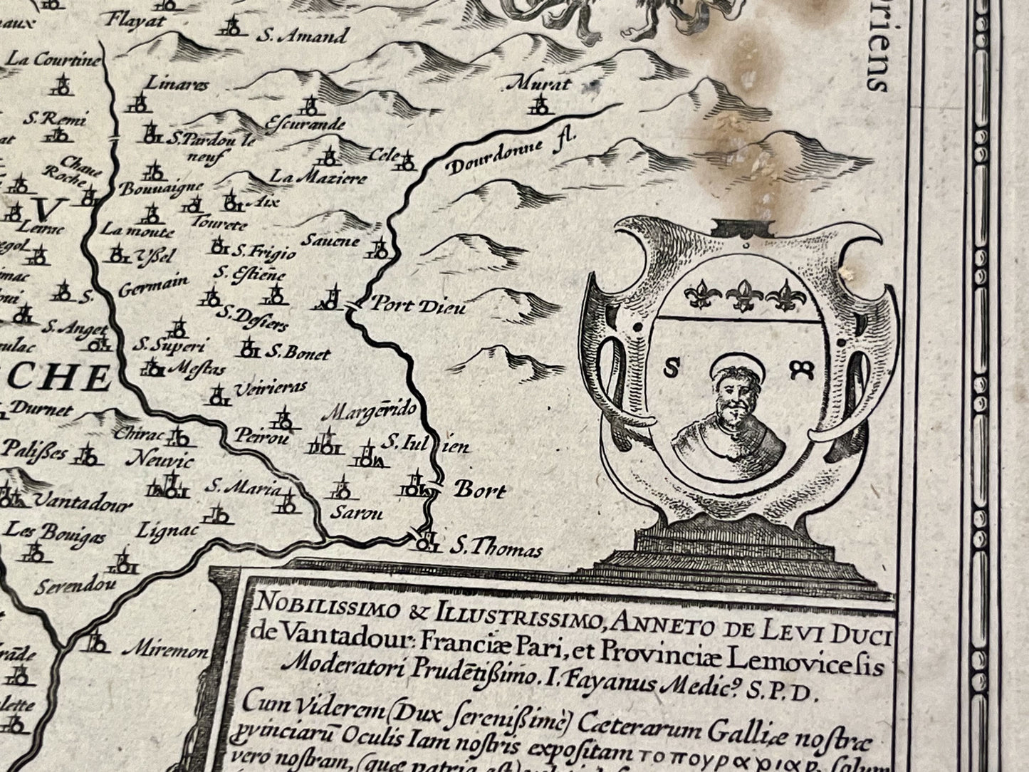
This antique map of Limousin, decorated with a map of Limoges, dates from the middle of the 17th century and its dimensions are 56x44cm. It was produced by the Dutch cartographer J. Janssonius.
Condition:
Center crease and stains on the right side. Please note, my maps are old and are not always in perfect condition!
List of main cities represented:
Limoges, Tulle, Saint-Junien,...


-

Secure payment
-

Careful shipping
-

No reproduction
-

Satisfied or refunded


-

“Hello, thank you for sending this, the cards are superb!”
Jean-Philippe
-
"They are very beautiful, just need to frame them! Thank you"
Baptiste
-
"Fast shipping and very good tracking."
Alice
-
"My husband loved the maps I gave him for Christmas!"
Solène
