


Antique map of Lorraine by J. Janssonius - ca. 1640
Antique map of Lorraine by J. Janssonius - ca. 1640
Regular price
160,00 €
Regular price
Sale price
160,00 €
Unit price
per
Taxes included.
Couldn't load pickup availability
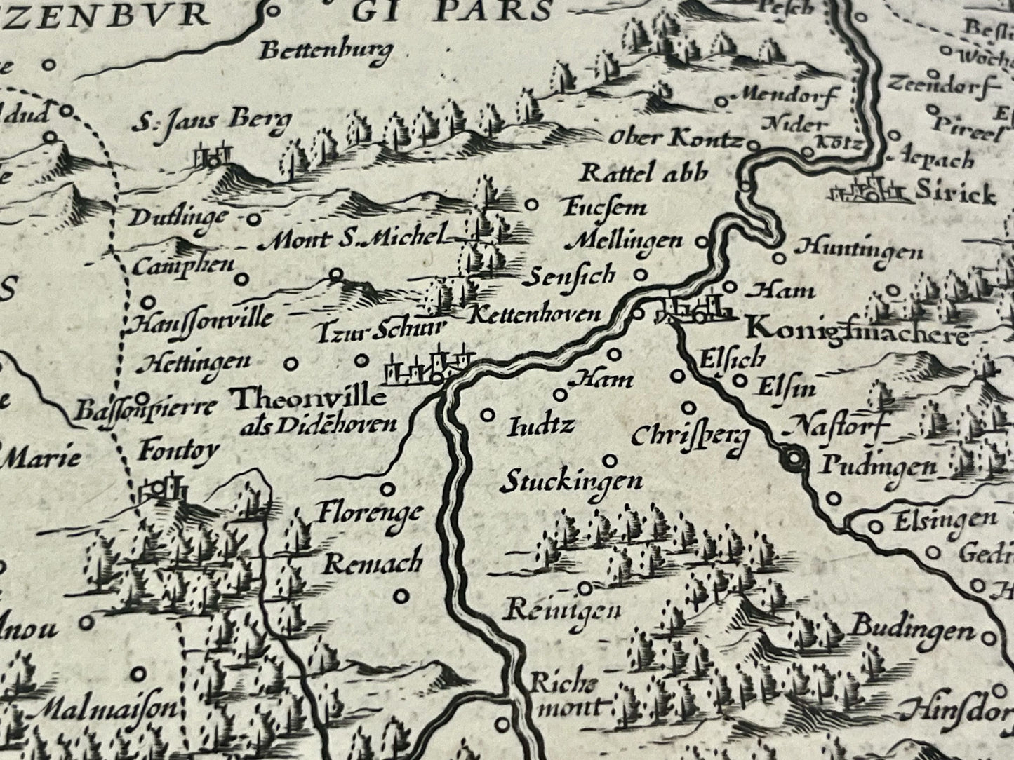
This antique map of Lorraine was drawn and published by the Dutch cartographer J. Janssonius in the mid-17th century. Its dimensions are 56x48cm.
Condition:
Central crease, wavy paper. Please note, my maps are old and not always in perfect condition!
Main cities represented:
Nancy, Nomeny, Metz, Dieuze, Thionville, Sarrebourg, Saarbrücken,...


-

Secure payment
-

Careful shipping
-

No reproduction
-

Satisfied or refunded


-

“Hello, thank you for sending this, the cards are superb!”
Jean-Philippe
-
"They are very beautiful, just need to frame them! Thank you"
Baptiste
-
"Fast shipping and very good tracking."
Alice
-
"My husband loved the maps I gave him for Christmas!"
Solène
