


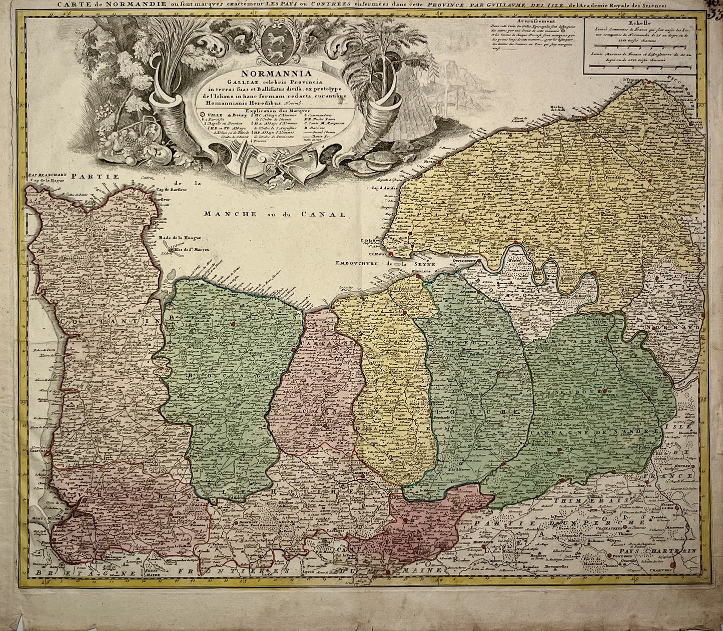
Antique map of Normandy by G. Delisle - ca. 1740
Antique map of Normandy by G. Delisle - ca. 1740
Couldn't load pickup availability
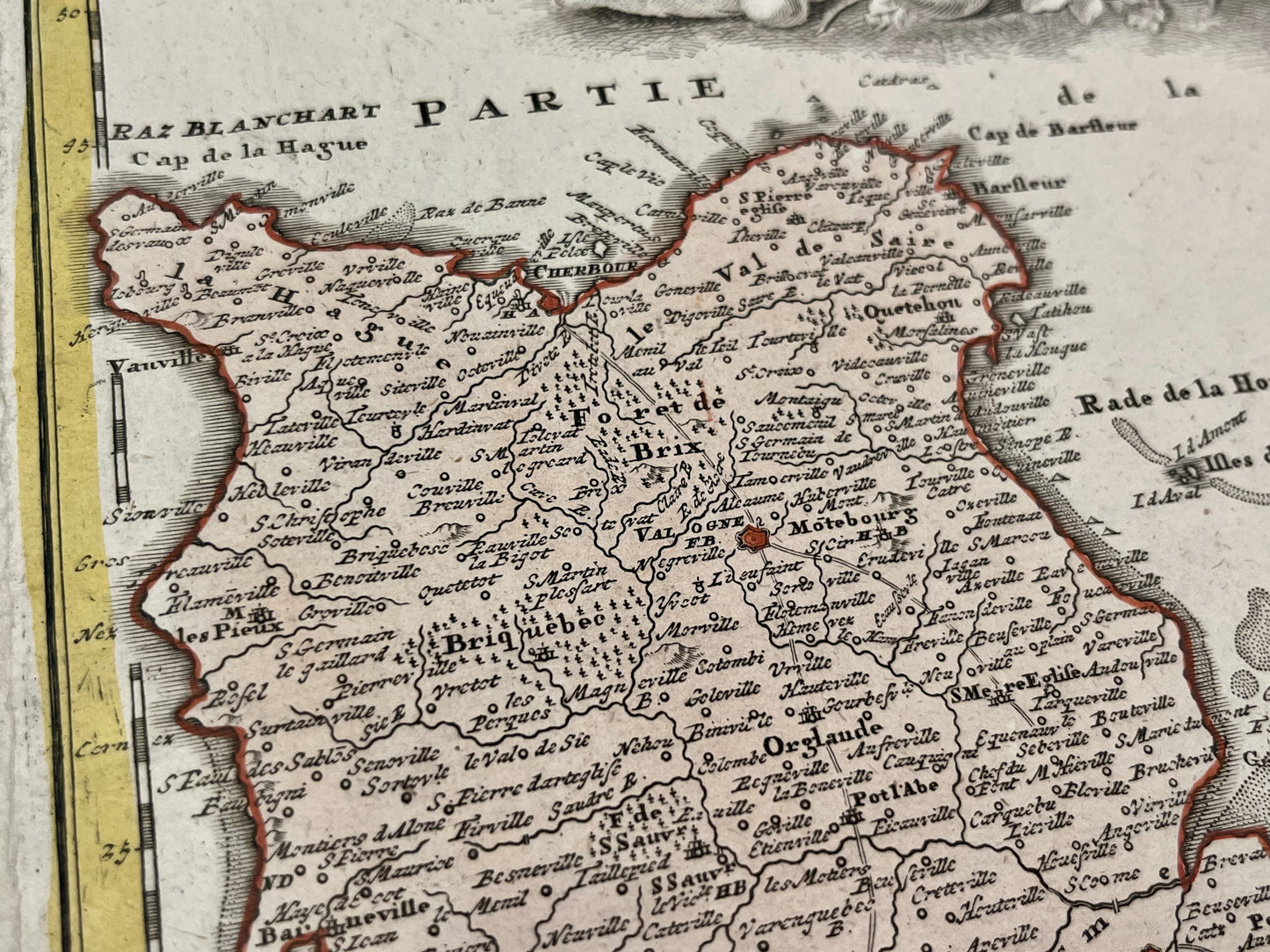
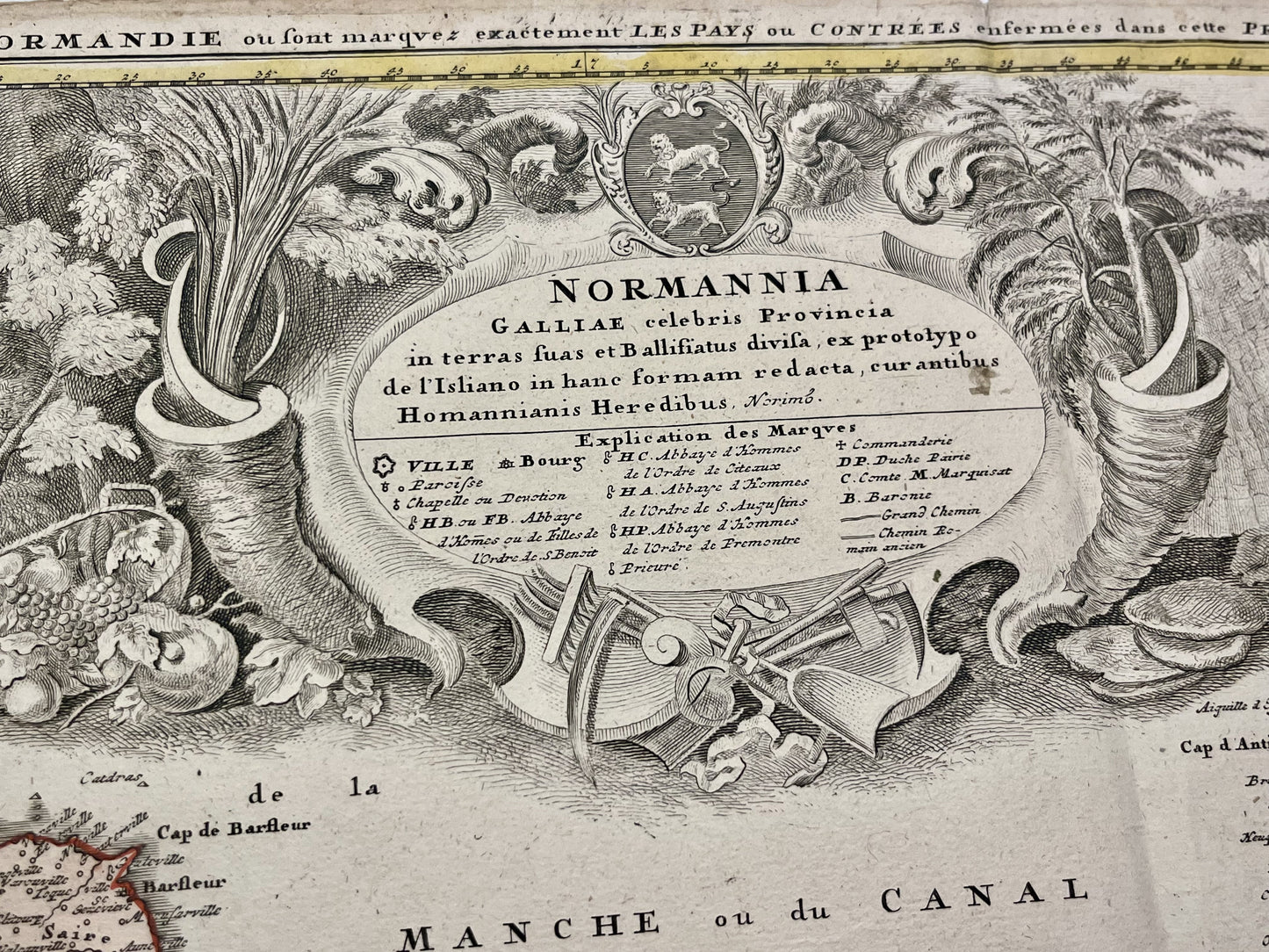
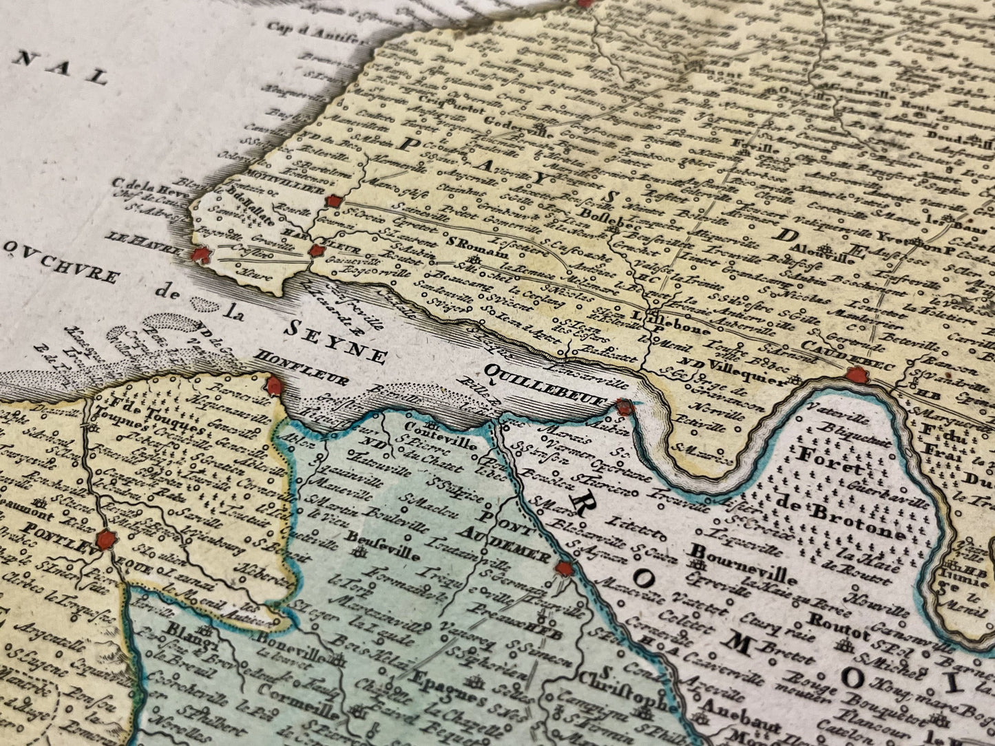
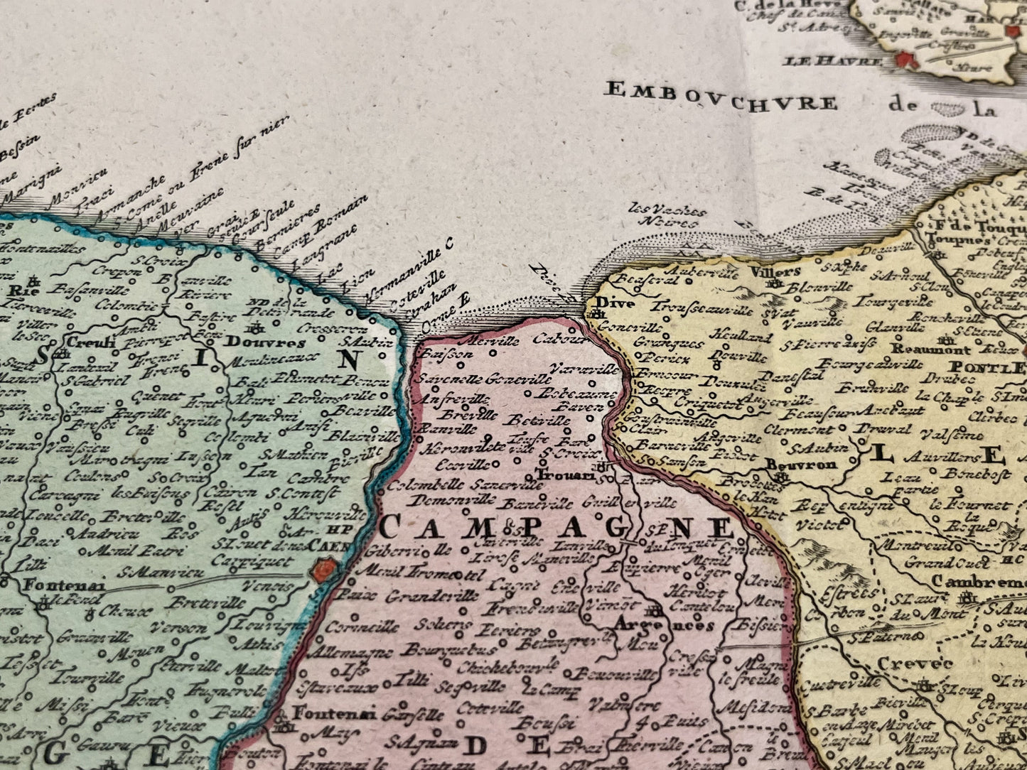
This antique map of Normandy was published in the early 18th century and measures 60,5x52cm. It was created by the French cartographer Guillaume Delisle based on the work of J.B. Homann.
Condition:
Crease in the center, small tears on the edges. Please note, my maps are old and are not always in perfect condition!
List of main cities represented:
Domfront, Mortain, Avranches, Granville, Cherbourg, Carentan, Bayeux, Falaise, Caen, Honfleur, Sées, Argentan, Pont-Audemer, Bernay, Laigle, Breteuil, Verneuil, Evreux, Rouen, Le Havre, Fecamp, Dieppe,...
-

Secure payment
-

Careful shipping
-

No reproduction
-

Satisfied or refunded


-

“Hello, thank you for sending this, the cards are superb!”
Jean-Philippe
-
"They are very beautiful, just need to frame them! Thank you"
Baptiste
-
"Fast shipping and very good tracking."
Alice
-
"My husband loved the maps I gave him for Christmas!"
Solène
