


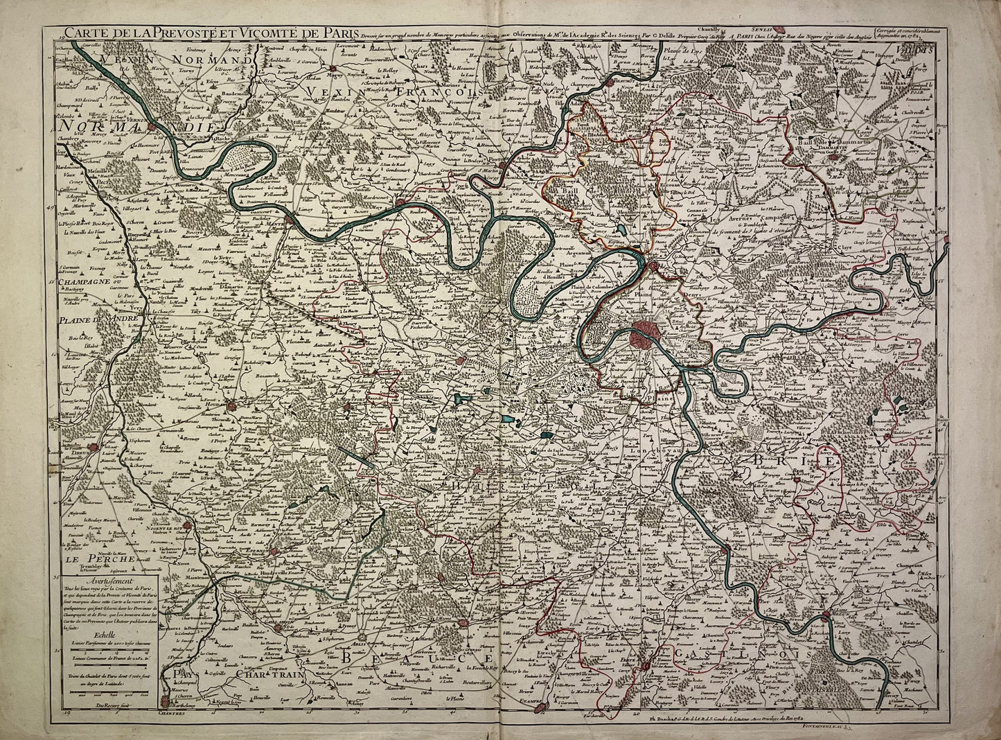
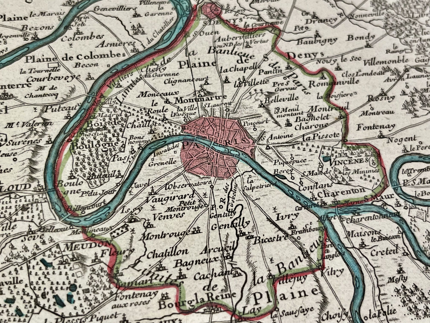
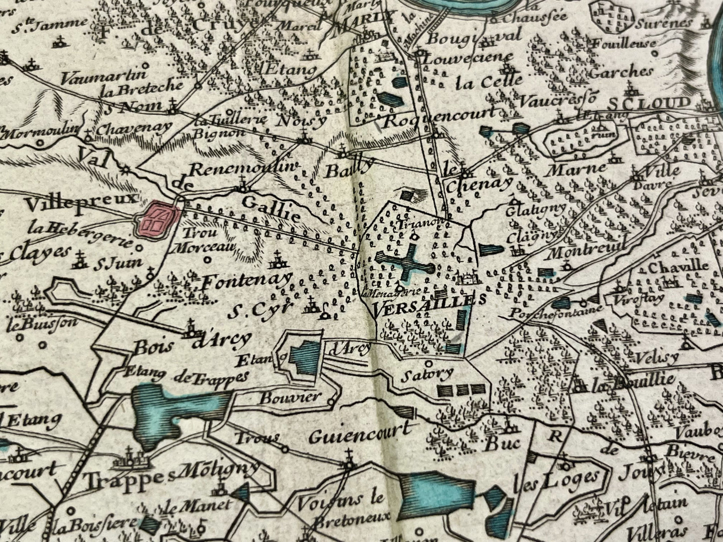
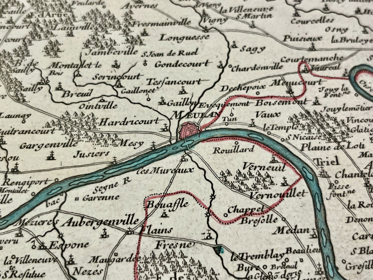
Antique map of Paris and its surroundings by G. Delisle - 1782
Antique map of Paris and its surroundings by G. Delisle - 1782
Couldn't load pickup availability
This antique map of the Île-de-France region was published in 1782 and measures 73x53.5cm. It was created by French cartographer Guillaume Delisle and later revised and corrected by Philippe Buache.
Condition:
Crease in center, minimal staining and tearing at edges. Please note, my maps are old and are not always in perfect condition!
List of main cities represented:
Paris, Versailles, Corbeil, Etampes, Dourdan, Chevreuse, Houdan, Dreux, Nogent-le-Roi, Brie-Comte-Robert, Saint-Denis, Mantes, Dammartin, Meudon, Sceaux,...
-

Secure payment
-

Careful shipping
-

No reproduction
-

Satisfied or refunded


-

“Hello, thank you for sending this, the cards are superb!”
Jean-Philippe
-
"They are very beautiful, just need to frame them! Thank you"
Baptiste
-
"Fast shipping and very good tracking."
Alice
-
"My husband loved the maps I gave him for Christmas!"
Solène
