


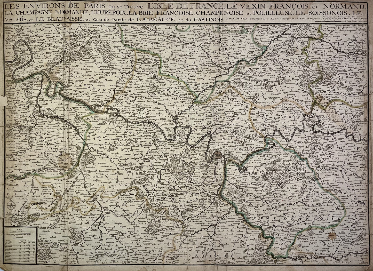
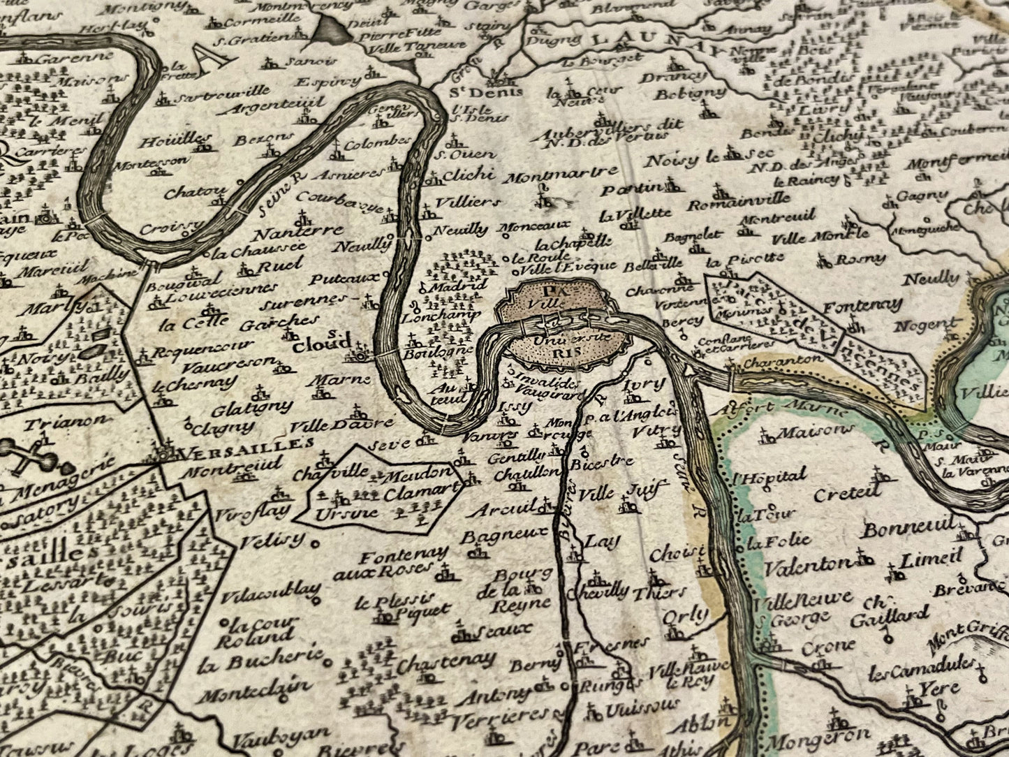
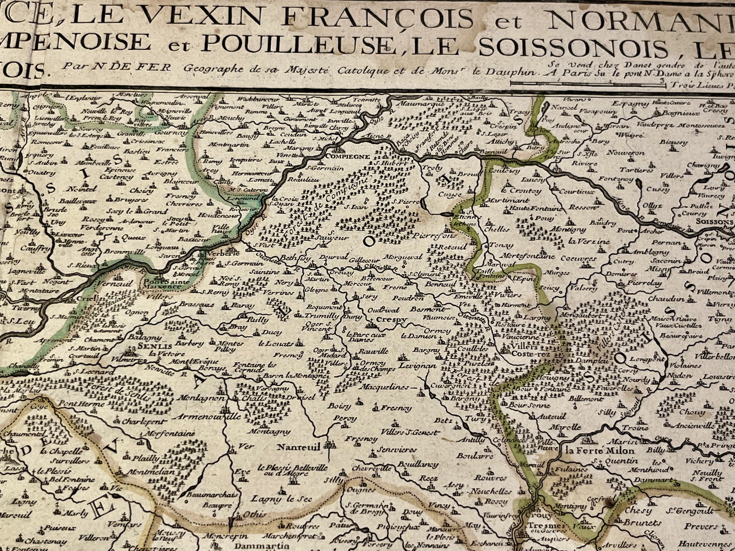
Antique map of the surroundings of Paris by N. de Fer - ca. 1700
Antique map of the surroundings of Paris by N. de Fer - ca. 1700
Couldn't load pickup availability
This antique map of the Paris area dates from the early 18th century and measures 69.5x51cm. It was created by Nicolas de Fer.
Condition:
Creases, stains and repairs. Please note, my maps are old and are not always in perfect condition!
List of main cities represented:
Chartres, Rambouillet, Nogent-le-Roi, Palaiseau, Corbeil, Paris, Versailles, Saint-Denis, Melun, Gisors, Senlis, Meaux, La Ferté-Milon,...
-

Secure payment
-

Careful shipping
-

No reproduction
-

Satisfied or refunded


-

“Hello, thank you for sending this, the cards are superb!”
Jean-Philippe
-
"They are very beautiful, just need to frame them! Thank you"
Baptiste
-
"Fast shipping and very good tracking."
Alice
-
"My husband loved the maps I gave him for Christmas!"
Solène
